Wewoka/Yaeger Tornado
as pursued by
George R. Hoelzeman and Scott Blair
8 June 1998
Map courtesy of NWS Norman, Oklahoma and NOAA
This tale begins in the epic tradition, in medias res . . .
It had already been a long and interesting chase day when we pulled into a restaurant (Braum's) parking lot south
of Harrah, Oklahoma on Hwy 270. We were trying to regroup and get our bearings after the previous chase, examining
maps, considering possibilities and noting that we were nearly out of gas. As we addressed these various issues,
the rain free base of the previous tornadic cell passed overhead, providing some dramatic photo opportunities.
This base was followed shortly by heavy rain, so we again proceeded south on 270. Reasoning that at the junction
of 270 and I-40 there would be a gas station, we made that our next goal.
The Texaco at which we stopped was a typical rural station, with the usual aroma of oil and old fried chicken.
Still, the folks were friendly and helpful in providing directions to Hwy. 9 toward Norman, where we had observed
a large cell developing for several minutes. Somewhere in this time frame, the NOAA went off with another tornado
warning, this one near Amber about 15 miles SW of Norman. It was this storm we decided to pursue next, though fuel
concerns mandated a brief stop.
Wherever you go, people are fascinated by storm chasers. This gas station was no exception. While most of the folks
hanging around were fairly blase about the issue of tornadoes (you get used to it in Tornado Alley after awhile),
one "well-fortified" gentleman (I use the term loosely) was aggressively intrigued by our activities.
After following us back to the car, he sat in the passenger door regaling us with tales of twisters past and asking
incessant questions about where the next one would be. Finally, knowing a powerful cell was approaching and in
an act of desperation, we (somewhat rudely) informed him that we had a storm to pursue and would he please leave
us to it. When this failed to dissuade him from beginning yet another story about his house trailer, I started
the engine and shifted into gear. We last saw him in the rearview mirror, gesturing enthusiastically, as we sped
down Hwy. 270 toward the (now strengthening) Amber storm.
Between the NOAA report and TV broadcasts we were able to identify the track of the storm over Norman. We theorized
that by proceeding to Hwy. 9 and going West, we would come in just south of the storm just east of Norman - at
least that was the theory. As we rounded the intersection of 270 and 9, we were able to observe a strong anvil
with well-developed mammatus overhead. At the same time local TV was indicating that the hook echo on this cell
was one of the largest ever observed in the area. Hwy. 9 curves though some hilly woodlands to the SW just after
the junction with 270 and (we believed) this would take us far south to be in prime viewing location for the wall
cloud - not to mention clear of any hail shaft.
After capping a few hills, we came to a ridge which gave us an excellent westerly view of the storm. Intense windshear
patterns could be identified in the upper levels of the cell, and an intense precipitation core was visible slightly
to the north. One the cusp of one ridge, we encountered some other chasers and decided to stop for a few moments
of conversation and photography. Meanwhile, local TV indicated that minimal rain was falling in Norman, and I opined
that heading what was now due west on Hwy. 9 would allow us to skirt the core and pass far enough south of the
wall cloud to be safe, yet get some excellent imagery. The storm, it seems, had other plans.
While parked near the top of the ridge, both Scott and I observed scud moving rapidly overhead. This was soon followed
by an intense gust front. Still under the impression that the storm was moving NE we stayed to photograph and video
this feature. Suddenly, however, we realized that the gust front was heading toward us followed by a strong hail
shaft. The storm had turned! Now a right-mover, the core and possibly the wall cloud was heading straight toward
us.
We launched into escape mode, throwing cameras and tripods into the car and quickly making an U-turn to go east
on Hwy. 9. Our goal now was to avoid the potentially baseball and larger hail in the core and get south of the
wall cloud. Realizing that proceeding toward Norman (west) was not smart, we attempted to run east, then cut south
on one of the county road to County Road 59B. This proved to be a fateful decision.
At this point I would add an interesting footnote: Immediately before we made the aforementioned U-turn, a guy
passed us heading straight into the core of this storm - on a bicycle. Considering the intensity of the hail which
we encountered, I shudder to think what befell this poor cyclist.
Anyway, we were running East. The gust front rapidly overran us and then the hail began. Dime, then nickel, the
quarter size hail. We passed one south running road and briefly slowed to consider turning back. This proved to
be a mistake. At this point let me recall to your attention my previous note concerning the direction of Hwy. 9:
southbound, it curved to the SW, which means that northbound, it curves to the NE.
Thus, Hwy. 9 now lead us inexorably into the core of the storm. In a matter of seconds, golfball and some baseball
hail overtook us. Traffic slowed, allowing the core to pound us with all its might. Now being slammed with increasingly
large hail, we desperately sought a side road with a shot straight south. Finally, with hail shredding trees and
inflow winds increasing, we found such a road and threw ourselves onto it. Again, an unfortunate decision.
In future, I think we will try to get a map with more complete details concerning local roadways. This road which
held such promise of escape went south for about 1/4 mile, then turned sharply west. With several cars, trucks
and a van parked under overhanging trees, we were trapped. The roadway was covered with debris torn from trees
by large, intense hail and strong inflow. Our only option was to return to Hwy. 9 and attempt to run north and
clear the core. For a 15 minute eternity, we crashed through pounding hail, then torrential rain. Finally, we were
free with only blue skies and gentle breezes before us. We decided to return to Oklahoma City and seek a room for
the night.
Then the NOAA wailed.
A tornado warning was issued for Seminole County. Realizing that we could come up on the cell from the rear (avoiding
the hail shaft) we abandoned the hotel quest and rejoined the chase. Exiting I-40 at Shawnee, we proceeded south
on Hwy. 177 to (again) Hwy. 9. After driving east toward Seminole, we cut SE on Hwy. 270 toward Wewoka. The (apparently)
LP supercell was now directly ahead of us, still a right mover, still showing a strong hail shaft and incredible
updraft towers and a solid anvil.
Impressive.
Wet roads and hilly terrain dictated cautious driving, and we were not able to pursue at the rate we would have
liked. We were, however, gaining on the storm and things were looking good. We paused briefly near Wewoka to consider
our route, but decided to stay on 270. Shortly thereafter, we rounded a small hill at a brisk pace. Suddenly, I
saw power lines in the road and phone poles snapped off and scattered. Tornado damage!
There is no rush like ardreniline. Now we knew - there was a tornado on the ground, possibly around the next corner.
Damage was fresh - the police had not even arrived on the scene. We opted out of stopping for photographs in order
to catch up to the guilty twister. As we approached Holdenville, we spotted other chasers along the roadside observing
a region of the storm to the NE. We pulled over to consult and were informed that Hwy. 48 North had been blocked
due to damage. This confirmed that the tornado was still on the ground. Unable to see what was being described
as a very large tornado, we ran further down Hwy. 270.
As we came over the next ridge, we discovered a half dozen chasers parked and again gesturing to the NE. Again
we stopped. Scott rushed to inquire as to the tornado's position while I scanned the NE skies. At this point, we
were clearly on the cusp of a wall cloud and scud was spinning up into the cloud base all around us. For several
minutes, both Scott and I thought that the others were indicating a funnel in the nearby clouds. Suddenly, my eyes
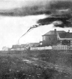
focused on an area near the hail shaft - there it was, in all its destructive glory! The Yeager Tornado.
Since childhood I remember hiding in cellars from tornadoes. I've seen hundreds on video. But the experience of
seeing a tornado in life cannot be described. White as snow it was, with the yellow-white hailshaft as background.
Gracefully it snaked between heaven and earth drawing life from one, destroying the other. This was a moment of
transcendent awe, a moment of Truth. The tornado was about four miles away and magnificent in its serpentine perfection.
Can you tell it was my first one?
Now excitedly yelling to Scott, I turned to get my camera at the same time he saw the tornado. But, alas, when
I turned back to photograph the wonder, it was gone. In the twinkling of an eye it had dissipated and now only
the hail shaft was visible. After watching for a few minutes, we backtracked up Hwy. 270 to Yeager Road, proceeded
north, then east on a farm road. This road was too muddy for the car to go too far, so we stopped by a cow pasture
gate and Scott tried to get some video. I spoke with a local who had just seen the tornado at its peak while a
herd of curious cattle chased Scott from the field.
After catching our breath, we returned to Yeager Road, wondering at the magnificent sunset accented by the anvil
of yet another supercell over Oklahoma City. Looping back to 270 East, we followed to storm for another hour or
so, maintaining a safe distance (night was falling). The lightening display was incredible, but the apex of our
chase day was over. Eventually, we stopped by Eufaula Lake on Hwy. 69 to watch the cell's fireworks, then returned
to Little Rock. It had been a long and satisfying day of hunting.
Another footnote: this cell remained tornadic until just short of Russelville, Arkansas, and was still producing
dime size hail east of Morrilton - a distance of more than 300 miles from its initial development.
PHOTOS SOON TO COME!
NWS Norman on the Wewoka/Yeager Tornado
Abandon the Chase/More Chase Accounts
Questions, Comments, Cries of Anguish