We left our campsite on Mitkoff Island at 6:00 am, taking FSR 6245 back to the Mitkof Highway. We drove past the Ohmer Creek Campground again.  Short ways farther south we found two other campsites, almost identical to one another. A short wooded road opened up to a large gravel area near a cove with an outhouse and picnic table. We came to a deadend at mile 32.
  There was a cove here. We turned back and saw 2 deer cross the road. We turned right on a turnoff close to the Ohmer Campground hoping it was Three Lake Loop Road (FSR 6235). About 4 miles down the road a sign told us we were on the right road. We parked at the Crane Lake Trailhead (mile 13). This was a 4 mile trail that took us two and a half hours. We started at 7:00 am. The trail was almost all boardwalk across muskeg with some steps. The trail went through a lush forest with huge skunk cabbage and was overgrown in places. There were 4 lakes, the first and last just a short 10 minutes from the road. Crane Lake had a rowboat with only one broken oar and a rope swing. Hill Lake had a boat with no oars. Shelter Lake had a three-sided shelter with lots of graffitti and a hand-made sign that said Frog Lake. The interpretive signs had no name for this lake, but the map distributed by the Chamber of Commerce called it Shelter Lake.
  Sand Lake had a small dock, a rowboat with two oars and a picnic table. We walked out to the road and then another half mile to where the truck was parked. We took FSR 6232 off the Three Lakes Loop Road to the La Conte Glacier Overlook before heading back into town on the Mitkof Highway.
On our way back into town we stopped for gas and asked an employee where to go for lunch and how the local economy was. He said the cannery workers are paid $6 an hour. They make there money in overtime pay. But this has been a poor year for fishing. 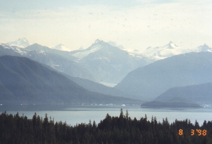
 We found four hour parking on Harbor Way and stopped in some of the stores. They weren't as tourist oriented as those in Sitka and Juneau. Most of the tourist items had something to do with the town's Scandinavian background. They liked to poke fun at themselves a lot! We ate lunch at the Seafood Deli at the Coastal Cold Storage on North Nordic Drive. The locals refer to this place as The Fish Store. We had fried seafood, seafood chowder and chicken adobe. The chicken was probably the best thing we ordered. This was a strange place for a fast seafood restaurant. Fisherman and tourist bring their catch here to be frozen. We worked our way past the freezers to an outside picnic table behind the building. We stopped at the Forest Service Office. They were not very helpful. The Visitor's Center was closed, probably for lunch. The Hammer Slough is a short creek with houses on each side buildt on stilts.
![]()
![]() We went to the ferry dock around 1:00 pm and didn't leave for Wrangell until 3:15 pm, an hour late. Almost every ferry we took had been on time. We got into Wrangell, which is on Wrangell Island at 7:00 pm. The ferry terminal is right in town. We drove a few miles northeast til the road came to a deadend past a shooting range and the airport. This part of the road goes around Mount Dewey. There is a trail to the top, but we didn't take it. On the way back to town we stopped at Petroglyph Beach and parked on a deadend street.
We went to the ferry dock around 1:00 pm and didn't leave for Wrangell until 3:15 pm, an hour late. Almost every ferry we took had been on time. We got into Wrangell, which is on Wrangell Island at 7:00 pm. The ferry terminal is right in town. We drove a few miles northeast til the road came to a deadend past a shooting range and the airport. This part of the road goes around Mount Dewey. There is a trail to the top, but we didn't take it. On the way back to town we stopped at Petroglyph Beach and parked on a deadend street.  If you look closely you'll find petroglyphs carved into some of the large boulders. At first you don't see them and then they're everywhere, mostly on the northend of the beach. Not much is known about who or why they were carved, but it is believed they were made by people who were here before the Tlingits. There was a surprising amount of broken glass bottles, plates and other rubish on this beach. The glass had not been roughed up very much, either because of the quanitiy, lack of wave action or just not being there very long. We asked one resident about it and she said this beach used to be a dumpsite.
![]()
 Back in town we took pictures of totem poles at the Kiksadi Totem Park. We stopped to take pictures of the sunset near the Stikine Inn and ate pizza for dinner at the Waterfront Grill around 9:00 pm. I think we were there last customers for the night. We drove south out of town looking for the Shoemaker Bay Recreation Area. We drove by without realizing it, and took the turn-off for Pat Lake. It was getting late and difficult to tell how long this road would go so we finally pulled over and slept in the truck.