Tuesday 8/10/99
Day 13: Dawson City, Mayo & Keno
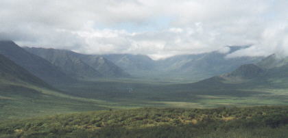
 We left the hotel at 10:00 as we got some gas and stopped for some books at Maximillians gold Ruch Emporium. We left townat 11:00 as ther didn't to be much to do in town. We drove east on highway 2 for the first 40 kilometers before we turned north on the Dempster Highway. You can take this highway 440 miles all the way north ito Inuvik and reach withen 80 miles of the Artic Ocean. We wanted to take this road for a little while becaseu we hadn't determined if the drive would be boring or if the scenary would be worth taking this trip someday inthe future. The weather kept on changing as we saw some sun, blue skies and dark clouds as itlooked like it would rain but didin't. At kilometer 71 we stopped at theTombstone Mt where there was a campground and Interpretative Center. the ranger said that about 100 came thru yesterday and that about 40 continue on north. We set up our campstove at one of the sites along the the river and ate breakfast. We continued north to kiilometer 95 before fianlly turning around as the clouds were getting darker. we took a couple more pictures on the way back but didn't really stop anywhere. It is nice territyor that isisolated with lakes, green meadows and mountains.
 Back on the Klondike Highway we wento south and would stop at the Moose Creek Campground to let the kids play on the toys for a little while.We then continued towards Mayo/Keno as we would eventually turn right to go across the bridge that would go to these mining towns. We first passed Mayo which is a small town 50 kilometers east of the main highway as we arrived there at 5:00. We checked outhte Binet House Interpretive Center. It display the gelogy, hospital artifacts and had a relief map We got lost getting out of town as it seemed like there was only one road that went back to the main road. After 15 minutes later we finally got on themain raod and we farther east on a gravel road. We drove around a silver mine in Elas that was abandoned in the 80's and they are waiting for the price of silver to go back up so they can open it up again.
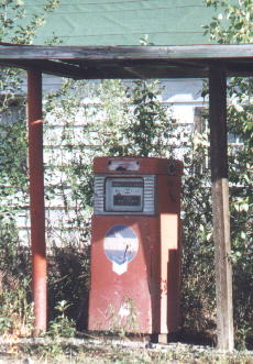
 We drove to Keno City in a hurry to get to their newly renovated Mining Museum before it closed at 6:00. We just made it in time befoer they closed. It wasa twostory building that had exibits on ining, bottles, school supplies, bikes, and photos. After themuseum we went over to the cafe across the street and alsohad lots of artifacts. this included Life magazines, signs and bottles from the 30's to 60's. After having a snack we walked around town as most everything was abandoned, there is still some mining going on here andthere are people living in housess on theoutskirts of town. We finaly left town and drove to mayo Lake/Dam as some people had set up tents around here for camping. We left here around 8:00 finally reacherd the bridge for Stewart Crossing at 9:00 where we got gas but the restaurent wsa closed
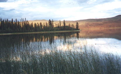
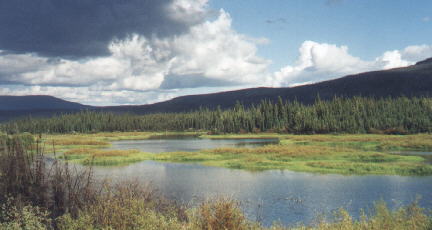
 We reached Pelly's Crossing around 9:30 where there was a small town here. Next we would drive past a areas theat had burned from a forest fire. They had bad fires here a couple years ago wher theyhad to close off the this road from Whitehorst to Dawson Creek. Tehr will be regrowth going on for miles along this highway an then you will see all green trees again. It was now sprinkling aroudn 10:00 and the sun had still not set. We saw rainbow at the end of the highway when we wernear Rock island Lake. this was actually the first rainbow we had seen on the trip. We got to Tatchum Creek Campground at 10:45 as thr wasa Lake nearby and the sun was just beginning to set. We were going to go to Carmacks but decided to change our mind and go back to the campground. We did take some pictures near Five Fingers Rapids before we went. We got the kids to bed and then we set up the camp stove and ate as it was still light enough to cook without a light. It started raining after wewent to bed aroudn midnight.
450 miles today and 4950 miles total