
L A S T U P D A T E D : 11 . 8 . 2001
Maps of the
Khazar kingdom from 300 c.e. to 1000 c.e.
L A S T U P D A T E D : 11 . 8 . 2001
Maps of the
Khazar kingdom from 300 c.e. to 1000 c.e.
Note:
The borders shown on these maps are approximate borders; the actual line
of control often fluctuated from year to year. Areas marked as 'tributaries'
are the outmost regions the Khazars extracted tribute from, but did not
necessarily 'govern' or claim rights to for any serious
length of time. The outmost regions the Khazars
retrieved plunder are far beyond the tributaries.
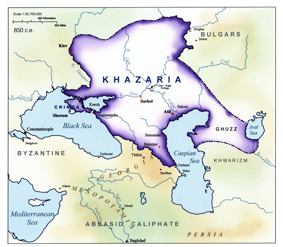 Introduction..........850 C.E.
.............................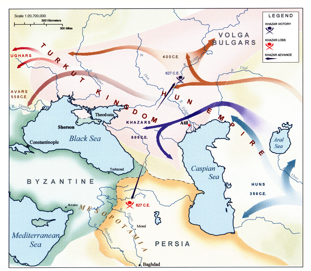 Pre-History............350 - 627 C.E.
 Rise of Khazaria....600 - 850 C.E.
............................. Fall of Khazaria......850 - 965 C.E.
uclaUniversity of California at Los Angeles
Slavic Studies Department .http://www.humnet.ucla.edu/humnet/slavic/slavic.html
Near Eastern Studies
Department http://www.humnet.ucla.edu/humnet/nelc/nelc.html
S P E C I A L T H A N K S T O :
K E V I N A L A N B R O O K F O R P R O V I D I N G E X P E R T H I S T O R I C C O N S U L T I N G
P R O F E S S O R D I N A M O K H N A T K I N F O R R U S S I A N T R A N S L A T I O N
COPYRIGHT 1999
ALL MAPS ON THIS PAGE ARE THE PROPERTY OF RICHARD
BURD
AND MAY NOT BE RE-DISTRIBUTED WITHOUT THE EXPRESSED WRITTEN, (or e-mail)
PERMISSION OF RICHARD BURD
K
H A Z A R I A N H I S T O R Y N O T
E S
....These
are my notes for this project. They are organized in chronological
order.
....They
are intended to be used as a quick (but detailed) academic reference.
....A
greater portion of these notes deal with the events that lead up the the
empire's greatness, as well
....as
the pre Khazar history of the region
....*click
here*
O
T H E R H I S T O R I C M A P S
....Historic
maps of Ukraine................................http://www.city.sumy.ua/history/ukraine.html
....Crusader
states c.e.1100...............................http://ccat.sas.upenn.edu/~rs143/sultan.jpg
....Georgia
1683 (country not state)...................http://www.raremaps.com/maps/big/3187.jpg
....The
Muslim east in the1200's........................http://ccat.sas.upenn.edu/~rs143/meast.jpg
....Safavid
Persia in 1500's - 1600's..................http://ccat.sas.upenn.edu/~rs143/timurid.jpg
....Eastern
Europe 19th Century (1882)............http://www.feefhs.org/maps/indexmap.html
....Provinces
of the Roman Empire 120 C.E....http://www.dalton.org/groups/Rome/RMap.html
...U
N I V E R S I T Y O F T E X A S A T
A U S T I N
...........The
foremost source of historic maps from various periods of history
........historic
map index - click here
O
T H E R H I S T O R I C M A P S b y R I C H A R
D B U R D
....The
Muslim east during the first half of the 13th century................

This
map I did for another history project. If you are a publisher or
University
professor and are in need of graphics consulting please
e-mail
me. Although I am a starving student I work for free,
([for
good referrals] :)
Back to the main Khazar page