 WAKE ISLAND DXPEDITION 98
WAKE ISLAND
WAKE ISLAND DXPEDITION 98
WAKE ISLAND

 ********** DAYTON HAMVENTION 1998 **********
 N2WB N2OO W2KH
Crowne Plaza Hotel DX Hospitality Suite
DAYTON HAMVENTION 1998
N2WB N2OO W2KH
Crowne Plaza Hotel DX Hospitality Suite
DAYTON HAMVENTION 1998
 Dayton Hamfest
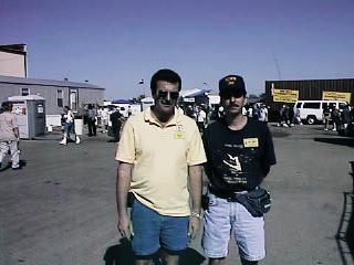
Tony - W2KH *** William - N2WB
The Dayton 98 photo Gallery is now up at the
"Ham Gallery"
The 1999 DAYTON Hamvention®
will be May 14, 15, and 16!
SEE YOU THERE!
 "ST CROIX DXPEDITION 98"
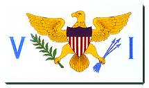 U.S.V.I. FLAG
ST. CROIX DXPEDITION Frequency Plan
U.S.V.I. FLAG
ST. CROIX DXPEDITION Frequency Plan
19-27 OCTOBER 1998 N2WB/KP2
From Woodwind Estates WP2Z
"900 Feet above sea level"
CQ-8 * ITU-11 * IOTA NA-106

 W4DXP
CALLSIGN OF THE FLORIDA DXPEDITION GROUP
The Florida DXPedition Group will be traveling to St. Croix in the U.S. Virgin Islands the last part of October 1998 to participate in the CQWW SSB contest. Members of the group will be utilizing Windwood Estates on the north shore of St. Croix as their QTH from October 19th-27th, 1998. Windwood Estates is the highest private residence on the island, sitting 900 ft. above the ocean.
Operations before and after the contest will include SSB, CW, and RTTY, with the individual team members signing their own call /KP2. During the CQWW SSB contest the team will be utilizing the call sign for Windwood which is
"WP2Z"
Map of St. Croix, U.S.V.I.
W4DXP
CALLSIGN OF THE FLORIDA DXPEDITION GROUP
The Florida DXPedition Group will be traveling to St. Croix in the U.S. Virgin Islands the last part of October 1998 to participate in the CQWW SSB contest. Members of the group will be utilizing Windwood Estates on the north shore of St. Croix as their QTH from October 19th-27th, 1998. Windwood Estates is the highest private residence on the island, sitting 900 ft. above the ocean.
Operations before and after the contest will include SSB, CW, and RTTY, with the individual team members signing their own call /KP2. During the CQWW SSB contest the team will be utilizing the call sign for Windwood which is
"WP2Z"
Map of St. Croix, U.S.V.I.
 LIST OF OPERATOR CALLSIGN'S
W4WX/WP2 N2WB/KP2 W4JCK/KP2
VE3FU/KP2 W5OXA/KP2 AA9TK/KP2
Please QSL via each individual's home CBA or via the buro for before
any contacts made or after the CQWW SSB contest. QSL's for the
contacts made with WP2Z during contest should be sent via KU9C !!
Please include a SASE or sufficient funds for postage if you QSL direct !!
LIST OF OPERATOR CALLSIGN'S
W4WX/WP2 N2WB/KP2 W4JCK/KP2
VE3FU/KP2 W5OXA/KP2 AA9TK/KP2
Please QSL via each individual's home CBA or via the buro for before
any contacts made or after the CQWW SSB contest. QSL's for the
contacts made with WP2Z during contest should be sent via KU9C !!
Please include a SASE or sufficient funds for postage if you QSL direct !!
This year's team includes the following
members:
| Clarence Kerous | W4CJK |
| Bill
Gallier | W4WX |
| William Beyer | N2WB |
| Jim Mornar | AA9TK |
| Chris
Allingham | VE3FU |
| ErnieOrman
| W5OXA |
Members of The FLORIDA DXPEDITION GROUP - FDXGP
ST. CROIX TEAM
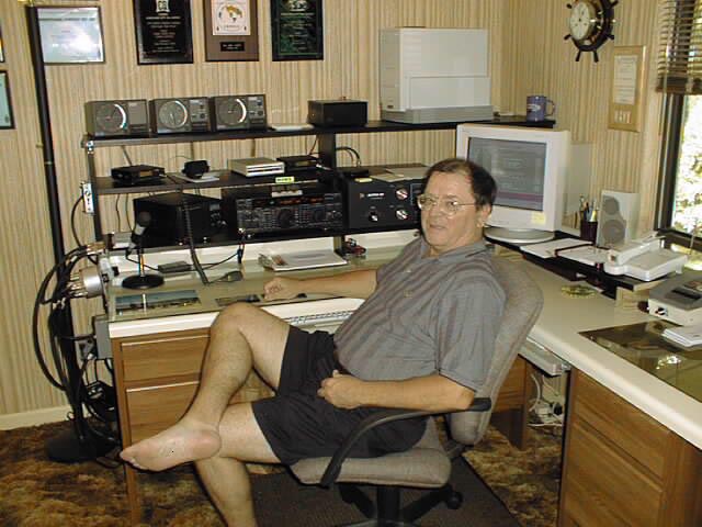 Photo of W4WX
Bill Gallier
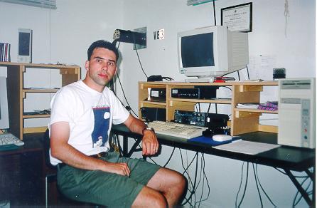 Photo of VE3FU
Chris Allingham
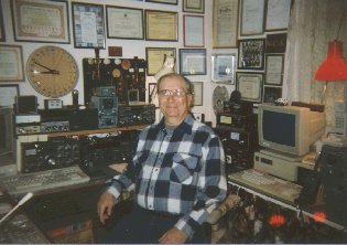 Photo of W4CJK
Clarence Kerous
 Photo of W5OXA
Ernie Orman
FLORIDA DXPEDITION GROUP
"FDXGP"
Club members are:
W4WX, K4GZ, W4USN, N2WB, W4CJK, AE4FY/TF, W5OXA, VE3FU, KG4AU,
AA9TK...
"An ARRL affiliated Club"

CQWW PHONE CONTEST - WP2Z
October 24-25 1998
Photo's from the 1997 DXPEDITION TO GUANTANAMO BAY
CUBA, GITMO - KG4-LAND
KG4WB operating at GITMO during and after CQWW SSB contest effort
Rusty-KG4AU operates run station while Bill-N2WB (KG4WB) opperates the
multiplier station at the 1997 CQWW SSB KG4QD GITMO contest station
CFDXA members: (L-R) Al-K3VN, Bill-N2WB and Jan-K4QD at GITMO for 1997
CQWW SSB Contest
The Guantanamo Bay area is a semi-arid desert very similar to the climate found in San Diego,
California. With predominantly dry, sunny days ranging from 80 degrees to 90 degrees Fahrenheit,
nearly one-fourth of Guantanamo's total average annual rainfall of 24 inches occurs in October. Not
surprisingly, the majority of green vegetation in the region is the product of the base's irrigation
system. The rest of the area contains parched, brown land and woody plants and succulents capable
of enduring the scarcity of water. Guantanamo is also the site of the "Cactus Curtain" -- an eight-mile
stretch of thousands of Nopalea cactus along the northeastern section of the Guantanamo Naval
Base fence. During the fall of 1961, in the wake of the Bay of Pigs invasion, the Castro regime gave
substance to the already-named boundary between the base and Cuban territory in an attempt to
physically deter Cubans from using the base as a means of escape from the island.
Guantanamo bay is situated in the belt of the Caribbean trade winds; it receives sea breezes from the
southeast during the afternoons, and, shortly after sunset, the wind changes to a northerly direction
and becomes a land breeze. The constant breezes help to keep the bay cooler than most semi-arid
deserts. However, the mountains that surround the bay to the west, north, and east shelter it from
cloud systems, thus producing less precipitation and maintaining the land's aridity.
Guantanamo Bay Naval Base, or "Gitmo" as it is commonly referred to, covers an area of 71 square
miles, of which 23 square miles are water and the rest is either solid ground (approximately 35
square miles) or swampland ( 13 square miles).
 Wayne KG4WD - Jan KG4QD
Wayne's antenna overlooking Guantanamo.
Link
to Guantanamo Bay Amateur Radio Page
Wayne KG4WD - Jan KG4QD
Wayne's antenna overlooking Guantanamo.
Link
to Guantanamo Bay Amateur Radio Page
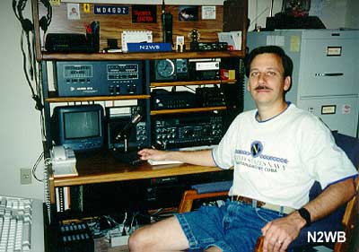
N2WB at home looking for DX!!
CW - RTTY - PHONE - SAT
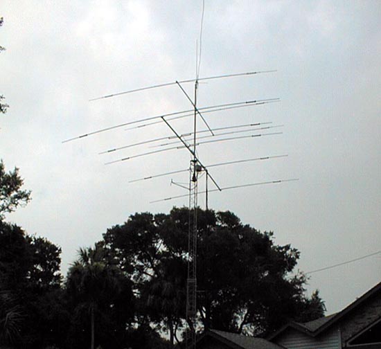
 Antenna Farm
 -. -. --.- -.. -..-
 Richard Paczkowski Jr. KF4BIA
"W5YI" - YOUNG HAM OF THE YEAR!!!
American Radio Relay League
Richard Paczkowski Jr. KF4BIA
"W5YI" - YOUNG HAM OF THE YEAR!!!
American Radio Relay League
 "ARRL LIFE MEMBER SINCE 1979"

 CHOICE OF THE WORLD'S TOP DX'ers!
" DX "
These days, having a good time is the job!
NOBARS-North Ormond Beach Amateur Radio Society
CFDXA-Central Florida DX Association
FDXGP-Florida DXpedition Group
DDXA-Dateline DX Association
CHOICE OF THE WORLD'S TOP DX'ers!
" DX "
These days, having a good time is the job!
NOBARS-North Ormond Beach Amateur Radio Society
CFDXA-Central Florida DX Association
FDXGP-Florida DXpedition Group
DDXA-Dateline DX Association
 73 from William Beyer/N2WB
 This page designed and maintained by Webmaster WILLIAM BEYER
LAST UPDATED 01 NOVEMBER 98
This page designed and maintained by Webmaster WILLIAM BEYER
LAST UPDATED 01 NOVEMBER 98


Please send any comments or inquiries to

 n2wb@bellsouth.net
This site has been accessed  times since 01 June 98
Sign Guestbook
View Guestbook
Copyright © 1997, 1998 William F. Beyer Jr.
Web Design by WFB Productions
times since 01 June 98
Sign Guestbook
View Guestbook
Copyright © 1997, 1998 William F. Beyer Jr.
Web Design by WFB Productions

 As always, this page is under construction


 n2wb@bellsouth.net
 As always, this page is under construction