MAP OF THE LAWRENCE ESTATE
FEBRUARY 1896

This is an 1896 survey map of the
land that eventually became Sections 3, 9 & 10 Of Mastic Beach
in 1926 & 1938
Originally owned by the Woodhulls
in the 18th century, then Charles Jefferey Smith 1803-76 through
his marriage into the family in the early 19th century. It was
then passed into the Charles W. & John S. Lawrence Family
via Charles J. Smith's will.
John S. Lawrence's son Frank M. 1862-1920 who grew
up here, and his cousin Hannah bought it all in 1896 for $7,950.00. It was most likely that this map was prepared for
that sale. The western part of it went to Hannah Newbold Lawrence. In 1907 Frank married Louise Mauran of Providence Rhode Island and probably built a large homestead in Mastic for her perhaps as a weeding gift. In October 1916, Frank & Louise sold their 166 + acres to Joseph F. Knapp.
Joseph aka "Dodi" moved there with his sister Claire
into the 22 room house that became forever known as the Knapp Mansion.
 Map was surveyed in February 1896
by John Raynor
Map was surveyed in February 1896
by John Raynor

 PATTERSQUASH LAKE!
It was located on North Side of
Neighborhood Road by the St. Jude's bridge. It was about 75 feet
wide and 250 feet long. It was reduced to a small 2 foot wide
stream and has been a drainage ditch for over 50 years.
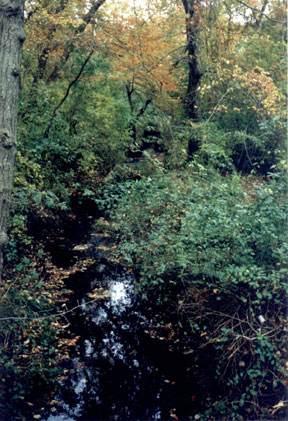 Pattersquash Lake Today
 That is the head of Pattersquash
Creek on the left. This would be about where Cedar Road now crosses
the land.
That is the head of Pattersquash
Creek on the left. This would be about where Cedar Road now crosses
the land.

The two houses both built By C.
J. Smith circa 1850's are still standing.
The one on the left is owned today
by The Heyers & is shown on the website in various places including
here

The one on the right was known as
The
Woodhull Lodge and was moved westerly and altered by
Hannah Lawrence in 1896. It has
been owned since 1948 by the Muse Family and is
shown in featured here
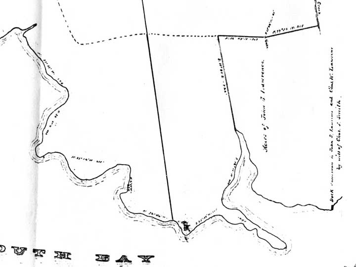
THE WATERFRONT
Notice how it changed, the little
Island that's still in front of Dodi's Cove was once attached
. Perhaps the seaplane base had something to do with it or maybe
it was too tricky to pull the big STORM
KING in there? Also there was a common dock for all the Lawrences
to use at the foot of where Jefferson Drive would end in 1938.
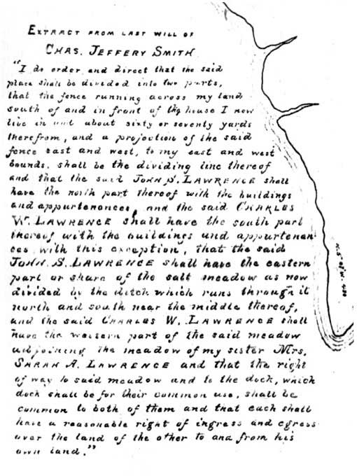 THE GAME PLAN ACCORDING TO C. J. SMITH
Right On The 'Ol Map Are C. J,'s
Last Wishes For What Was To Become Of A Place
Once Known To The Locals As "Charles
Jefferey's Meadows".
THE GAME PLAN ACCORDING TO C. J. SMITH
Right On The 'Ol Map Are C. J,'s
Last Wishes For What Was To Become Of A Place
Once Known To The Locals As "Charles
Jefferey's Meadows".
 HOME
HOME