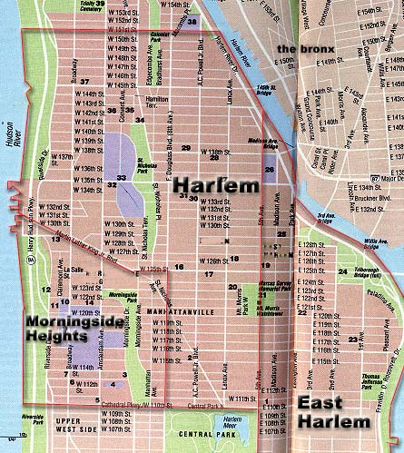
Harlem territory is bounded by 151st Street in the North, 110th Street (aka Central Park North) in the South, 5th Avenue in the East, and the Hudson River, Martin Luther King Jr. Blvd, and Frederick Douglas Blvd. (aka 8th Avenue) in the West. East Harlem territory is bounded by the Harlem River in the North and East, 96th Street in the South, and 5th Avenue in the West.
For more information, go to MapQuest and type in any of the bordering streets.

Map of Harlem, East Harlem, and Morningside Heights. Regions labeled. Click on thumbnail to enlarge. Be aware that in order to preserve image quality, some of the files will load slowly. 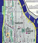
Map of Harlem, East Harlem, and Morningside Heights. Harlem and East Harlem are labeled. Purple stars denote location of the girls' and boys' lodging houses. Click on thumbnail to enlarge. Be aware that in order to preserve image quality, some of the files will load slowly. 
Map of Harlem, East Harlem, and Morningside Heights. Regions labeled. Red triangles denote location of girls' and boys' lodging houses. Red star denotes location of Journal distribution center. Click on thumbnail to enlarge. Be aware that in order to preserve image quality, some of the files will load slowly. (Note: this file is the largest.) 
Map of entire Manhattan Island, as well as parts of New Jersey, Brooklyn, Queens, and the Bronx. All boroughs are labeled, as are all the neighborhoods in Manhattan. Harlem, East Harlem, and Morningside Heights are highlighted. Click on thumbnail to enlarge. Be aware that in order to preserve image quality, some of the files will load slowly.