Kelvin Grove Community Assn. Inc.
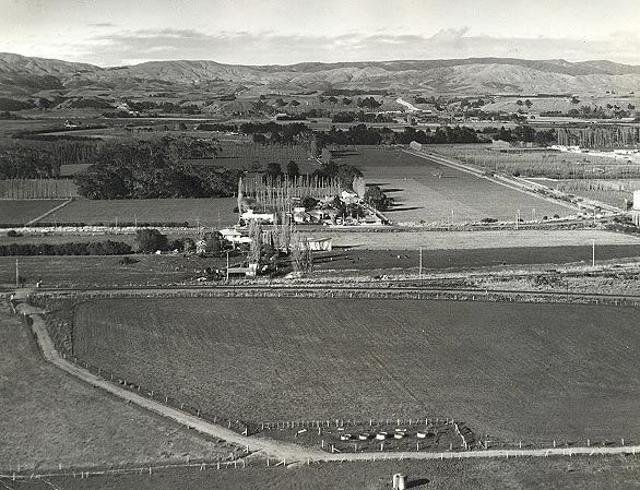
Overlooking the present Makomako Road area
in about 1968
The Burr family farm in about 1968, after the hayshed was moved from the site of the troughs in the foreground. It is visible near the centre of the photo near Napier Road. The hayshed had proven too much of an unsupervised playground for the children from the adjoining Roslyn suburb. When a group of them started a tractor in the shed one day, plus the many stolen packets of biscuits (or remnants of them) from the nearby biscuit factory that were found in the hayshed over several years, it became clear that this was the wrong place for a hayshed.
At this time, the siding to the old gasworks and power station was still in place. It can be seen uppermost on the right of the photo. Originally that line was part of the Hawkes Bay line heading into Palmerston North. By this time the new Milson railway route was open and the new section of track linking the Hawkes Bay line to its new route (in fact a piece of the former main trunk line), is visible lowermost on the right.
The Tararua Ranges and the Manawatu River provide a backdrop to this scene. The Terrace, that runs alongside Napier Road between Ashhurst and Terrace End, is almost obscure in this photo, however, it is immediately beyond the railway tracks.
Nowadays the land in the foreground is largely covered by light industry.
Last Updated: 1 January 2007


