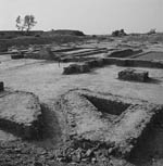
The Harappan Civilization was wide ranging geographically
(Figure 1). Cultural influence extended from the highlands of
northern Pakistan to the Arabian Sea, from the foothills of Baluchistan and central Afghanistan to the Aravalli Hills and the
Yamuna River of central India. Primary settlement was on the alluvial
plains of two river systems: the Indus, and the Ghaggar-Harka. Both
rivers
 flowed from the Himalayas to the Arabian Sea. These rivers
formed vast floodplains with regular flooding which provided moisture
and fertile soil for pastoral and agricultural activities on a large
scale (Kenoyer 1988).
flowed from the Himalayas to the Arabian Sea. These rivers
formed vast floodplains with regular flooding which provided moisture
and fertile soil for pastoral and agricultural activities on a large
scale (Kenoyer 1988).The direct and indirect exploitation of
periphery environments enriched the Harappan Civilization. The
foothills and upland valleys of Baluchistan supplied timber, copper,
stone, and precious minerals (Asthana 1982). Copper, tin, silver,
lead, stone and precious minerals were obtained from the Aravalli
Hills of the southeast (Asthana 1982). The Gujarat Plains served as a
bread basket for urban centers such as Harappa, Mohenjodaro, and
Kalibangan (Kenoyer 1988). Fish and shell were available from the many
rivers of the area, the Makran Coast and the Arabian Sea (Kenoyer
1988). The northern gallery forests supplied timber in great
quantities for building and fuel (Kenoyer 1988).
Disruption of the agricultural base possibly caused by a river course
change due to sedimentation and/or tectonic movements may have led to
the collapse of the Harappan Civilization (Kenoyer 1988). At about 1500
B.C.E ., the Saraswati, Ghaggar, and Hakra Rivers were captured by the
River Yamuna which shifted their drainage from the Arabian Sea to the
Bay of Bengal (Kenoyer 1988). The Sutlej River was captured at this time
by the Indus which shifted to the east (Kenoyer 1988).


