|
Delightful Doi Inthanon
In September 1997, I travelled to neighbouring Thailand with several other Malaysian writers
to look at sites of interest to nature lovers. The high point of our five-day tour
of the northern provinces of Chiangmai and Chiangrai was, for me at least, the
visit to that Kingdom’s highest mountain.

I have gone to the top of
Gunung Kinabalu,
Malaysias highest mountain. It was quite a tough trek
to the summit. I have also gone up our second highest mountain,
Gunung Trusmadi. That was an even more difficult trek.
When I climbed Gunung Kinabalu (4,101m or 13,455ft) with some
Malaysian Nature Society members
in March 1990, we took two days, like most tourists do, to reach the summit and descend.
Earlier that month, we had taken nearly a week to scale Gunung Trusmadi (2,462m or 8,669ft)
and find a new route down the other side of this mountain. (These two mountains are in the state of Sabah.)
In sharp contrast, the ascent of Doi Inthanon (2,565m or 8,415ft), Thailand's
highest mountain, was accomplished in several hours. And it
required virtually no effort on my part. You see, I was driven up there, together
with the other visitors from Malaysia, in a ten-seater tourist van one misty
morning last September.
Many people may find it amazing, as I did, that there is surfaced road almost
to the very top of Thailands highest doi (mountain in the Thai language).
I had known before the trip that one could drive up but I had expected
an unsealed road or track catering only for four-wheel-drive vehicles. It was
indeed a surprise to see a fairly wide and well surfaced road.
Located in northern Chiangmai Province, Doi Inthanon is a granite
massif that forms part of the Thanon Thongchai Range, the southern-most
extension of the foothills of the Himalayan Range.


The main entrance to the national park, and the photo display at the new visitor centre.
The mountain, a few lesser summits in the range, and the surrounding areas
totalling 272 square kilometres were gazetted as a national park in 1972.
Some years later, the parks boundaries were extended to protect more of
the watershed sources of these mountains. The park now covers 482 square kilometres.
The 48-kilometre summit road was constructed by the Royal Thai Army in the 1970s
to provide access to a military radar installation close to the peak. Before that, the summit could
only be reached after a long and gruelling trek by foot or on pony.
The Doi Inthanon National Park is one of the most visited natural sites in Thailand today,
receiving between 200,000 and 300,000 visitors a year, largely due to this well-maintained
road which provides a comfortable ride to the summit and facilitates visits to the parks
many attractions.
The park itself is easily accessible from Chiangmai city, which is about 60km away.
We arrived at the main entrance (designated as Checkpoint 1 on the
park map) after less
than two hours drive along Highway 108 from Chiangmai,
Thailands second largest city.
We took a slow drive to the top, drinking in the scenery and stopping at a new visitor
centre at Km9 of the summit road to seek information about this national park and to look
at the display of photographs of the flora and fauna found within its boundaries.

This emperor moth, Loepa miranda, was photographed at Checkpoint 2. © Chin Fah Shin
At Checkpoint 2 (Km38), while the bird watchers in our group peered through the mist
for avian life, I was shown some large Saturnid moths, striking because of their lemon-yellow
colour. They had been attracted to the fluourescent lights at the checkpoint buildings the
previous night but were now rendered inactive by the cold at this high altitude.
(This species turned out to be Loepa miranda, which has a wingspan of about 10cm (4 inches).
It is one of the many spectacular emperor moths illustrated in Moths of Thailand, Vol. One Saturnidae, by
Bro. Amnuay Pinratana and Rudolf E. J. Lampe. This is one of the books that I bought on our last day in Chiangmai.)
After a brief stop at the old visitor center at Km47.5, we were soon
standing on the "Roof
of Thailand". The mist was now condensing and falling as a drizzle, but I was prepared with
a poncho (which I always carry in my camera bag).
The radar complex stretches from one side of a fairly large parking lot. A sign
on its parameter fencing warns against photographing this military installation.
A series of steps opposite the radar complex leads to a large sign proclaiming the spot
on which it stands the highest point in Thailand.
 A few more steps lead to the
very top of the mountain dominated by a stupa.
It is here that the ashes of the last sovereign of Chiangmai, King Inthawichayanon,
were interred after his death in 1897. The stupa is a pilgrimage site attracting
thousands of visitors each year. Doi Inthanon bears
a shortened version of his name, and is also known as Doi Luang (Royal Mountain).
A few more steps lead to the
very top of the mountain dominated by a stupa.
It is here that the ashes of the last sovereign of Chiangmai, King Inthawichayanon,
were interred after his death in 1897. The stupa is a pilgrimage site attracting
thousands of visitors each year. Doi Inthanon bears
a shortened version of his name, and is also known as Doi Luang (Royal Mountain).
During his reign, King Inthawichayanon had expressed concern for, and the
need to safeguard, these forested peaks as an important watershed area. His early
convictions have since been proven right by the modern study of rainforest hydrology.
From these forested slopes flow four major tributaries of the Ping River,
the lifeline of northern Thailand. The Ping River in turn is one of the four major
tributaries of the Mae Nam Chao Phraya.
Another interesting feature at the summit is a small sphagnum moss bog which
is a paradise for bird watchers. Avid bird watchers return here year after
year to indulge in their passion. The mountain was formerly known as Doi Angka
(ang means a tub, and ka means crows) after the tub-shaped pond located 300 metres
west of the peak where mountain crows once flocked.
Although bird watching is good throughout the year, the best time is from
February to April when most of the species resident on Doi Ithanon are breeding.
This is also the time when migratory birds from the wintery north are to be seen
seeking refuge in the park.
The entire park area is reputed to support a total of 383 species of birds,
and is one of the two most favoured sites in Thailand for bird watching and for
nature study because of its animal and plant life. The other site is the Doi
Suthep-Doi Pui National Park, just 10km outside Chiangmai.
The swirling mist discouraged us
from making any further exploration of the moist hill evergreen
or cloud forest of the summit area as most of us were not dressed for this adventure,
and we did not stay long; besides the cold made us ravenously hungry.
 The mist lifted slightly after we had taken lunch, and emerging from the
spanking new restaurant at Km42 we could just make out the outline of two collosal
chedi (Siamese pagodas), one dedicated to the reigning monarch of Thailand, King Bhumipol,
and the other to Queen Sirikit, towering over the vicinity.
The mist lifted slightly after we had taken lunch, and emerging from the
spanking new restaurant at Km42 we could just make out the outline of two collosal
chedi (Siamese pagodas), one dedicated to the reigning monarch of Thailand, King Bhumipol,
and the other to Queen Sirikit, towering over the vicinity.
During a slide show at park headquarters later in the day, we were shown
pictures of a showy red rhododendron (Rhododendron delavayi), a species
endemic to the Himalayas. This species, we were told, also grows on the Doi
Inthanon summit, a living proof that this mountain is part of the Himalayas.
It blooms from December through February. We were also told the best time to visit
the park is during the dry season from November to April
(May to October being the rainy season in this part of Thailand).
The following morning ~ the last day of our tour ~
we made a brief visit to the Doi Suthep-Doi
Pui National Park. The five-day tour had also taken us to Chien Saen Lake, a winter
refuge for migratory birds from the north, to Mae Sae,
the border town on the Thailand-Myanmar border, and to the Golden Triangle, where
the boundaries of Thailand, Laos and Cambodia converge.
I wish that we had more time to spend in Doi Inthanon, to explore this
unique nature conservation site more thoroughly, to seek out its
many natural delights (there is so much to see that cannot be covered in a day),
to trek along its highland trails, and
to see and photograph its spectacular waterfalls.
The 250-metre-high Mae Ya Waterfall is said to be the
highest in all of Thailand. One writer describes it thus:
"It is a beautiful, fanning cascade, dropping down an ever-widening
series of steps ~ without a doubt, a photographic favourite." Now, I wouldnt
want to miss that again if I have another opportunity to
visit Doi Inthanon.
Doi Inthanon is the sixth of Thailands 77 national parks established from 1962
to 1992. These national parks include about
a dozen marine parks in the Gulf of Thailand and off the Kingdom's southwest coast facing the Andaman Sea,
some of which are well-known diving sites.
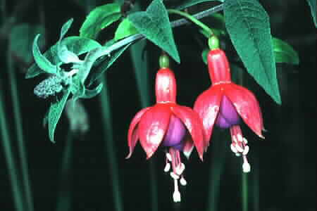
Fuchsia is widely cultivated around park headquarters. Copyright © Chin Fah Shin
|