Links:
Penitencia Creek Trail Dedication
Penitencia Creek Stroll by Jean Rusmore
Santa Clara County Parks
Penitencia Creek
Ed Levin Park
Volunteering
Outdoor Activities
Healthy Trails
Bay Area Ridge Trail
Ridge Trail Guidebook
San Jose Parks
Penitencia Creek Trail
Penitencia Creek Park
Penitencia Photo Gallery
Penitencia Trail Map
Alum Rock Park
Noble Park
Wildlife Center of Silicon Valley
Valley Transportation Authority
San Francisco Bay Trail
Santa Clara Valley Water District
Upper Penitencia Creek Flood Control Project
San Jose Water Company
San Jose City Council District 4
Santa Clara County Supervisor District 4
SCC Open Space Authority
San Francisco Bay Trail
Ron Horii's Park and Trail Pages:
Los Alamitos Creek Trail
Guadalupe River Park and Gardens:
Guadalupe River Trail
Guadalupe Creek Trail
Coyote Creek Trail
Bay Area Biking
Bay Trails, South Bay
Bay Area Parks
Santa Teresa Park
Almaden Quicksilver Park
Bay Area Back Pages
SF Bay Rec & Travel
The Penitencia Creek Trail
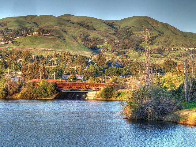
Robert W. Gross Percolation Ponds (HDR Picture)
In
1777, Spanish missionaries founded Mission Santa Clara de Asis. The
padres made pilgrimages to the east side of the valley to an oak grove
bordering a creek. Here they prayed and gave penance along this creek,
which became known as Penitencia Creek.
Penitencia Creek originates in the rugged foothills of the Diablo Range. It fills Cherry Flat Reservoir, then flows through steep canyons into Alum Rock Park, where it joins the Arroyo Aguague. After cutting through Alum Rock Park, with its woodland trails and mineral springs, it runs through flatlands covered with urban neighborhoods. Penitencia Creek used to empty directly into the Bay, but in the 1800's, a farmer plowed a channel to re-route the water from the creeki to his fields so the south. This split Penitencia Creek in two. Upper Penitencia Creek in San Jose joins Coyote Creek at Berryessa Road. Lower Penitencia Creek starts north of Berryessa and flows through Milpitas, joining Coyote Creek near Dixon Landing Road. Despite being surrounded by urban development, Upper Penitencia Creek still maintains much of its natural character, tumbling over rocky beds and lined by riparian trees and bushes. Large native trees, such as sycamores, oaks, and cottonwoods, shade and cool the waters of the stream and provide nesting places for birds. Frog, salamanders, and fish, including trout and steelhead, live in the creek's waters.
The Penitencia Creek Trail is in East San Jose's Berryessa and Alum Rock neighborhoods. It runs along Upper Penitencia Creek from Noble Avenue in the east to Mabury Road in the west. It is only about 3 miles long, but it is an important trail. For the thousands of residents who live near it, it provides a safe, mostly off-road trail to go for a walk or bike ride along the creek or to get to parks and schools. On October 25, 2008, a dedication ceremony was held to designate the trail as part of the Bay Area Ridge Trail network. (See the Mercury News article.) It will provide a gateway to Alum Rock Park and the Boccardo Trail, which are parts of the Ridge Trail. It will someday connect to Coyote Creek, which will provide access to the San Francisco Bay Trail.
This tour of the Penitencia Creek Trail starts at its east end at Noble Avenue. On the upstream side of Noble Avenue is a Water District gate and levee along the creek, but that area is not yet open to the public. There are plans to extend the trail to Alum Rock Park, in a segment called Reach 1. The tour below will follow the creek and take sidetrips to nearby points of interest. The pictures are not necessarily all in the direction of travel. This is the second version of this page. The original pictures were taken on October 25 and 26, 2008. They have been moved to this page. The pictures on this new page were taken on March 7, 2009. The information reflects conditions at that time and may change.

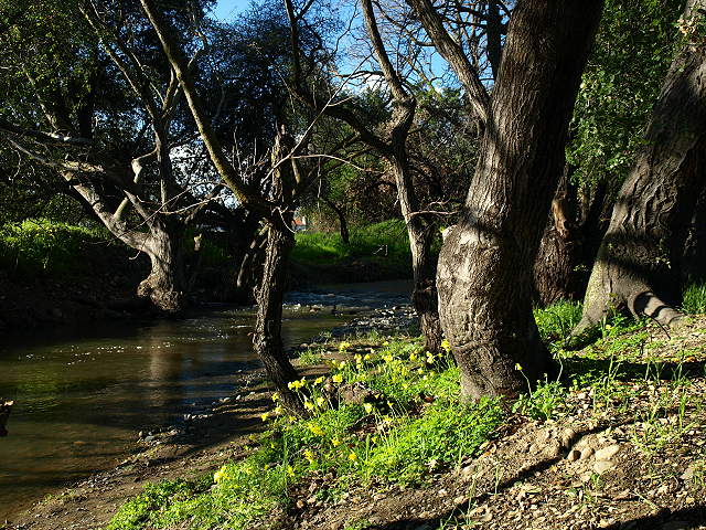
Penitencia Creek upstream from Noble Avenue.

The Noble Avenue Bridge over Penitencia Creek. The trail entrance is ahead and to the left.


Penitencia Creek


There are several ponds here
with gravel levee trails around them and spillways joining them (see
the picture at the top of the page). These percolation ponds cover 20
acres with an average depth of 7 feet in each pond. They are named the
Dr. Robert W. Gross Groundwater Recharge Ponds. They honor Dr. Gross,
who was a Santa Clara Valley Water District director for 20 years.
Water for the ponds comes from Upper Penitencia Creek and the South Bay
Aqueduct, which carries water from the Sacramento River Delta.


Looking back at the bridge.


Old dam on the channel.


Poppies by Penitencia Creek.

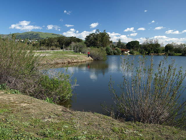
On the west side of Piedmont Road is the entrance to San Jose's Penitencia Creek Park.

Flowers by the trail.


The centerpiece of Penitencia Creek Park is a large pond filled with waterfowl.


Penitencia Creek next to the trail.

This is a view looking back along the trail.

This is part of the large open space park area south of the trail.
There is a circle of stones surrounded by a circle of trees in this park.
Great egret near Penitencia Creek

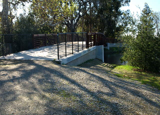
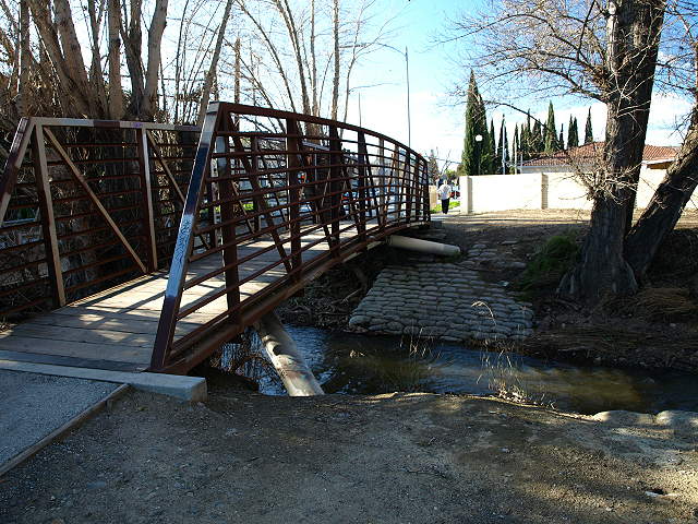
The trail crosses over Penitencia Creek on a small bridge.


Penitencia Creek from the Capitol Avenue Bridge.

Penitencia Creek flows under the Capitol Avenue Bridge. As yet, there is no under-crossing.

There is habitat restoration going on near the trail.

The under-crossing is at creek
level and is subject to flooding. At the time these pictures were taken
(in March), the trail was closed due to flooding. To reach the other
side of the trail, Take Berryessa or Mabury over I-680 and turn on to
Jackson Avenue. Turn onto Mossdale Way.

On the other side of the I-680 under-crossing, the creek runs close to the level of the trail.

The trail runs next to Mossdale Way.


Just after Penitencia Creek crosses back under Mabury Road, the Penitencia Creek Trail officially ends at this sign

This
ends at King Road. This last section from Mabury Road to King Road is
called Reach
6. The City of San Jose and the Bay Area Ridge Trail Council got
funds from the State
Coastal Conservancy to pave this section and make it part of the
Bay Area Ridge Trail, which should be happening in the near future. This is effectively the end of the trail.
You can
backtrack along the trail or take a road back. Just north of the creek
is Commodore Drive, which will take you back to North Jackson Avenue.
Penitencia Creek itself turns after King Road and parallels Berryessa Road. It flows past the entrance of the San Jose Flea Market. At the corner of the Flea Market, it ends at Coyote Creek. There are plans to develop the Flea Market site and proposals to build a BART station there, which will affect the development of public trails in the area. Coyote Creek is lined with levees, and the Coyote Creek Trail will eventually follow them all the way to the San Francisco Bay Trail. The lower parts of Coyote Creek at Milpitas' McCarthy Ranch, Fremont's Coyote Creek Lagoon, and the Alviso salt pond trails are already along established segments of the Bay Trail. For now, only parts of Coyote Creek are open to the public as trails. Note that the south part of the Coyote Creek Trail to Morgan Hill is already a part of the Bay Area Ridge Trail.

At the end of the day, you can enjoy the sunset at one of the ponds along the trail.
Created by Ronald Horii, 3/8/09Penitencia Creek originates in the rugged foothills of the Diablo Range. It fills Cherry Flat Reservoir, then flows through steep canyons into Alum Rock Park, where it joins the Arroyo Aguague. After cutting through Alum Rock Park, with its woodland trails and mineral springs, it runs through flatlands covered with urban neighborhoods. Penitencia Creek used to empty directly into the Bay, but in the 1800's, a farmer plowed a channel to re-route the water from the creeki to his fields so the south. This split Penitencia Creek in two. Upper Penitencia Creek in San Jose joins Coyote Creek at Berryessa Road. Lower Penitencia Creek starts north of Berryessa and flows through Milpitas, joining Coyote Creek near Dixon Landing Road. Despite being surrounded by urban development, Upper Penitencia Creek still maintains much of its natural character, tumbling over rocky beds and lined by riparian trees and bushes. Large native trees, such as sycamores, oaks, and cottonwoods, shade and cool the waters of the stream and provide nesting places for birds. Frog, salamanders, and fish, including trout and steelhead, live in the creek's waters.
The Penitencia Creek Trail is in East San Jose's Berryessa and Alum Rock neighborhoods. It runs along Upper Penitencia Creek from Noble Avenue in the east to Mabury Road in the west. It is only about 3 miles long, but it is an important trail. For the thousands of residents who live near it, it provides a safe, mostly off-road trail to go for a walk or bike ride along the creek or to get to parks and schools. On October 25, 2008, a dedication ceremony was held to designate the trail as part of the Bay Area Ridge Trail network. (See the Mercury News article.) It will provide a gateway to Alum Rock Park and the Boccardo Trail, which are parts of the Ridge Trail. It will someday connect to Coyote Creek, which will provide access to the San Francisco Bay Trail.
This tour of the Penitencia Creek Trail starts at its east end at Noble Avenue. On the upstream side of Noble Avenue is a Water District gate and levee along the creek, but that area is not yet open to the public. There are plans to extend the trail to Alum Rock Park, in a segment called Reach 1. The tour below will follow the creek and take sidetrips to nearby points of interest. The pictures are not necessarily all in the direction of travel. This is the second version of this page. The original pictures were taken on October 25 and 26, 2008. They have been moved to this page. The pictures on this new page were taken on March 7, 2009. The information reflects conditions at that time and may change.
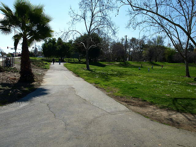
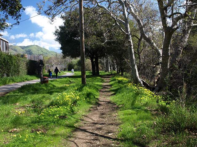
Penitencia Creek upstream from Noble Avenue.
The Noble Avenue Bridge over Penitencia Creek. The trail entrance is ahead and to the left.
This
is the start
of the Penitencia Creek
Trail on Noble Avenue. There is no parking lot nearby, but you can park
on the street. There's a Water District bench at the entrance, with a
diagram of the Valley's water system and how Penitencia Creek fits into
it. The trail starts through the gates.
After
passing through the gates, you travel down a gravel levee road between
Penitencia Creek on the left beyond the fence and a drainage channel on
the right.
Penitencia Creek
You
pass by the side of a percolation pond.
There's
a bridge across the spillway of one of the upper ponds. On the other
side, is a field and a small parking area on Noble Avenue, next to the
Berryessa Community Center Office. Across Noble Drive and a little to
the west is the Berryessa Library and Noble Park.
This
is the Berryessa
Branch Library on 3311 Noble Ave. The original library here covered
8,367 sq. ft. and opened in 1968. The new library replaced it. It has
26,000 sq. ft. and opened on March 12, 2005. It has an Internet Cafe,
Technology Center, study rooms, and a community room.
This
is the pond at Noble Park, next to the library. The park has picnic
tables and a playground.
Back
at the percolation ponds, the main trail parallels Penitencia Creek and
crosses over a spillway on a new bridge.
Looking back at the bridge.
On
the other side of the bridge is gravel levee trail that runs between a
channel and the backyards of homes. Penitencia Creek is to the left of
the channel.
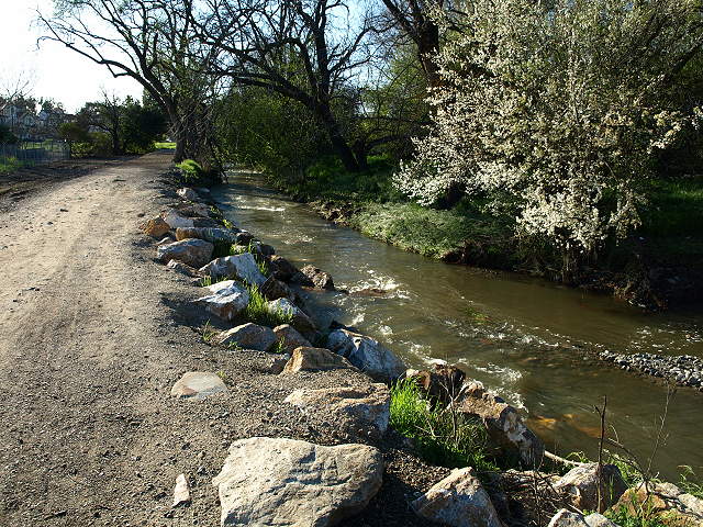
Old dam on the channel.
The
levee trail ends at Piedmont Road. There is a bridge over the creek,
but there is not an official under-crossing for the trail yet. You have
to cross over Piedmont Road at the traffic lights at Penitencia Creek
Road or Noble Avenue.
Poppies by Penitencia Creek.
On the west side of Piedmont Road is the entrance to San Jose's Penitencia Creek Park.
At
the same point is the entrance to the paved Penitencia Creek Trail.
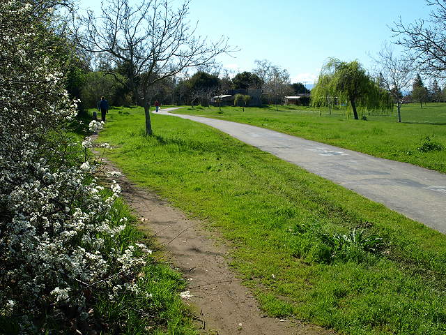
Flowers by the trail.
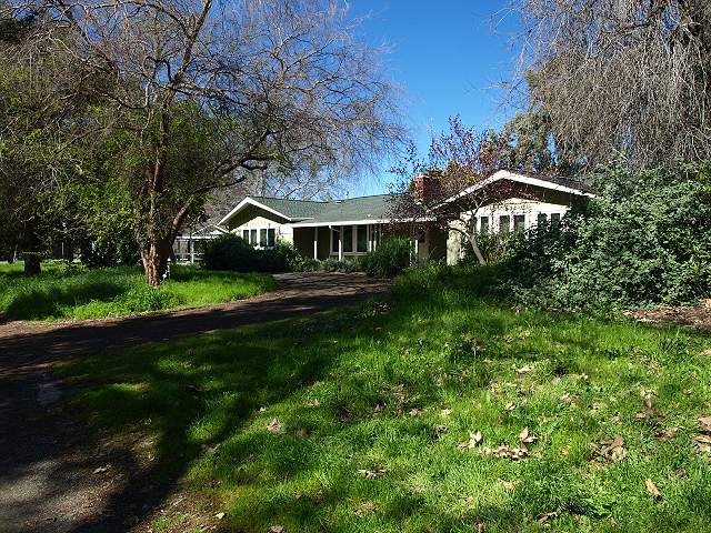
Along
the trail is the Rainbow's
End Girl Scouts Program Center, which is used by the Girl Scouts of
Northern California for day camps.

Here is the tree-shaded trail between the creek and the Rainbow's End center.

This old bridge crosses over Penitencia Creek to Penitencia Creek Road (HDR picture).
The trail enters an open area. The park used to be an orchard. Some trees are holdovers from those days.

This dirt path parallels the paved path next to Penitencia Creek (HDR picture).
Trail next to the Wildlife Center
Here is the tree-shaded trail between the creek and the Rainbow's End center.
This old bridge crosses over Penitencia Creek to Penitencia Creek Road (HDR picture).
The trail enters an open area. The park used to be an orchard. Some trees are holdovers from those days.
This dirt path parallels the paved path next to Penitencia Creek (HDR picture).
Trail next to the Wildlife Center
Farther
along the trail is the Wildlife Center
of Silicon Valley, which cares for and rehabilitates injured and
orphaned animals.

Paths
lead through Penitencia Creek Park, which has large lawn areas.
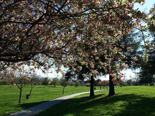
Crabapple trees bloom along a park path.
The park has big lawns.
Crabapple trees bloom along a park path.
The park has big lawns.
The centerpiece of Penitencia Creek Park is a large pond filled with waterfowl.
On
the north side of the park is a playground and the Berryessa
Community
Center. There are picnic areas here. Next door is Piedmont
Middle School,
which has playing fields.
The
Berryessa Community Center has trompe l'oeil murals that look like
windows onto the farmlands that once covered this area. There is a
large parking lot by the community center.
At
the southwest corner of Penitencia Creek Park is the park entrance and
parking lot. The trail continues on the other side of Penitencia Creek
Road. Use the pedestrian crossing to reach the other side. Cross over
Viceroy Way to reach the trail entrance.
The
trail runs to the left of Penitencia Creek, running through a large
undeveloped area of open space.
Penitencia Creek next to the trail.
This is a view looking back along the trail.
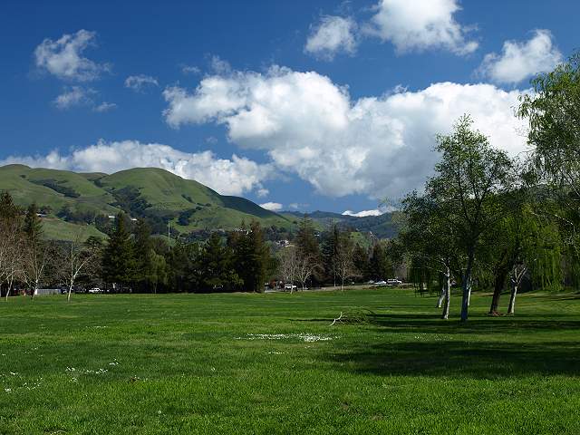
This is part of the large open space park area south of the trail.
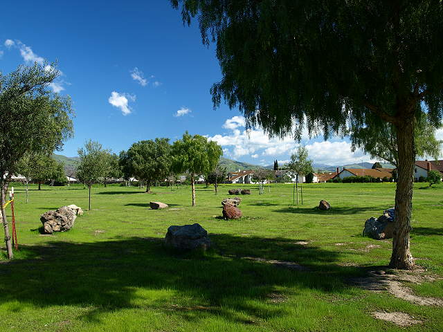
There is a circle of stones surrounded by a circle of trees in this park.
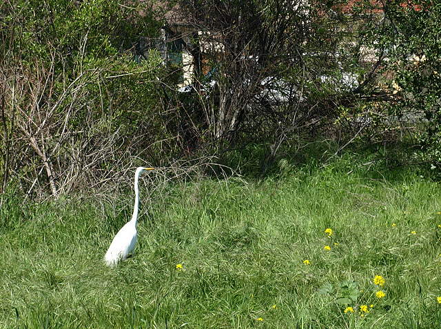
Great egret near Penitencia Creek
The trail crosses over Penitencia Creek on a small bridge.
The
trail runs through another large area of open space to the intersection
of Penitencia Creek Road and Capitol Avenue.
This
is near the trailhead at Capitol Avenue. To continue on the trail, head
south on the sidewalk on Capital Avenue.
On
Capitol Avenue is the Penitencia Creek Light Rail station. Cross over
Capitol Avenue at the signal just south of the station.
Penitencia Creek from the Capitol Avenue Bridge.
Penitencia Creek flows under the Capitol Avenue Bridge. As yet, there is no under-crossing.
There is habitat restoration going on near the trail.
Ahead
is the I-680 under-crossing.
On the other side of the I-680 under-crossing, the creek runs close to the level of the trail.
The trail runs next to Mossdale Way.
This
is the trail entrance at the intersection of Mossdale Way and N.
Jackson Avenue. You can cross Jackson Avenue at Mossdale Way, but there
is no traffic light.
This
is the entrance to the Penitencia Creek County Park Gardens on Jackson
Avenue. The
Gardens take up a triangle of land along Penitencia Creek at the corner
of Jackson Avenue and
Mabury Road.
This
is Penitencia Creek running next to the gardens. On the other side of
the creek is a large area of open space. The Berryessa Community Garden
occupies 2 acres of it.
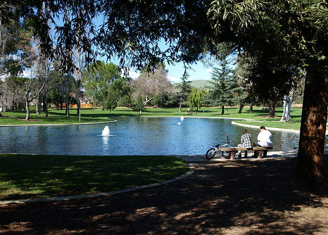
In
the middle of the gardens is a pond with fountains. The park has shade,
lawns, and picnic tables. Trails lead past garden areas.
This
is the southwest corner of the park at Mabury Road, looking back into
the gardens. The Penitencia
Creek Trail ends here as a paved off-road trail.
The
trail route
continues as a bike lane and sidewalk along Mabury Road. They run next
to a
long undeveloped area of open space, which has informal paths through
it.
Penitencia Creek itself crosses under Mabury Road and runs behind a corner of Independence High School. There are no official trails along it. Water is diverted into a percolation pond, so downstream from here, the creekbed may be dry in the late summer and fall. Partway down Mabury Road, at the intersection with Educational Park Drive, is a path crossing the open space, leading to the intersection of Cape Horn Drive and Kennedy Drive.
Penitencia Creek itself crosses under Mabury Road and runs behind a corner of Independence High School. There are no official trails along it. Water is diverted into a percolation pond, so downstream from here, the creekbed may be dry in the late summer and fall. Partway down Mabury Road, at the intersection with Educational Park Drive, is a path crossing the open space, leading to the intersection of Cape Horn Drive and Kennedy Drive.
Just after Penitencia Creek crosses back under Mabury Road, the Penitencia Creek Trail officially ends at this sign
Next
to the sign above, there is a paved path
that follows the creek near a residential complex on Creekland
Circle.
The
paved path ends and turns into a dirt levee along the creek bank.
Penitencia Creek itself turns after King Road and parallels Berryessa Road. It flows past the entrance of the San Jose Flea Market. At the corner of the Flea Market, it ends at Coyote Creek. There are plans to develop the Flea Market site and proposals to build a BART station there, which will affect the development of public trails in the area. Coyote Creek is lined with levees, and the Coyote Creek Trail will eventually follow them all the way to the San Francisco Bay Trail. The lower parts of Coyote Creek at Milpitas' McCarthy Ranch, Fremont's Coyote Creek Lagoon, and the Alviso salt pond trails are already along established segments of the Bay Trail. For now, only parts of Coyote Creek are open to the public as trails. Note that the south part of the Coyote Creek Trail to Morgan Hill is already a part of the Bay Area Ridge Trail.
At the end of the day, you can enjoy the sunset at one of the ponds along the trail.