|
Local Satellite/Radar
STT/STJ/STX/PR Doppler Radar/Sat.
WSTA-AM Radio St Thomas USVI
News , Weather , Talk , *Art Bell
Storm and Hurricane tracking
Java animated tracking
Hurricane City
Storm Information and stateside links
NOAA Weather Radio
RealAudio Live weather forcasts & warnings (eng/esp)
Carib Radio Link
Listen to the latest news on CNN
The Caribbean Hurricane Page
Down Island Reports & links
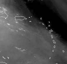
Interactive Weather Satellite
Click and zoom to enlarge your area
Weather Downloads
Hurricane & storm tracking downloads
Realtime Tropical Atlantic Movie
This java realtime graphic takes more than a minute to load
Maps/Charts
Weather Charts and nautical maps with island forecasts
& Tropical Surface Chart
Caribbean World Service Radio (realaudio)
The BBC Caribbean News Service (audio) ......
|
|
Hurricane Storm Chat
Hurricane weather chat
Disaster Message Service
Post & Read Messages from family and friends
BVI Weather Emergency *CDERA
Govt. links for Tortola ,Virgin Gorda & Jost Van Dyke
Solar Activity Monitor
Up to date solar activity
Local area Lightning Map
Virgin Island Lightning Tracker
*SeismicWatch
Latest Caribbean Earthquake Inf.


|


 StormVI@msn.com


 .....
.....
 ..... Oct. 18. 2009 --
Partly cloudy with isolated showers in the morning...then mostly sunny in the afternoon. Breezy. Highs 88 lower elevations ranging to 77 higher elevations. East winds 15 to 20 mph. Chance of rain 20 percent
.....
..... Oct. 18. 2009 --
Partly cloudy with isolated showers in the morning...then mostly sunny in the afternoon. Breezy. Highs 88 lower elevations ranging to 77 higher elevations. East winds 15 to 20 mph. Chance of rain 20 percent
.....


![[ Latest hi-res satellite .... ]](satlo.jpg)

