| Map |
Description |
 |
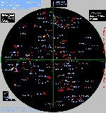
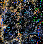
A REAL starchart (1980's) with positions of "Trek-related" systems
within 15 LY. Yellow indicates dust clouds/nebular matter.
Grade: A |
 |
A REAL starchart (1990's) with positions of "Trek-related" systems
within 22 LY.
Grade: A |
 |
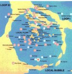
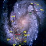
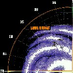
A REAL starchart (1980's) with positions of "Trek-related" systems
within 50 LY. Yellow/Orange indicates dust clouds/nebular matter.
Grade: A |
 |
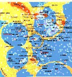
The starchart above with positions of "Trek-related" systems and estimated
borders. Yellow/Orange indicates dust clouds/nebular matter.
Grade: NA - as I estimated the borders, I make no claim that they are
correct. |
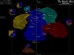 |
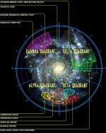
Political map of the Alpha/Beta quadrants. Very well done!
Some real systems out of place, but excellent anyway.
** Very Large file**
Grade: A- |
 |
Another political map of the Alpha/Beta quadrants.
Grade: B |
 |
"Canon" map of UFP systems.
Grade: D |
 |
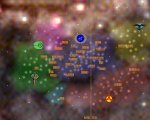
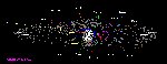
A Full galaxy political map.
Grade: B+ |
 |
Yet another galaxy political map.
Grade: B- |
 |
A 4th galaxy political map.
Grade: B- |
 |
A 5th galaxy political map.
Grade: C+ |
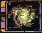 |
An "LCARS based" galaxy map.
Grade: C+ |
 |
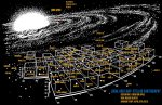
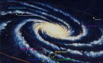
End-on Galaxy map showing political borders above/below galactic rim.
Grade: NA another made by me. |
 |
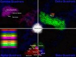
Map of the Alpha Quadrant
Grade: B |
 |
Map of the Beta Quadrant
Grade: B |
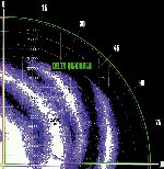 |
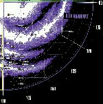
Map of the Delta Quadrant
Grade: B |
 |
Map of the Gamma Quadrant
Grade: B |