![]()
![]()
![]()
![]()
|
|
|
|
Mount Timpanogos Hike Scrambleû Orem Utah Date Scrambled û August 10, 2009
View of the West side from Orem, Utah
The trail head sign 30 yards from the Aspen Grove parking lot
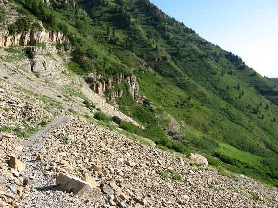
Primrose cirque and the first waterfall, the route eventually curves left
A early view of the upper left cirque
The first waterfall, the trail is partly paved to here
The second larger waterfall, switchbacks begin in earnest here
A better view of the upper cirque
View of the trail
Look back down Primrose Cirque
View of trail in the upper cirque
At the crest of the upper cirque, Hidden Lake just above
Hidden Lake
Trail just past Hidden Lake, Roberts Horn center right
Finally can see the summit objective at hill just before Emerald Hut
Emerald Hut at last, ascent route to the right or west in the background
Emerald Hut Plaque
Route over snowfield to gain lowest point on the North ridge
Looking back from near ridge top
View of last section of trail to ridge top
View to the west from ridge top
Ridge top trail heading south with peak in view
Looking back on ridge trail
Turn up the rock gully, don't follow the trail around the rock outcrop
A view of the rock gully, there is a small switch backing trail here, see pics below
Looking down on the small switch backing trail
View at the top of the rock gully
Trail after the rock gully
The trail soon approaches the final summit block
The last few feet of the trail
Looking back from the summit
Emerald Hut looks a long way down there
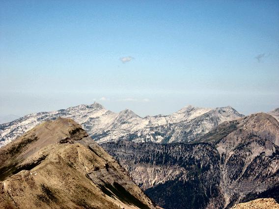
Summit view south Mt Nebo way in the distance
4,900 feet and 7 or 8 miles later I arrive, where are my electrolyte chews A northern clime guy hikes in the heat to bring light!
Summit view to the north, Lone Peak left of center in the distance
Alternative descent route to the south and down the steep snowfield
Alternative descent route as viewed from Emerald Hut. It appears to me that people are a little too casual with such terrain.
A summit view of Mt Nebo to the south
The best mountain scrambler poses for the camera!
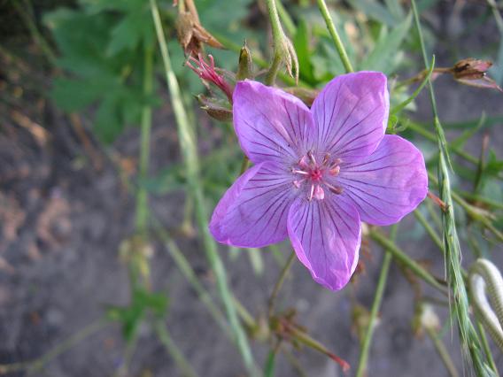
Beautiful wild flowers
More wildflowers
Genetic programming by an infinite artist! Mount Timpanogos Hike Scramble û Orem Utah Date Scrambled û August 10, 2009 Scramble: Class 1, 2 û Steep Hiking Altitude: 3,582m (11,749 ft) Elevation Gain: approx 1,494m (approx 4,900 ft) Ascent Time: 4 1/2 û 5 1/2 Hours Best Season to Scramble: Mid-July to Sept Highlights This scramble is one of UtahÆs most popular and I can see why, beautiful greenery, many wild flowers, numerous waterfalls, high alpine area, a great scramble Getting There From the I-15 near Orem take exit 272 (800 North Orem) and head east for approx 4 miles until you hit the junction for highway 189 north and south. Take the highway 189 north turn which is also called the Provo Canyon Road. Follow this road for approx 7 miles and take a left hand turn just after the tunnel onto highway 92 for the Sundance Ski Area. Continue on this narrow windy road for approx 6 miles passing the Ski Area and the Aspen Grove Lodge area. Just past the lodge you come to a road toll booth. Just past the booth take a left into the Timpagonos Aspen Grove trailhead parking area. There is a fee payable in the parking lot, as sometimes the booth is closed. The fee is $6 for 3 days in the area. Lots of people backpack doing a loop from this trailhead to the other trailhead a bit farther down the road called Timpooneke or vice versa. The Aspen Grove trailhead elevation is 6,850 ft. Route Description The trail starts near the NE corner of the parking lot although there is no sign. A trail exists on the NW side of the parking lot beside the washrooms but the direct spot is the NE corner exit. Within 30 yards you come to the trail head info sign. From here you head straight up the cirque to the first waterfall. If the creek crossing is high there is a slight detour to take a bridge but on my trip day the creek bed was dry so kept going straight up the trail. From the first waterfall the many many switchbacks begin as you ascend to the right up into Primrose Cirque. The trail eventually takes you back to your left and into the upper cirque and as you crest the upper cirque you reach Hidden Lake at approx 9,800 feet. About 2 ¢ to 3 hours to this point. Another ¢ hour to reach the Emerald Hut at approx 10,300 ft then another 2 hours to go to the summit. From the Emerald Hut to your right is the route to reach the lower part of the North ridge. This trail also intersects the trail coming from the Timpooneke trail head. To your left of Emerald Hut above Emerald Lake is the snowfield which many use as an alternative descent route. Head right or west to intersect the low ridge point in the distance. It looks closer than it is and good part of the trail is on a fairly low lying snowfield. Once you reach the ridge at approx 11,300 ft take a left and follow the well defined trail. There is a spot where you head left up a rock gully instead of heading around the rock outcrop on a trail that peters out. Note the photo that I posted for the rock gully ascent as it looks like many follow a trail around the whole rock outcrop then have top backtrack. From above the gully the defined trail continues up to the summit.
|