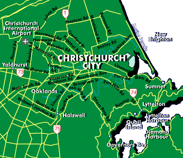
| Christchurch is surrounded by the Pacific Ocean to the east, the Canterbury Plains to the west, and the Port Hills to the South. On a clear day, the Southern Alps, which run down the center of the South Island, can be seen to the west. I live out Papanui Road, which is just above the S in Christchurch City on the map to the right. I work at Christchurch Hospital, which is located just to the left of the C in City. This can best be seen in the map below. |  |
 |
The map to the left illustrates the city centre of Christchurch. Cathedral Square is at the heart of the city and is a popular tourist attraction. Hagley Park, the large light green area is a popular place for cricket, touch rugby and netball, three sports quite popular in NZ. Christchurch Hospital is located at the southeast edge of North Hagley Park, where Riccarton Avenue meets Oxford Terrace. On nice summer days, we often eat lunch by the Avon River which runs just beside the hospital. As you can see on this map as well, it is not a long bike ride for me to go from the hospital to Papanui Road. |