
by: Rick Johnson 
PO Box 40451
Tucson, Az.
85717
RikJohnson@juno.com
Back to the Atlas main page.
Back to the Contents page.

This is the North East quarter of Barsoom.
Keep in mind that if this were placed on a globe, the entire north line (90 degrees) would be a dot! The further north you go on a flat map, the more distorted it becomes. To understand this, look at a flat map of the Earth. Notice Greenland. See how to looks like a triangle?
Now look at a globe of the Earth. See how Greenland now looks like an oval?
That is the distortion caused by a flat map.
The further you go North or South on my maps, the greater the distortion. Feel free to convert them to a globe for a true relationship.
The North East quarter runs from 0 degrees to 180 degrees east, from 90 degrees north to the Equator and encompasses Horz, Duhor and Dusar and the Eastern Throxus Ocean.

A pennensula strikes north into the Throxus seabed to divide this mighty ocean into the Western and Eastern regions. When the Ocean was filled with water, sea travel could only happen in the Summer when the ice melted enough to allow passage. You see here a number of pumping stations and the waterways they feed.

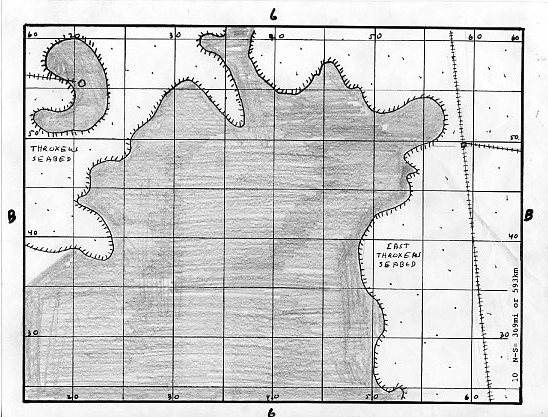
There is not much to see here in the Eastern Throxus seabed save a few waterways and a couple pumping stations.

There is not much to see here in the Eastern Throxus seabed save a few waterways and a couple pumping stations.

Here is the coastline of the Throxus Ocean where you see a couple unknown cities. The large diamond object in the senter south of this section is the Mons Olympus, the largest volcano in Barsoom. This volcano spews not lava but moisture-laden air from the depths to cover the Artolian Hills which you see in the East.
This is the main part of the peninsula that separates the Throxus. In the northwest of this map is a large crescent-shaped hill, once an island and home to an unknown nation with a climate similar to northern Canada.

Here we see the Throxus seabed and in the south the city of Thaandor.

Here is the final section of the mighty Throxus, now a dry seabed inhabited by wild thoats and the banths and calots who hunt them.

Here we see the southern section of the Artiolian Hills and the nation of Duhor on their western slopes. Duhor controls all the land between the Hills and the Throxus shoreline.

These are the highlands that stretch from Gathol to the Forest of Lost Souls where the inhabitants have developed the invisibility pill. Splitting the Forest is where the river that connects the Torquas Basin meets the East Throxus at Dusar.

Here we see the northern part of the Forest of lost Souls and the cities of Invak and Onvak.
Further along the coast, the coastal city of Thaandor.

Here is the SE section of the Eastern Throxus showing the mouth of the eastern river that connects Torquas to the Throxus. We see also the presumed locations for Thilium mentioned in When the Princess Disappeared by The Bards of Barsoom and Jhama.

Just east we see how the Artolian Hills sweep south then east to form the Phundahl hills.
Back to the Atlas main page.
Back to the Contents page.

To contact me or to request topics to be covered, send to RikJohnson@juno.com
by: Rick Johnson
PO Box 40451
Tucson, Az.
85717
