
by: Rick Johnson 
PO Box 40451
Tucson, Az.
85717
RikJohnson@juno.com
Back to the Atlas main page.
Back to the Contents page.

This is the South West quarter of Barsoom.
Keep in mind that if this were placed on a globe, the entire south line (90 degrees) would be a dot! The further south you go on a flat map, the more distorted it becomes. To understand this, look at a flat map of the Earth. Notice Greenland. See how to looks like a triangle?
Now look at a globe of the Earth. See how Greenland now looks like an oval?
That is the distortion caused by a flat map.
The further you go North or South on my maps, the greater the distortion. Feel free to convert them to a globe for a true relationship.
The South West quarter runs from 180 degrees west to 0 degrees, from 90 degrees south to the Equator and encompasses Most of the River Iss, the Lost Sea of Korus, Jahar and the Great Desert.
The thing to remember most is that the SW Quadrant of Barsoom is mostly empty. The rest is jealously guarded by Koal in the far north, Jahar in the far east and the Great Desert that makes the Sahara look like prime grazing land. The only cities of note here are Kobol and Tjanath.
As the Iss runs through this area, the Therns have always kept colonists from the one source of dependable water and even though their religion is discredited, Custom rules on Barsoom and custom decrees that the Iss be kept free of habitation.
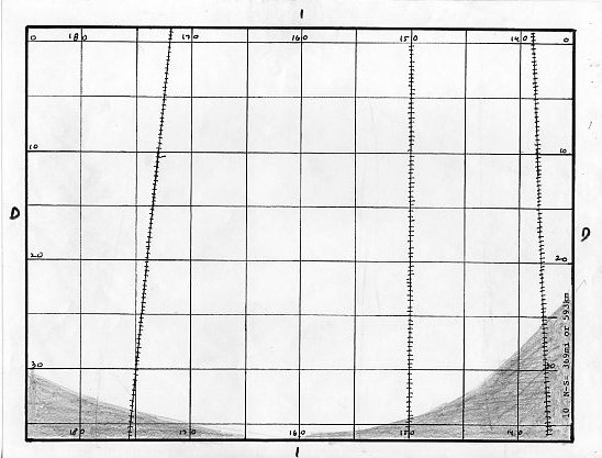
This shows the desert well below Ptarth. You see a few of the rare southern waterways here.
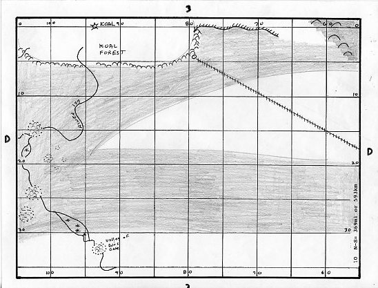
These are the Highlands of the great Desert that surrounds the River Iss. The Iss comes in from the east, passes through a forested crater, a marsh and another forest before leaving this section. Since the Iss tends to cut through many craters and valleys, these create micro-environments that vary with the moisture captured.
Here you see the entire of the lower Iss from the Koal Forest to the Otz Mountains and the eastern part of the Great Desert.
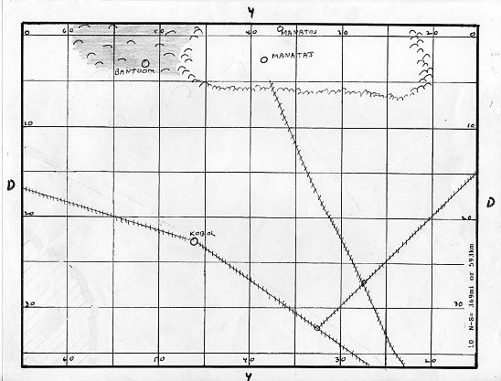
More of the Great Desert and the southern part of the Forest of Manator. You see a waterway that runs from the Koal Forest through the city of Kobol then to Jahar.
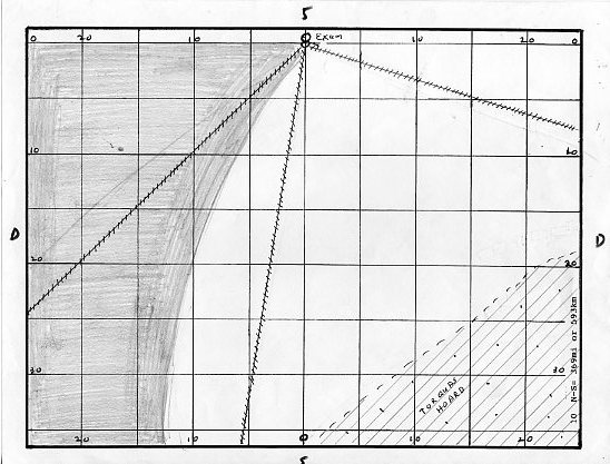
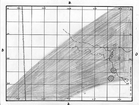
Here is Exum in the north with three waterways stretching south, one to Jahar. You also see the NW tip of the Torquas basin, inhabited by the Green Hoard of that name.
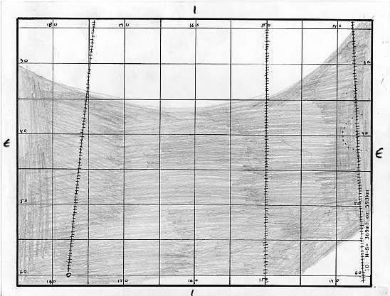
This is just a more southerly portion of the Great Desert west of Korus and well south of Ptarth. This section is mostly high desert, not as harsh as the low desert but not as lush as the seabeds.

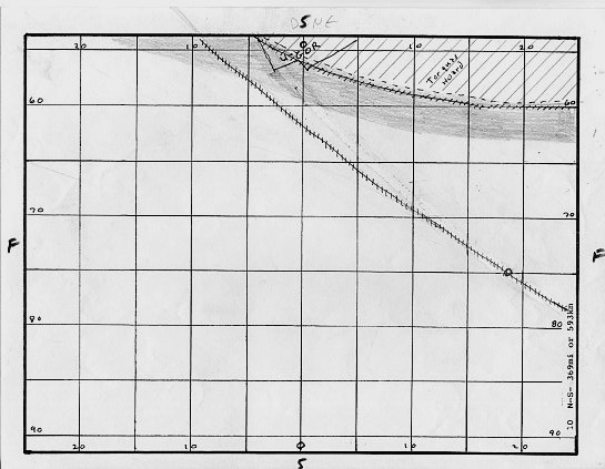
Here you see most of the Sea of Korus, including the Valley Dor and the Valley of Lost Souls where the final Pilgrims would turn aside rather than face the Plant Men of Heaven.
Korus itself is a massive impact crater with the Otz Mountains being the crater rim.

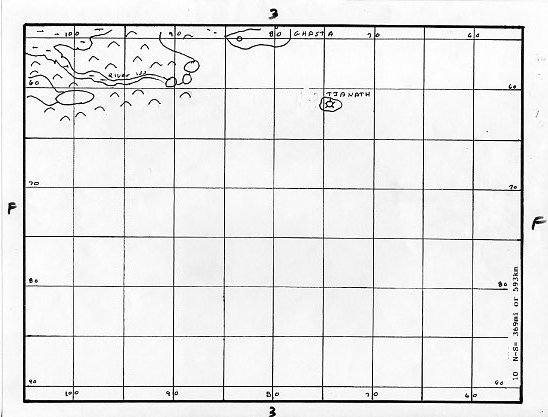
This is the eastern area of Korus showing the southern part of the Iss and the Valley of Ghasta. The dotted line represents the underground river beneath Tjanath and Ghasta to the Iss.
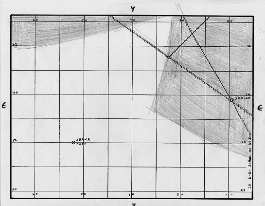
Here we see the eastern edge of the Great Desert with the Jahar fortress of Jhama that was taken over by Phor Tak when he left Jahar. The highlands to the east are the beginnings of the lands of Jahar.
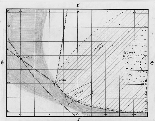
This shows Jahar proper, the unfortunate province of U-Gor which is inhabited by cannibals and the western area of the Torquas Basin.

This area is totally empty save a couple waterways from the south that are, at best, only intermittently full. Most of the year, and often for years at a time, the southern waterways are but a trickle or even empty of water so any cities on these waterways are poor and desperate.

Again, empty save this shows the location of the Valley Dor and the entrance to Omean which was for thousands of years, a secret.
Back to the Atlas main page.
Obviously, there is nothing here. It is desert and cold art night. Any moss that lives here must be able to survive being frozen at night.
Again, more desert and the sw tip of Torquas with a bit of U-Gor. The most interesting feature is the southern waterway that comes from the southern icecap to Jahar. Jahar receives most of its water from the waterways through Kobol and Exum, thus this southern waterway, though poor, reduces their dependence on the former cities.
Back to the Contents page.

To contact me or to request topics to be covered, send to RikJohnson@juno.com
by: Rick Johnson
PO Box 40451
Tucson, Az.
85717
