NAME: DATE:
STREAM SPEEDS AND EROSION/DEPOSITION
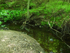
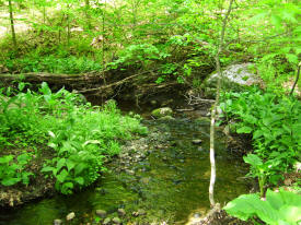
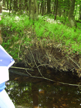
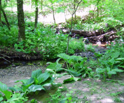
 You
were assigned to visit a stream near your home and examine the way it erodes and deposits
material. If you have not had a chance to do that yet, examine the photo of
the river at right. Compare this stream to the one studied in class. Use
your notes, text, and your own reasoning to answer the questions
after each of the following statements
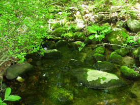
You
were assigned to visit a stream near your home and examine the way it erodes and deposits
material. If you have not had a chance to do that yet, examine the photo of
the river at right. Compare this stream to the one studied in class. Use
your notes, text, and your own reasoning to answer the questions
after each of the following statements
1. The size of the sediment carried by a stream depends on the speed of the water. Will the stream studied in class carry larger or smaller particles than the stream near your home? Why?
2. Sediment carried by a stream scours the bed and sides of the stream channel. Which sides of the stream - the inside or the outside of the curves appeared to be more scoured?
3. A suspension is a mixture of water and particles in which the particles do not settle out because of the energy in the motion of the water. Silt is suspended in water that has any motion at all, sand is suspended and carried in fast moving water, and gravel and rocks are rolled along the bottom of fast moving water. What size sediment was the stream carrying? Why?
4. A solution forms when molecules occupy spaces between water molecules by dissolving into the water. Give an example of three substances that dissolve into water.
5. Suspensions usually appear cloudy, but solutions usually appear clear. Give an example of a beverage that is a solution or a suspension depending on what you add to it, describe how it is changed.
6. Dissolved materials are carried by streams no matter what its speed. Explain why streams continue to be agents of erosion even when they are moving slowly between storms.
7. Areas of slow moving water such as lakes, ponds, swamps cause sediments to drop out of suspension. Explain how ponds turn into wetlands.
8. Deposits of sediment are dropped and sorted by size as the water slows down: largest particles first, fine particles last. Explain where in a marsh or lake you would expect to find sand built up into a sand bar, and where the fine, muddy sediments would be deposited.
9. Areas of slow moving water allow more material to dissolve into the water. Would you expect a groundwater sample to have more dissolved material than runoff or less? Why?
10. Streams remove the most where the water moves fastest: 1) on the outside of curves, and 2) the middle of the stream in straight stretches. Sediment is deposited along streams where they move slowest: 1) on the inside of curves, and 2) the edges of straight stretches. Draw a map of a real or fictional stream that shows removal or deposition in all four places.
11. Floods occur when more runoff enters a stream or river than can be carried by the main stream channel, and are a normal, predictable occurrence along larger streams and rivers. Describe surface and weather conditions that will cause this to happen.
12. When a flood occurs, the excess water flows over flat areas near the stream called a floodplain. What indicated the flooding area along the stream we studied?
13. Sediments are deposited on the floodplain as the flood water slows down. What kind of soil is produced by this?
14. The sediments deposited during floods produce the best soils in Connecticut. If it was your decision, describe WHY you WOULD or WOULD NOT use a piece of flat land along the Farmington or Naugatuck Rivers for each of these uses:
Forest:
Schools:
Open space recreation (hiking, picnicking, camping, fishing):
Recreation fields (baseball, soccer, etc):
Farming:
Houses:
Industrial/commercial uses:
Sewage treatment:
15. Much of the danger of flooding can be prevented by not allowing building on the floodplains of rivers and streams. List three reasons why society should try to make sure people use floodplains appropriately.
16. Many of our rivers and streams have been artificially straightened and deepened to remove water faster to prevent flooding, this is called channelization. This channelization results in greater erosion due to faster water, and more flooding and sedimentation downstream. Explain why channelization does this.
Runoff, Erosion, Deposition Field Notes
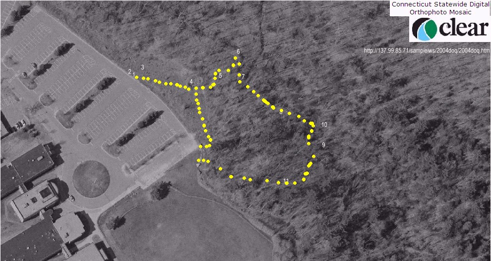
Add notes about what you saw during the fieldwork to the left side of the chart. On the right, draw a diagram or picture to represent each concept. Make up sample questions below each station description.
|
Station Number/ Location |
Notes /Sample Questions |
Diagram |
| 1. Bare soil on slope near parking lot | Look closely where bare
soil is directly exposed to raindrops. When it rains faster than the
water can soak into the ground, water flows over the surface as a
thin film or sheet. This called sheet flow. Soil loosened by the
direct force of raindrops is carried away, this is called sheet erosion. Evidence of sheet
erosion: more pebbles on surface after rainstorms, pebbles on
pedestals. Fix sheet
erosion by covering soil. Example Sample Question:How can sheet erosion be prevented?
|
|
| 2. Rills on slope | Rill erosion: loose material removed in small channel (1-6 inch) straight down hills. Fix by raking then cover. | |
| 3. A gully may form in the middle of the slope | Gullies: large channels
form with removal of lots of soil, major erosion. fix by diverting
water flow, fill in gully, cover, monitor.
|
|
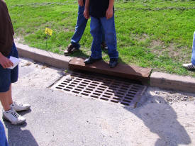
| 4. Sedimentation Basin | Sedimentation basin slows
flow from storm drains, helps it soak in. It was flattened out to
clean it, now it is just a flat, rock area.
|
|
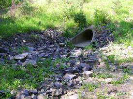
| 5. Channels downhill from basin | Transient
(intermittent) streams: channels that only flow with runoff, get
wider, deeper every rainstorm, collect water from sheet flow, rills, gullys from large area, may be found at base of hills.
|
|
| 6. Stream at bottom of valley | Permanent streams flow
between runoff times because of base flow from groundwater.
|
|
| 7. Downhill from erosion channels | Sedimentation where
intermittent stream reaches permanent stream shows that runoff
is reaching stream.
|
|
| 8. Downstream where trail goes along stream | Straight sections of
stream shows sedimentation in pools only.
|
|
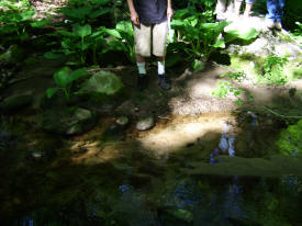
| 9. Follow trail to where the stream goes through an "S" curve | Outside of curves is
eroding the stream bank, inside of curves has sand bars, other
deposition.
|
|
| 10. Bottom of the valley | Flood plain of stream
- whole bottom of valley is flat, sides of valley have steep banks
where the stream flowed against it at some point in the past.
|
|
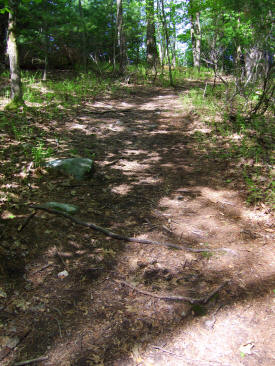
| 11. Follow trail uphill back to parking lot | Trail is eroding and exposing rocks
and roots where it goes straight down the hillside. A diagonal path
would let water flow off the side of the trail and soak in. Diagonal
drains across the trail would divert water to natural soil to soak
in.
|
 |
 |
 |
 |
 |
 |
 |
 |
 |