

June 5th, 1999
This trip we were a little more prepared for. The first thing we checked
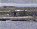
out when we got there was the CBQ/BOQ. There's a wooden fence around the
whole building now and it's pretty impossible to get any closeup shots of
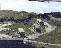
the building. Next stop was the 900 block housing. I wanted to get a few
more pictures of if before those buildings are totally gone. The construction/destruction
site security are pretty suspicious, as soon as i came near the area they
were watching us. We deciding to get out of their way and go check out the
underground bunkers on the dirt road behind 1000 block housing, on the
last trip. I was suprised to find out home far back the road goes, and how
many bunkers there actually where back there. I saw about 8. Some are being
used as a temporary place to store asbestos with pad locks on the huge iron
and cement doors, while others were totally welded shut. On a side note,
i wouldn't suggest driving a vehicle up these roads the farther back you go,
the more chance you'll get stuck in the mud. A few of the bunkers have an
open grate on the door that you can stick a flashlight in or, as i did, a
camera with a flash, to see whats in there. All the ones that we could see in
were empty. The path/road continues up behind the BOQ/CBQ (depends where you
read the name). On some of the older, less used roads there are little
(almost unnoticable) paths. The two of these that i found had older looking
bunkers at the end. These ones had steel culverts at the front and were
camoed alot better. The second one i found was almost impossible to see even
from 15 ft away. Another side note, these pathways took us almost 1 1/2 hours
to walk and we didn't even check out all the side paths. We made our way down
the hill which came out just below the BOQ/CBQ. While we were looking at the
map of the offical trail (which we thought we were on, nope), a security guy drove
down to us and asked me my name and if it was our vehicle that was parked up by
1000 block housing. He informed us that the trail that we were on was off
limits. I did my usual, play dumb and apologize. We offered us a ride up the
road back to our vehicle, and he told us about the offical trail and how to get
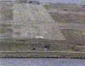
down there. The public trail (Backland Trail) is down past the 900 block housing.
The road is paved and isn't it too bad a condition. There are 2 open bunkers
along the road going down. Although one was filled with sand for some reason.
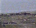
There are two different lookouts along this road as well was a spot up by the
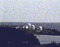
Coast Guard radar station at the top of the hill. The radar station is probably
the best place to get a overhead shot of the airfield/runway and stuff on the
northside of Argentia. The Backland trail has road running through most of it,
but to get down to the US Naval lookout is about a 10-20 minute walk. Once we
got enough pictures of the northside we went back down the hill to get some
shots of the Radar station of the other side of the ferry road. This area is
off limits. There are lots of warning signs and just past the gate there is an
old delapitated sign that reads "Rifle and pistol range". The signs on the gate
are Canadian Federal Govn't, but it's actually the a US Govn't sub tracking station.
|


|
back
Disclaimer: We do not accept responsibility or think it's a good idea
for anyone to enter any of these buildings or do anything we talk about on this
page.
questions, comments, or new spot tips?:
urbanexplorer@hotmail.com
|