Live Cameras Around the Island
Thanks
to the Department of Works, Services & 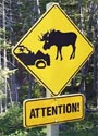 Transportation,
Government of Newfoundland and Labrador, you can view
road conditions live around our island by clicking
the images below. Enjoy, and watch out for the moose!!! A
new image should be available every few minutes. Transportation,
Government of Newfoundland and Labrador, you can view
road conditions live around our island by clicking
the images below. Enjoy, and watch out for the moose!!! A
new image should be available every few minutes.
You can also visit the Offical
Web Site to see
more options.
Click on image
to see a larger view..
 |
Foxtrap,
Newfoundland Canada, Trans Canada Highway,
Route # 1, Looking East |
 |
Goobies,
Newfoundland Canada, Trans Canada Highway,
Route # 1, Looking West |
 |
Grand
Falls - Windsor, Newfoundland Canada, Trans
Canada Highway, Route # 1, Looking West |
 |
Pynn's
Brook, Newfoundland Canada, Trans Canada
Highway, Route # 1, Looking West |
 |
Channel-Port-aux
Basques, Newfoundland Canada,
Trans Canada Highway, Route # 1, Looking West |
 |
flower's
Cove, Northern Peninsula
Newfoundland Canada, Route # 430, Looking North |
 |
Salt Pond, Burin Peninsula Newfoundland Canada,Route # 220, Looking South-East
|
 |
Happy Valley - Goose Bay,Labrador Canada,
View from Elizabeth Goudie Building |
 |
L'Anse Au Loup,Labrador Canada,
Branch Road near the Town Center Building |
|


