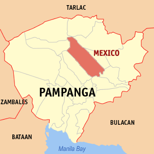
Composition
Apalit (Pop as of 2005: 78,295), Candaba (97,921), Macabebe
(68,339), Masantol (48,129), Minalin (35,150), San Luis (46,209), San Simon (41,253),
Sto. Tomas (32,695), Arayat (101,792),

Significance of
the Area
The towns lie within the lowest portion of the
The area is critical for various concerns of the national government that include:
1. Environmental
Protection, Conservation and Management that spans the length of the
2. Agriculture and Aquaculture that can feed the growing demands of the nearby National Capital Region and surrounding growth centers;
3. Flood mitigation and Water Management;
4. Alternative routes and transportation for trade and commerce through Pampanga;
5. Balanced
land utilization for a model of sustainable development in
6. Eco-tourism.
Objectives of the
Caucus/Group
- To promote and live fully the spirit of the Local Government Code that mandates the local government units to be active partners in national development and implementers of programs and projects within their areas of jurisdiction and responsibility.
- To promote cooperation and establish effective coordination among member local government units in addressing mutual cross-border concerns.
- To build and beef up capabilities of member local government units to plan and implement projects in relation to the above-mentioned concerns.
Member Local
Government Units
 1. Apalit
|
Barangays of Apalit |
||
|
Balucuc |
Colgante |
San Vicente |
|
Calantipe |
Paligue |
Sucad |
|
Cansinala |
Sampaloc |
Sulipan |
|
Capalangan |
|
Tabuyuc |
Barrio Capalangan which
derived its name from the Kapampangan word "Palang" meaning machete
or bolo is believed to have been founded by the son of a certain Gatbonton
named Pangpalung who in his in youth was called Macapagal. This barangay was the
home of Panday Pira, the first known Filipino maker of cannons. He manufactured
cannons called lantakas for the troops of Rajah Soliman and after the Spanish
conquest of
Puerto Sulipan was once
the haven of Philippine high society and elite circles of the rich and famous
in politics and in business during the time of Capitan
With about 72 square
kilometers in land area, the town of
Apalitenos are also noted for their cottage industries such as weaving of cloth, mats, hats, pottery and metal working in gold, iron and silver.
Apalit is also a farming and fishing town. However, during the last few years, commercial and manufacturing firms have been established in this town. Several banking institutions, shopping malls, department stores, supermarkets, movie theaters, restaurants are also flourishing in the business area of the town.
 2. Candaba
Candaba, Pampanga is a Philippine town noted for its productive farmlands where sweet watermelons were made popular. It is known for its wide and scenic swamps, migratory birds, mudfish, catfish and many others. Candaba, once known as Candawe, has also become a major source of tilapia and duck eggs.
It is one of the oldest settlements during the pre-Hispanic time, and long before the encomenderos took hold of the town in 1593.
Basically a fishing and farming community, the place was administered by
"datus" even as early as 1577. Topographically, Candaba, specially
the swamps for what it became famous, represents the lowest point in
The swamps are communal fishing grounds encompassing some 430 square kilometers of highly arable land.
Nowhere in Pampanga can one find any more fertile land than that of the
Candaba swamps due to its sustained deposits of humus and decaying vegetable
residues. Migrant wild ducks and various bird species escape winter winds from
The barangays of Candaba are Bahay Pare, Bambang, Barangca, Barit, Buas,
Cuayang Bugtong, Dalayap, Gulap, Dulong Ilog, Lanang,
Candaba has developed into 3 regions because of its geographical
characteristics. The Tagalog region comprising of 14 barangays shares border
with Bulacan, the Capampangan region, comprising of 8 barangays lies farther
north sharing boundaries with both Bulacan and Nueva Ecija, while the town
center, the Poblacion with 11 barangays is separated by the vastness of the
Candaba has a total of 18,711 hectares of agricultural land with 5,433 farmers. During the rainy season it decreases to 12,425 hectares with 3,875 farmers.
Aside from rice, the other significant agricultural products are green corn involving some 332 hectares and 194 farmers and melon covering some 226 hectares with 105 farmers. About 60 hectares are used for commercial growing of various lowland vegetables.
Candaba has 462 fishpond operators utilizing some 3,425 hectares of wetland. The rivers and their tributaries are inhabited by various species of fish that provide sources of income for marginal fishermen and trappers.
Tilapia is the main produce of the fishponds contributing significantly to making Pampanga the top tilapia producer of the country.
A fledgling ornamental fish industry exists in Candaba offering good prospects for the highly lucrative Koi industry.
3. Macabebe

Macabebe is an ancient
town of the
The fact that the dialect
of the Macabebes is more severe and louder is attributed to how the ancestors
of the town must have shouted their ideas across the waters.
The
Macabebe has 25 barangays:
|
|
4. Masantol
 Although this town is still called
Masantol which means abounding in santol trees, there are that not many santol
trees growing anymore in this area. Several tropical fruit trees grow in
backyards but not in large numbers or in mass production. According to Mr.
Manny Fajardo, a descendant of one of the founders of the town and the son of a
former mayor of Masantol, that if the town will be renamed today, the
appropriate name should be "Masugpo" in Tagalog or "Maparo"
in Kapampangan.because of the abundance of shrimps in the fishponds and rivers
in this town.
Although this town is still called
Masantol which means abounding in santol trees, there are that not many santol
trees growing anymore in this area. Several tropical fruit trees grow in
backyards but not in large numbers or in mass production. According to Mr.
Manny Fajardo, a descendant of one of the founders of the town and the son of a
former mayor of Masantol, that if the town will be renamed today, the
appropriate name should be "Masugpo" in Tagalog or "Maparo"
in Kapampangan.because of the abundance of shrimps in the fishponds and rivers
in this town.
|
Barangays of Masantol |
|||
|
Alauli |
Malauli |
|
Sta. Lucia Wakas |
|
Bagang |
Nigui |
|
Sta. Monica |
|
Balibago |
Paguiaba |
San Nicolas |
Sto. Nino |
|
Bebe Anac |
Palimpe |
San Pedro |
Sapang Kawayan |
|
Bebe Matua |
Puti |
Sta. Cruz |
Sua |
|
Bulacus |
Sagrada |
Sta. Lucia Anac |
|
|
Cambasi |
San Agustin |
Sta. Lucia Matua |
|
Shrimp raising has become
very profitable. Large acreage of rice plantations have been converted into
fish ponds producing shrimps and milkfish. Fishing in rivers and in
 5. Minalin
Like a typical town
located in the Pampanga delta, the principal industries of Minalin are farming
and fishing. Despite of the damages caused by the eruption of
|
Barangays of Minalin |
|||
|
Bulac |
|
San Pedro |
|
|
Dawe |
|
|
Santa Rosario |
|
|
|
|
Saplad |
|
Maniango |
San Nicolas |
Santa Rita |
|
Minalin which is also known as the "Egg Basket of Luzon" because
of its large scale production of eggs and chickens is still a dream town and a
tourist attraction for its "Belles of Minalin" New Year’s Celebration
in which men dressed as beauty queens ride through town on festive floats. This
annual display of beautiful dresses and expertise in women’s make up signifies
that this town follows the dynamic changes in women’s fashion not only in the
6. San Luis
|
Barangays of San Luis |
||
|
San Agustin |
San Roque |
|
San Luis was originally
divided into six geographical divisions: Candola, Bularit, Bonot,
 Prior to the construction of the
Arnedo Dike during the term of Don Macario Arnedo as governor of the province
of Pampanga in 1904-1908, barrio roads and most of the land area were
frequently flooded during the rainy seasons because of the overflow of water
from the Pampanga River. It was very difficult for the people to travel around
the local community to market their farm products, fish and other produce. Due
to these annual calamities, the municipal government located in barrio
Prior to the construction of the
Arnedo Dike during the term of Don Macario Arnedo as governor of the province
of Pampanga in 1904-1908, barrio roads and most of the land area were
frequently flooded during the rainy seasons because of the overflow of water
from the Pampanga River. It was very difficult for the people to travel around
the local community to market their farm products, fish and other produce. Due
to these annual calamities, the municipal government located in barrio
Like their fellow
Kapampangans and other Filipinos in other towns and cities in the
President
Magsaysay launched his economic program for rural reconstruction with barrio
 7. San Simon
San Simon, an emerging business
haven in Central Luzon particularly in the province of Pampanga had its humble
beginnings in 1770 as a farming village when it was founded by Don Mariano del
Pilar de los Reyes and named it Barrio Del Pilar. It was located in a productive
agricultural area between the towns of San Luis in the North and Apalit in the
South. As the population kept on growing in the local community, the leading
citizens of the progressive village initiated a petition to consolidate a
portion of the southern part of the town of
By the year 1835, the town had
eight barrios. However, since the late 1940s, the number of barrios increased
to fourteen in a land area of 57.36 square kilometres and by the early years of
the 21st century, the population grew to more than 39,000 people. As of today,
the barrios or barangays in San Simon are the following:
Concepcion, San Juan, San Pedro
(Cutcut), De la Paz, San Miguel (Calonge), Santa Cruz, San Agustin(Tulauc), San
Nicolas (Sompong), Santa Monica (Pangkiari), San Isidro (Litlit), San Pablo
Libutad, Santo Nino, San Jose, San Pablo (Pulo).
In 1904, the town
of
Another factor that contributes
to the potential economic growth of San Simon in the 21st century is its
geographic location. It is strategically located in the central part of the “W”
Growth Corridor of Central Luzon and it is accessible from major road networks
and arteries coming from the different provinces of
Taking advantage of the conducive
local business environment, tax incentives and availability of skilled workers,
many manufacturing and commercial firms have been established or relocated in
San Simon. The infusion of private capital investment was about ten billion
pesos and expected to increase to more than twenty billion pesos by the early
years of the 21st century.
 8. Santo Tomas
The town of
Although the population of Santo Tomas had been consistently increasing from 21,382 in 1975 to 38,483 in 1995 as per the National Census compiled by the Provincial Planning Office, its geographical area remained the same at 21.29 square kilometers. Economic growth and increases in population initiated the creation of two barangays in 1970. These two barangays, Sapa - Santo Nino and Moras de la Paz were former purok or sitios of the progressive barrio of San Matias.
The primary industries of the town are pottery, ceramic, carpentry, trading and farming.
9. Arayat
 The
The
The
historic
By
declaring
Pampanga
residents, particularly those living near the 1,026-meter-high dormant volcano,
would benefit if it is declared and developed as an ecotourism center because
it will generate additional revenue for the local residents and firms.
Concerned
government agencies and civic organizations will also be encouraged to promote
the place and invest in tourist-oriented establishments and facilities there.
This
is now the most opportune time to develop
If
Arayat is politically subdivided
into 30 barangays.
|
|
10.
When water transportation was still the primary means of travelling,
the town of
|
Barangays
of |
|||
|
Acli |
Gandus |
Sabanilla |
|
|
Anao |
Lagundi |
|
San Roque |
|
Balas |
Laput |
|
San Vicente |
|
Buenavista |
Laug |
|
Sta. Cruz |
|
Camuning |
Masamat |
|
Sta. Maria |
|
Cawayan |
Masangsang |
|
Sto. Domingo |
|
|
Nueva |
|
Sto. |
|
Culubasa |
Pandacaqui |
San Miguel |
Sapang Maisac |
|
Divisoria |
Pangatlan |
San Nicolas |
Suclaban |
|
Dolores |
Panipuan |
|
Tangle |
|
|
Parian |
San Patricio |
|
The town of
In olden times Sta. Ana was a vast place of forest bordered
by places known as Santa Ana which used to be called "Pinpin" had its
first Augustinian Mission authorized by the first bishop of the Philippines,
Don Fray Domingo de Salazar on August 29, 1590, the same date the Augustinian
Mission in Arayat was authorized to be founded, both missions were under the
jurisdiction of the Parish of Candaba Santa Ana, a farming area that now has
tilapia fishponds and a modest poultry industry.
Soon more people came to settle in the place. They selected a leader from the
settlers, one who was bravest, the most diligent and how understood the
problems of the people. He was addressed as Datu, Gat and Apo.When the
Spaniards came, they named the place Sta. Ana.