Homage to the beauty of Nordland
(This page is VERY heavy on pics, but it'll be well worth the wait)
Although the climate can be harsh at times, Nordland, the southernmost county of the three considered northern Norway, deserves to be noted for its beauty as well as its rather wily weather conditions. Although this part of the country is mostly made of mountain ranges, people have still been able to scratch out a living at the most amazing places and settled in more amazing locations still. There is no such thing as a straight line in Nordland, the nature is all crooked and bent, which makes communications very difficult. Mountain ridges, multitudes of fjords and myriads of islands and islets make travelling a pleasing aspect to the eye (while the weather is fair).
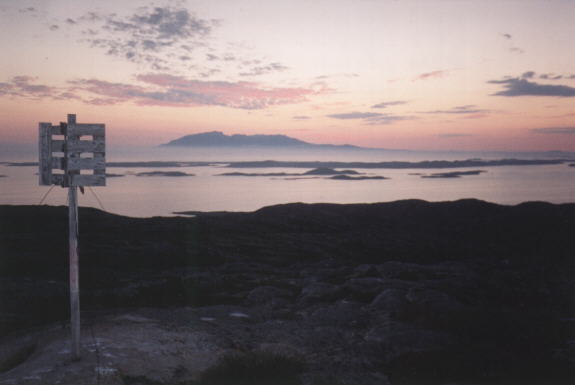
In the north, Nordland consists of several large islands in the Vesterċlen and Lofoten archipelagos. These islands have for eons been a haven for fishermen wanting to be close to their catch, with the Atlantic outside their doorstep. Fishing at winter and farming during summer has for ages been the way of making a living, all up to our industrialized age.
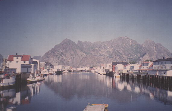
Fishing villages ("vĉr"), like Henningsvĉr (above pic), lived and breathed for fishing only, and still largely do. The reason for settling down on these rocks with close to no vegetation or arable land, was of course the proximity to the fish. During the cod-fishing season in late winter, these small communities would be the bustling metropolies of the north. The harbours would be packed with small fishing vessels waiting to deliver their catch or waiting out a storm in safe waters. During seasons up to the 1970s, you could still walk dry-shod across the harbour of Henningsvĉr, whichever direction you might choose, because of the throng of boats. Today, the coastal fishing fleet is vastly decimated due to decline in fish stocks and factory ships on the high seas. But still, many families have their own fishing boat, ready to put out when the season starts in mid-february.

Even though the Lofoten islands are extremely mountainous, there are some areas where old seabed have risen above the water level to create small havens like Ramberg (above). In fact, some of the Lofoten islands are among the county's most productive agricultural areas. And, since it would be such a waste to let those lovely beaches stay unused because of the chilly waters of the north, children tend to become rather blazé about the bathing temperatures at 68 degrees northern latitude. Wonder when they'll start sprouting gills at birth...*s*
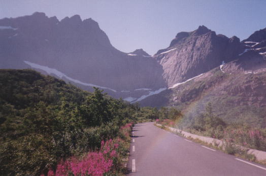
Due to the rather savage treatment the Lofoten and Vesterċlen islands got during the last ice-age, they look like they've been carved out by an ice-scoop or by God doing quickstep... The similarity to the Alps is rather striking, though these mountains never reach more than 1/3 of the height of their mid-european counterparts. But still, having a mountain rearing 1100 m above you straight up from sea level, is an awe-inspiring sight anyway....

Even on the most remote and outermost islands of Lofoten, where there's hardly any trees or anything resembling a field, people have settled, carved out a space in the bedrock to put their houses...
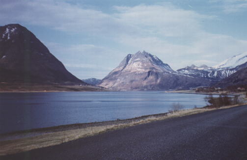
Leaving the Lofoten islands, we cross southeast over the wide mouth of Vestfjorden, passing the Ofoten, Tysfjord, Hamarĝy and Steigen regions as we come south to the Salten region. Salten is the mid-part of the county. Here you find the regional capital Bodĝ, long winding valleys, high mountain plateaus excellent for hiking, more ragged mountains and the Svartisen Glacier. The great malstrom Saltstraumen, just outside Bodĝ, is also a feature worth visiting.
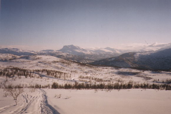
In winter, some places in Salten may become isolated due to bad weather or snow. Beiarn (above), is one such place, where people have found plenty of rich farming soil in an isolated valley.
Moving south from Salten, we come to the southern part of Nordland: Helgeland. Helgeland is a realm of mountains and thousands upon thousands of great and small islands.
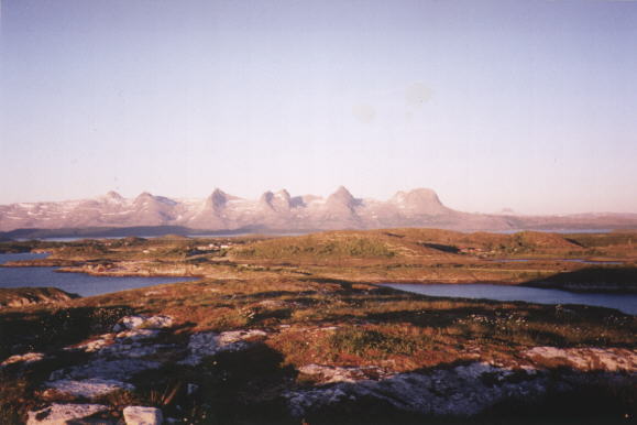
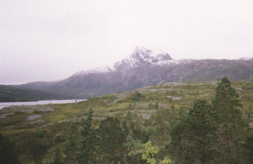
Quite a few of the major islands number some rather impressive mountain ranges, like "the Seven Sisters" (above), and Dĝnnamannen ("The Dĝnna Man", below). There are plenty of old myths and legends about the creation of these mountains...ask me if you ever run into me on the net, and I'll tell you a few... :)

The inner parts of Helgeland is very sparsely populated, and those living there live in isolated valleys, like here in Grĝnfjelldalen (below). These valleys are packed with snow during winter, and enjoy (?) some of the greatest variations of temperatures in Norway. From +30C in summer to -35 in winter.... The red tinge on the pic below is because of the temperature when it was taken: -20C...*shiver*

Helgeland has 4 larger towns (by Norwegian standards) - Mo i Rana in the northeast, Sandnessjĝen in the northwest, Mosjĝen in the southeast, and Brĝnnĝysund (below) in the southwest. All these towns serve as regional centers to the rural districts around. Mo i Rana and Mosjĝen are largely industrial towns with huge melting plants for various metals. The other two rely on various kinds of small industry, a budding off-shore activity in the region and information services.

And so, we come to the southern end of Nordland, just south of Brĝnnĝysund. If we cross the county border, we'll find ourselves in Southern Norway, and in quite another realm entirely. But I'll leave it to other people to describe that part of the country and leave you with this lovely picture of a foggy night outside Brĝnnĝysund... (The Seven Sisters, Dĝnnamannen and last 2 pics courtesy of Odd Walter Bakksjĝ).