|
 |
 Geography
of Iraq Geography
of Iraq
Area : total: 437,072 sq km
land: 432,162 sq km
water: 4,910 sq km
Population: 27,499,638 (July 2007 est.)
Iraq is situated in Southwest Asia
and is bounded on the east by Iran on the south by Kuwait, Saudi Arabia and
the Persian Gulf, on the west by Jordan and Syria and on the north by Turkey.
Iraq
has four distinct geographic regions.
The
north-eastern, mountainous region is known as al-Jazira, rising to nearly
2135m (7000 feet) near the Turkish border. Iraq's two highest points are Haji
Ibrahim, which rises to 3600m (11,811 feet) and Mount Halgurd (3,728m; 12,230
feet). The land area between the Tigris and the Euphrates is an alluvial plain
and is Iraq's most fertile region.
In
the south-east, adjacent to the Persian Gulf, is a low-lying swampy area,
containing marshes, lakes and reedy waterways.
To
the west of the Euphrates is the desert region, where the land gradually rises
to join the Syrian Desert. This desert area constitutes about 35% of Iraq's
total land area.
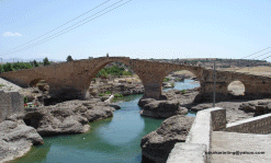
Iraq's
two main rivers, the Tigris and the Euphrates, flow from north-west to
south-east. They converge near Baghdad, then diverge and meet once again about
160km (100 miles) north of the Persian Gulf, to form the Shatt al-Arab River.
This river flows through Basra and drains into the Gulf. Richly alluvial soil
characterizes the Tigris-Euphrates basin; elsewhere, soils are very light and
not especially fertile.
Iraq's
mainly continental climate brings a wide range of temperature, with hot
summers, particularly in the south, and cold winters, especially on the higher
ground.
In
the mountainous region of the north, summers can be a little cooler and
humidity is lower than in the south. During the winter months (October to
April) snow often falls on the mountains.
In
the central areas of Iraq, summers are much hotter, with temperatures in
Baghdad rising to about 33.3°C (92°F) in July and August. It is not unknown
for temperatures to soar as high as 50.6°C (123°F) in this region. Winter in
Baghdad brings a mean temperature of about 9.4°C (49°F). Temperatures in
Basra range from 37°C (98.6°F) in summer to 14°C (57.2°F) in winter. Dust
storms are an unpleasant feature of the central plains region.
The
southern area around the Gulf has extremely high humidity and some of the
highest temperatures recorded anywhere in the world.
Rainfall
is heaviest in the north-east and falls mostly between October and May. On the
central plain, however, less than 152mm (about 6 inches) falls annually.
Desert areas receive virtually no rainfall.
Iraq's mineral resources are
chiefly petroleum, in addition to
natural gas, phosphates, and sulfur
Iraq
is formed of
18 governorates (muhafazat, singular - muhafazah); Al
Anbar (Arramadi), Al Basrah, Al Muthanna (Assimawa), Al Qadisiyah (Aldiwaniyah),
An Najaf, Arbil, As Sulaymaniyah, At Ta'mim (Kirkuk), Babil, Baghdad, Dahuk,
Dhi Qar (Nassiriyah), Diyala, Karbala', Maysan (Alamara), Ninawa (Musol),
Salah ad Din (Tikrit), Wasit
(Alkut).
Time Zone (UTC +3) Note
that UTC is also known as GMT, or Greenwich Mean Time.
|
|
 |


|
|
|
|
|
Active since 1998
|
|
|
 |
|