


|
|
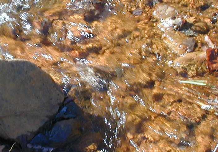
Just downstream from the Matthew #1 site after impact by AMD. Note the orange precipitate. |
|
Matthew Run showing the water from the site Matthew #1 before AMD impact. |
|
Neff Run looking up stream over both sites Neff #1 and Neff #2. The acid mine seep flows into the stream near the middle of the image. |
| Bottom after the AMD seep water enters the stream. |
|
Neff Run a little over a mile downstream from Neff #1 and Neff #2 sites and also carrying water from Matthew Run. This site is called Neff#3. |
|
Shows bottom at Neff #3 site. Algae tries to grow here but has to battle the precipitate that often covers it. |
|
|
|
This shot looks up the seep path from Neff #1 and Neff #2 sites. Route 36 is toward the top of the image. |
|
Sand Spring Run near Frostburg State University. Identified as SSR fsu in data charts. |
|
View of Sand Spring Run from near the car into the woods below Kemp Drive and above Water Treatment Plant. This site is called SSR Kemp in data tables. |
| Closer view of Sand Spring Run kemp site. |
|
Sand Spring Run Kemp - riffle and pool |
|
This water, which tests very acidic, is the highest up in the watershed in Sand Spring Run above Kemp Drive. The site is identified as SSR top in the data tables. |
|
|
|
Very clear Sand Spring Run (top) water which doesn't appear to support much life probably due to the pH problem. |
This page created on a Macintosh using PhotoPage by John A. Vink.