| June 11th Radar Imagery Page Two |
 |
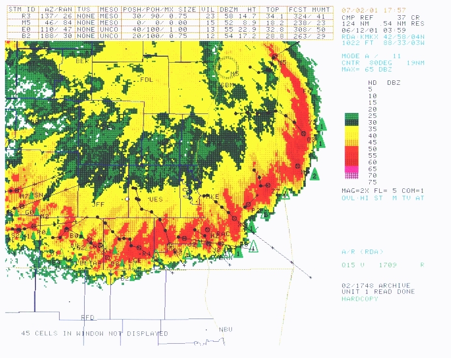
| This radar image is from 10:39pm showing that every county on the screen had been affected except for Kenosha County. At 10:39pm this storm had lost its tornadic potential, and most of its severe hail potential and was now producing hail under 1/2 an inch and winds between 50 and 60mph. The reason why the reflectivity was so high was torrential rains throughout the storm. Areas were being affected by the rainfall and still quite gusty winds, but not much hail. |
 |
| This radar image shows the storm apparently still very strong, even in Kenosha, where I live. However if you advance to the next page you can see the base reflectivity images which tell the true story. In fact the portion of the storm that hit Kenosha only produced 40mph gusts which is still high enough to be considered strong, but not severe. |