 |
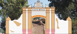
1st Capital of Abra |
|
|
|
|
|
|
|
1st Capital of Abra |
|
|
|
|
|
Bucay lies on an alluvial plain sloping to a 30-m high cliff by Abra Rivers left bank. Nesting on the western side of the Cordillera ranges, some 17 km Southeast of Bangued, Bucay limits on the east and west with secondary mountain ranges and with two rivers - the Baay River on the north and the Ikmin River on the south. It is dotted with moderately rolling hills with most barangays situated on the available plains, usually near creeks and other bodies of water. Climate on the municipality belongs to Type I, characterized by two pronounced seasons - the wet and the dry. The wet season begins in May and ends on October with a maximum rain period between June and September while the dry season starts in October and ends in April. Typhoons mostly ocuur in July and August. Bucay sits roughly in the geographical center of the province of Abra (refer to map, Plate # 1.) At the time of its creation by the Government of Spain in mid-nineteenth century, the province of Abra corresponded approximately with the basin of the Abra river, carved out of the 2nd and 3rd Districts of Igorots taken from the old province of Ilocos Sur. After the Philippine revolution of 1898, Abra as a Province ceased to exist and was re-created in 1917 by the US Government. The Province today has a southern boundary pushed north from the original, a large area of which passed back to the Province of Ilocos Sur under the American regime. The province could not be established from the beginning with exact geographic limits in all its boundaries due to its rough mountainous character and to cultural factors as well.3 Bucay is today a charming sleepy provincial town, a fifth class municipality whose main employer is the government, both local and provincial: for many of its inhabitants while living in Bucay work in Bangued in the Provincial Capitol, a short 30 minutes away. The towns land area is 12,603 has of which 335 has (2.7%) are built-up land; 2,133.5 has (16.9%) are used for agriculture; 6,634.5 has (52.61%) are occupied by forest; and 3,500 has (27.81%) are open grassland. Of the 21 Barangays of Bucay, only four, Poblacion, Labon, San Miguel and Pagala are not forested. Like in mid-nineteenth century, Bucay's economy is still basically agricultural with fishing, gold panning, retail trading and small scale industries such as livestock rising, furniture making and woodcraft as secondary economic activities. The last survey made in 2005 returned a population of a little above 19,000 souls, of which some 6,000 live in the poblacion. Considering that a good number of able bodies in the poblacion live off farming, it cannot be said that Bucay is a very urbanized town. Other than the normal institutions, Government, Church and Schools, Bucay has a public market, a few eateries, and practically no intra-town commuting facilities as everything in town is within a few minutes walking distance. Travel to outlying barrios is by tricycle or jeepney. There used to be a bus service between the capital, Bangued, and Manabo up the river valley to the South that passed through the town; the service was discontinued. Up to the moment of this writing, Bucays only telecommunications service is cellular telephony and wireless Internet. Bucay may be one of the few sizable communities in the worlds information society without telephone land lines. The main development issue for the town is the primitive state of the network of communications and services we call infrastructure, as is for the rest of the province. Conditions today resemble very much those of its origins. As early as October 1847, Captain Tajonera, Abras first Provincial Governor, wrote a letter to the Governor General in Manila, at the time Narciso Claveria, requesting help to improve with bridges, culverts, leveling, etc the main road from Talamey (todays San Quintin) to Bucay. In arguing his case, Tajonera cites the multitude of resources available in Abra waiting to be developed and argues rightly that the road is essential to promote the development of the interior.4 The town, the province and the river Abras most notable geographical landmark is of course the great Abra River, also known in the past as Rio Grande. One of five mayor rivers born in mount Data near the boundary of Benguet and Mountain Province,5 it flows due north between the Ilocos coastal range to the west and the crests of the Cordilleras on the south and east. The river bends west and west-by-southwest in the vicinity of Lagangilang to reach the sea just south of Vigan City. It is a fickle river given to great surges in the rainy season when it could reach 1 km in width as it flows past Bucay, or dividing itself during droughts into ever-changing river channels. Given its geography, the natural access to the Province at the beginning was through the River and its valley. This configuration made of Bucay at its origins a frontier town, the last in the Province before venturing into the great unknown land mass of the Cordilleras. A main road was built along the river's left bank connecting the bocana of the river south of Vigan with the towns of San Quintin, Bangued, Tayum-Lagangilang and Bucay. Later, the road was extended to a point across the river from Manabo, which lays on the rivers right bank. As the first capital of the newly created province of Abra in 1846, Bucay was for seventeen years the administrative, military and political center of the province. Amidst extensive forests, its main economic value was timber besides another important produce of the forest, wild honey, but it also developed agriculture producing rice, vegetables and an all-important crop of the time and government monopoly, tobacco. For the time it was the provincial capital, Bucay had a significant role as concentrator of tobacco harvests for which a substantial camarin or bonded warehouse was built near the river, the main line of communication and transportation at the time. It also became a hub of commerce for the towns sited up river to the south and the point from which to launch expeditions to find a way east towards the Cagayan Valley. The bulk of the provincial population is concentrated in the North, in the towns bordering the Abra River from Bucay in the South to the point where the River crosses into Ilocos Sur on its way to the sea a few kms away. These are the towns of Bucay, Lagangilang, Tayum, Bangued, Pidigan and San Quintin, connected today by paved roads, narrow but quite adequate. The rest of Abra, a good nine tenths
of it, is made of crests of craggy, practically inaccessible high mountains
and deep mountain valleys of tributaries to the Abra River that are of
difficult access through dirt mountain roads leading to small mountain
towns. With decent infrastructure, not only roads but also services like
lodging, restaurants, shops and the like and holding as it does a very
good strategic location in the center of the Province, Bucay could easily
become the hub of commercial activity as the head of the region to its
northeast, east and southeast. As it is now, it doesnt even have telephone
service except cellular, with the effect that e-mail has to be wireless
and no fax communication is possible up to the publication of this paper.
It is no wonder then that a lot of people in the rest of the Philippines
are surprised to hear that there exists such a town as Bucay.
|
|||