Federal Republic of Whitlam.
Geographical Department.
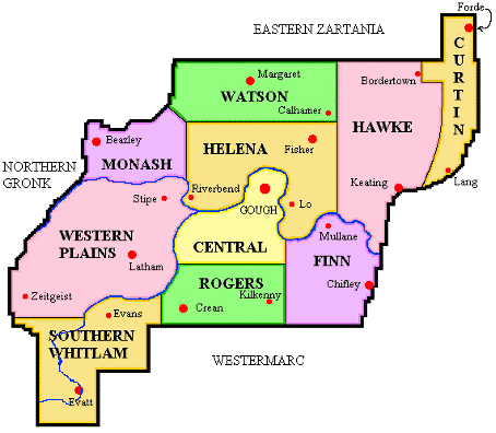
Political Map of the Federal Republic of Whitlam,
showing the 10 States and their major cities.

Physical Map of the Federal Republic of Whitlam,
depicting the costal and inland plains, with the land rising in the southwest
to Mount Edward in Southern Whitlam. Mt. Edward is the only official mountain
in Whitlam, with an elevation of 6960m above Sea Level.