|
NASA/JPL/NIMA.
ōAsiaSRTM-Bosporus-picasa.jpgö
Online Image. Shuttle Radar Topography Mission. 16 May 2005 109kb. 577×577px.
<http://photojournal.jpl.nasa.gov/jpegMod/PIA03349_modest.jpg>
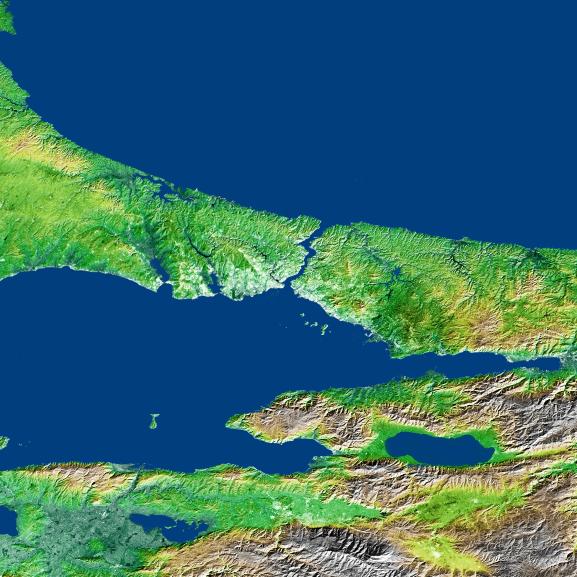
The Bosporus Straits
This image shows an SRTM data set for Bosporus straits between Europe and Asia
and separating the Black Sea (to the north) from the Sea of Marmara (to the South).
It was created from an original map produced from data obtained by NASA's
Shuttle Radar Topography Mission (SRTM). Using Google's free Picasa2 program, the
color and lighting were enhanced and then sharpened to obtain the image above. The
original image can be viewed at the NASA link above. If you look closely, you can see the
site of Istanbul, ancient Constantinople. On the western side of the straights. It is a small
finger of land that sticks out on the extreme southern flank into the channel of the Bosporus itself.
The thin blue line of water on its north side is the Golden Horn, the famed harbor of Istanbul.
The land is whitish in color which makes it stand out a bit from the surrounding green and yellow.
|
