New Flinders Ranges photo galleryThis page is fairly popular so on 2003/04/13 I created a new gallery for anyone to contribute to. If you have exceptional photos of the Flinders Ranges, I'd like to include them. Hopefully this new Internet site will become a collection of all the best photos of the beautiful Flinders Ranges. See Flinders Gallery and pass the word. |
This page provides a selection of photographs from South Australia's
Flinders Ranges: a unique area that combines interesting and
beautiful landforms with fascinating native fauna and flora.
The traveler can indulge in walks of up to several day's duration,
perhaps climbing peaks that offer wonderful views,
or if less energetic can tour by road.
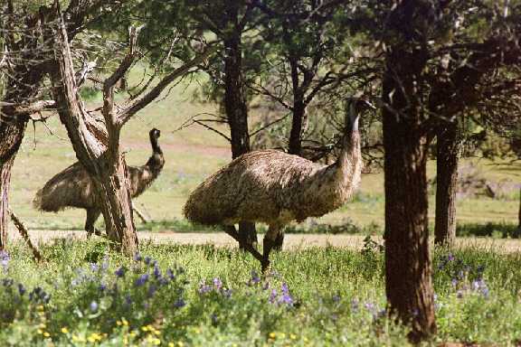
These emus at Rawnsley Park were very curious. If my wife and I sat on the ground for a break from walking the emus would come close for a look.
Click on the pictures that have a bright border to see them full size. Then use the 'back' button to return to this page.
|
Home Top Bottom |
 The Flinders Ranges are an extension of the Mount Lofty Ranges in
South Australia.
The Flinders Ranges are an extension of the Mount Lofty Ranges in
South Australia.
The rocks which make up the greater part of both Flinders and Mount Lofty Ranges date from late Precambrian to early Cambrian. The fossils that can be found are of very primitive life-forms. A paleontologically very significant group of fossil animals is preserved in the Flinders Ranges, called the Ediacaran Fauna. They lived a little before the great explosion of multicellular life at the beginning of the Cambrian Period.
Wilpena Pound, in the background of this photo, is one of the most
picturesque parts of the Flinders Ranges.
|
Home Top Bottom |

 Left
LeftThese cliffs, with their Callitris (native cypress pine) trees, are on the face of Rawnsley's Bluff. There is a well marked walking trail from near Rawnsley Park (about 35km north of Hawker and 20km south of Wilpena) up to the top of Rawnsley Bluff.
Right
A yacka (Xanthorrhoea) close to the trail up St. Mary's Peak.
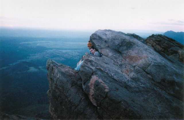 My family and I once camped on top of St Mary's Peak overnight.
It was cold, windy, and there was the occasional thundery shower,
but the 270 degree rainbow and the shadow of the mountain climbing
into the air as the sun went down made it all very worthwhile.
My family and I once camped on top of St Mary's Peak overnight.
It was cold, windy, and there was the occasional thundery shower,
but the 270 degree rainbow and the shadow of the mountain climbing
into the air as the sun went down made it all very worthwhile.
We had to find crevasses between the rocks and each of us slept in our own little hole.
I've been to the top of St. Mary's Peak at least eight times.
The view is stunning, as good as the best in the world, I
believe. It's a fairly long and strenuous climb, but if you
haven't climbed St. Mary's Peak you haven't seen the Flinders
Ranges.
|
Home Top Bottom |
 Many camping grounds and caravan parks do not allow dogs;
Rawnsley Park, south of Wilpena Pound, does.
Many camping grounds and caravan parks do not allow dogs;
Rawnsley Park, south of Wilpena Pound, does.
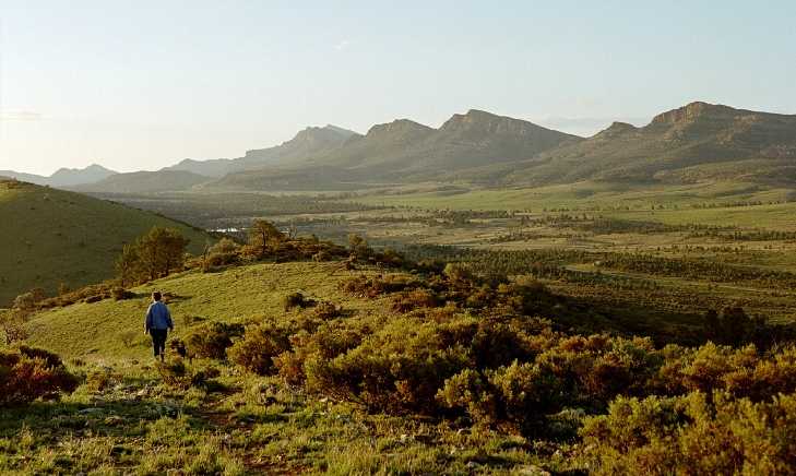
This was the view one late afternoon looking south from the top of
the Ulowdna Range near Rawnsley Park. There is another well marked
walking trail here.

|
Home Top Bottom |
Again, taken from the Ulowdna Range.
 A scenic flight in the Wilpena area can be worthwhile.
Here the northern wall of the Pound is on the left, St. Mary's
Peak, the highest mountain in the southern half of South
Australia is the high point; Bunyeroo Valley is
toward the right.

|
Home Top Bottom |
The highest peak in the distance is Pompey's Pillar; on the opposite side of the Pound to St. Mary's Peak and of not greatly less hight. It is a much harder climb because there is no marked trail and it is further from any camp-ground. The scrub on parts of the climb is quite dense.
I tried to climb it once, but had to turn back because
I ran out of time.
 Edeowie Gorge, on the northwestern end of Wilpena Pound is
spectacular from the air. It is also a good hiking destination;
there is another marked walking trail and usually water is
available in ponds somewhere in the upper part of the Gorge.
Edeowie Gorge, on the northwestern end of Wilpena Pound is
spectacular from the air. It is also a good hiking destination;
there is another marked walking trail and usually water is
available in ponds somewhere in the upper part of the Gorge.
You will need at least two days if you are to have any significant time at the Gorge. You can camp near one of the ponds. It is possible to walk in through the Pound and out (or vice versa) over Tanderra Saddle near St. Mary's Peak.
Water should be boiled before drinking if it is stagnant. I have
never had any problems following drinking flowing water
without boiling in the Flinders Ranges.

|
Home Top Bottom |
The Heysen Range, another of the many that make up the Flinders
Ranges, is seen in the distance here,
the western end of Wilpena Pound is in the foreground.
 It is unusual for Wilpena Pound to be covered in cloud like this.
The photo was taken during a period of unusually wet and thundery weather.
While Wilpena, being the highest point in the Flinders Ranges, gets
more rainfall than the surrounding areas, cloud like this is
unusual.

|
Home Top Bottom |
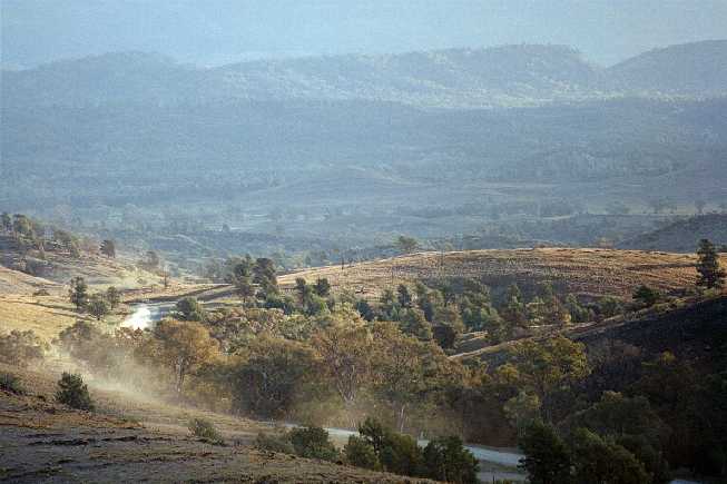
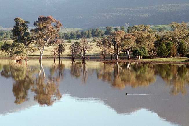
There is often not sufficient winter rain to fill the reservoir.
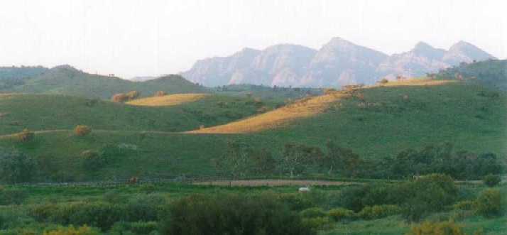 The sun was lowering while my wife, dog, and I were driving north
past the Hills of Arkaba.
The sun was lowering while my wife, dog, and I were driving north
past the Hills of Arkaba.
This is an area made famous by South Australian artist Hans
Heysen. He was an expert at capturing the dry Australian bush and,
in particular, the character of the gum trees.
|
Home Top |