Journal
| About Downunda | Trail
Facts | Hiking the Trail
State Guide | Elevation
Map | Fun Facts
Gear | Photos | Guestbook
| Mailing
List | Home
|
|
Journal
| About Downunda | Trail
Facts | Hiking the Trail |
|
7th May 2002 From:
Knot Maul Branch Shelter
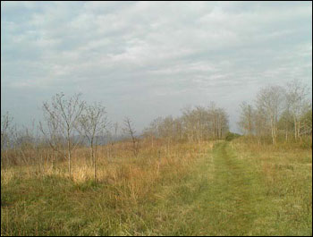
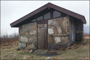
This morning there was a long, steep climb up Chestnut Knob. Once near the top, there were grassy meadows that the trail followed for a mile or so (pictured right). I didn't like the look of the shelter there, so I decided to push on (pictured right below). Six miles later, in the pouring rain, I decided to check out a campsite listed in my Thru-hikers Handbook. I should have sensed the bad karma as the trail to the campsite went down and down very steeply. I found a great view with a lousy campsite, so I turned around and slogged uphill forever to rejoin the AT. I slipped on some greasy rocks and cut my shins - my, I was having a bad hair day!! Once at the next shelter, I cleaned up and set up my tent and I was a happy man again. I made a cup of tea and had a bagel with Vegemite, then cooked a Lipton's Broccoli and Cheese Pasta Dinner with peas and onions thrown in for good measure - it was delicious. The last few days the trail has been passing through many rocky outcrops and boulder fields; similar in some ways to the Grampians at home. Highlights today were the first sighting of a wild turkey bursting out of the brush in front of me and when the sky cleared, the views to the west (West Virginia, I presume). Goodnight all, from a tired hiker. |
|