by Eric M. Ouellette, P.Eng.
Grand Falls, New Brunswick
WELCOME TO THE NEW
"STEAM LOCOMOTIVE 508"
WEBSITE
Grand Falls, New Brunswick
|
DATE OF LAST JOURNAL ENTRY:
FEBRUARY 27, 2007
|
|||||
|
|
|
POLL
|
SOUNDS
|
CONTACT ME
|
LINKS
|
| RESEARCH DOCUMENTS |
 |
HOW TO GET MARCEAU'S BOOK | |||
|
|
|||||
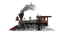
This website is dedicated to the ongoing search for the Canadian Pacific Railway (CPR) locomotive No. 508. The 4-4-0 standard type locomotive was built in 1885 at Manchester locomotive Works in Manchester, New Hampshire for the New Brunswick Railway (NBR) as their locomotive No. 34. After CPR took over the NBR in a 990 year lease, July 1, 1890, CPR renumbered the locomotive to No. 508 in September 1890.
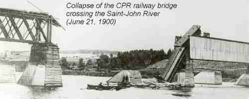
Locomotive 508 operated in Northwestern New Brunswick at the beginning of the last century and on June 21, 1900 the engine suffered quite a spill into the Saint John River at Grand Falls.
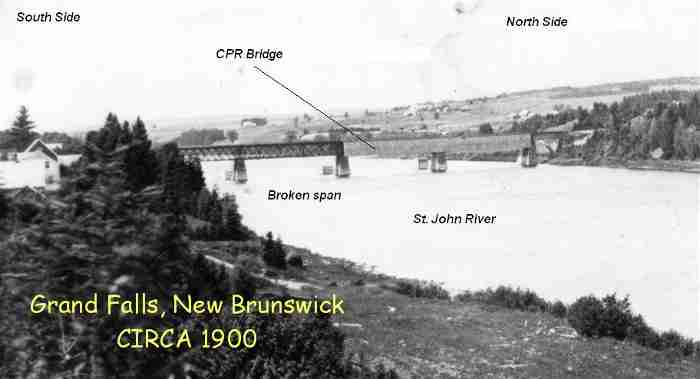
The third span of the bridge (coming from Edmundston) collapsed under the weight of the train and all but the passenger car and the caboose were spared from the waters below . The passenger car fell almost vertically on top of the debris pile created by the other cars ahead of it. Miraculously no one died in the accident but there were some very serious injuries, to the point that some newspapers of the day reported casualties at press time. Wrecking crews were dispatched and clean up was done but no one seems to know for sure if the engine was ever recovered. Since the beginning of my search efforts in the spring of 2003, I have heard many stories on what happened to the engine but no one has yet to show up with some information that would put to rest the mystery for good. Some say it was recovered, some say it was not and some even say it was only recovered many years later by locals and cut up into pieces for scrap metal.
In my early inquiries concerning any information on 508 through CPR I was told the following:
"CPR must have fished the locomotive out of the river, because it continued to serve us until being disposed (likely scrapped) in February 1910. But this only after it was modified and renumbered as CPR locomotive No. 62 in November 1908. We have the locomotive assignments for July 31, 1904. Locomotive No. 508 was assigned to and maintained out of Edmundston, N.B.”.
If anyone has ever read Clive Cussler's book entitled "Sea Hunters", you will understand why I haven't ceased searching for the locomotive. Click here to read what really happened to the Kiowa Creek locomotive. In the Kiowa creek accident the train company did find the locomotive and secretly covered up the salvage in the middle of the night and then claimed her as lost through the insurance company. They made in the order of $20,000 off of the insurance pay out (big money back then). They then fixed her up and put her back into operation under a different number, making even more money off of the supposedly lost engine.
Now, coming back to the story of locomotive 508. What if the train company never salvaged the engine because it was very badly damaged but reported to the insurance company that they did. They could of taken a similar "out of commission" engine from a scrap yard and fixed it with the insurance payout. The only thing left to do afterwards would of been a simple renumbering game for the newly repaired look-alike. Renumbering locomotives back then was quite common as you can see. According to CPR archives, locomotive 508 went through 3 different numbers during her lifetime of service. The above possibility is why I didn't get caught up with the information from the archives or local stories and decided to proceed with solid scientific evidence instead.
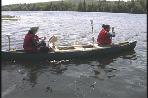
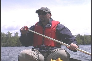
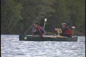
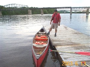
With the help of Karl Butler from the University of New Brunswick (U.N.B.) in Fredericton, we managed to get a detailed magnetometer survey of the river at the accident site. A magnetometer (metal detector) was fixed to a fiberglass canoe along with a global positioning system (GPS). These two instruments would then take simultaneous readings while paddling up and down the river. The entire width of the river was scanned between the north and south abutments.
 |
 |
 |
 |
 |
 |
 |
 |
 |
 |
 |
 |
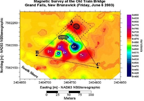
The scan revealed a huge metal debris field with significant magnetic variations shown by the dark colors on the map below. The little black dots all over the place represent readings from both instruments giving us location and magnetic intensity at that location.

Same map but zoomed in on the area of interest defined by triangle A B C
With the help of Nick Burchill from Kongsberg Maritime., we got a sonar survey of the metallic debris field as delineated by triangle ABC (map above). Nick came all the way from Dartmouth, Nova Scotia, at no charge, just to assist in the search. Actually all of the help to date (i.e: divers, boats etc..) has come at no cost. The Town of Grand Falls did however pay for the accommodations when the divers from Fredericton (East Dive) and Nick (Kongsberg Maritime) from Dartmouth came up but besides that... 0$. Thanks to the geodetic information gathered when we did the magnetic survey, we were able to locate ourselves directly over the metallic debris field for the sonar investigation. The plan was to strategically core holes [150mm (6") Ø] in the ice and get sonar images at these locations. A local surveyor offered to locate 5 holes on the ice with coordinates provided by GEMTEC (map bellow). At each hole we measured the depth to the bottom of the river. The sonar head was then lowered to approximately 1m (3ft) from the bottom and secured as best we could in order to get less movement possible during image acquisition. The sonar head then rotated on itself 360º while sweeping a 50 meter distance in the process. The areas swept are represented by the blue circles on the map. As you can see the locations of holes 1, 2, 3, 4 & 5 cover the entire area of magnetic interest defined by the grey triangle ABC. The red triangle was just a safety factor zone to make sure we covered everything. The coordinates for points ABC on this map are the same as the ones from the magnetic map also defined by triangle ABC.

Pictures of the sonar survey
 |
 |
 |
 |
 |
 |
 |
 |
 |
 |
 |
 |
 |
 |
 |
 |
 |
 |
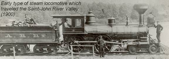
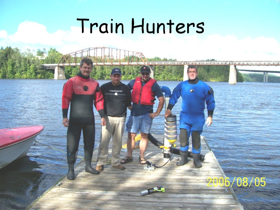
The sonar image (below) revealed a very large object (≈ 6m or 20ft long) visible directly between the two underwater piers and almost directly under hole #3. You can also observe how closely the alignment of the old bridge fits with the objects orientation. The centre of the image represents the exact coordinates of hole #3 and the divisions moving away from the centre of the circles represent intervals of 6m (20ft). If you take for instance the picture at the beginning of this page showing the men standing along a locomotive and assume one of them as being approximately 1.8m (6 ft), the length of the engine in that picture is roughly 24 ft. Pretty close for quickly scaling off measurements.
Sonar survey of Hole #3

Pieces found near Hole #3

The following drawing helps compares our salvaged pieces from above with actual specifications found in a 1904 book on steam locomotives. I have taken pictures of these parts in the proper orientation in order to overlap them and compare them to a typical braking systems found on locomotives of that period. Piece # 3 was an air tank prior to the accident and was badly damaged. In the currents for over a 100 years, the fractured edges of this piece have since become soft and smooth to the touch. Pieces #1 and #2 were found cemented together by sand and came apart when later washed off. Piece #2 is a steel spring that still is quite flexible and is surprisingly in good condition.

| Note: Similar brake systems existed for the tender. These pieces may not be from the engine but they are 100% from the accident. |
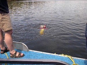
We have had many dives at the accident site.
 |
 |
 |
 |
 |
 |
 |
 |
 |
 |
 |
 |
Dive#1 (May 24, 2003): Found and recovered some spikes from the bridge. Also found a rail at the bottom between the piers from the second span. Very poor visibility and only one diver. The second span is were the first magnetometer scan was done during the winter of 2003 on the ice.
Dive#2 (June 14, 2003): Two divers this time but rain and very poor visibility.
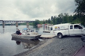
Dive#3 (June 21, 2003): 103 year anniversary of the accident and still no luck. It was however a big day for the the memory of the accident. A few months ago many did not know of the existence of this event and on dive #3 crowds could be seen on the river and at the new marina site, eager to get the latest news on the search efforts. Many media representatives were present along with the mayor and volunteers cooking hot dogs and giving out drinks to those who stopped by and those who helped with the search. A total of 8 divers (with some from Quebec) and 6 boats were dispatched to the scene of the historic accident on this day.
Dive#4 (July 2, 2003) & Dive#5 (July 3, 2003): The pleasant thing with these two dives is that we had communication capability with the diver and unlimited air supply. He was giving us actual descriptions of what he was seeing at the bottom and with his bubbles we could literally guide him to where we wanted him to search and not waste time searching in the wrong area outside of the magnetic debris field. This was a very useful advantage that was not present in all other dives. This was also when we discovered the brake pieces resting by a sand mound between the piers of the broken span. These pieces were later confirmed to be from the accident and quite possibly from the engine itself. The sand mound complete with timber debris was previously noted in the other dives but never really investigated until dive 4 and 5. The timber pieces coming out of the mound were described as being of a square cross section with long metal spikes in them like the ones found during our first dive. In my opinion this timber could be either from the piers or from the bridge deck that fell into the river during the collapse.
Dive#6 (July 10, 2004): This last dive was done after the sonar survey by Kongsberg Maritime. We had a local surveyor on the boat with us to make sure we were directly over hole #3. This is the hole that revealed a long mound of some sort directly between the old bridge piers. It just so happens that the sand mound were we found the brake pieces in dive 4 and 5 is the same mound/anomaly revealed by the sonar survey on the ice. This is nice because we can now go directly to the mound anytime we want to with future dive expeditions. The sonar mound/anomaly was inspected on this dive and revealed it to be a long mound of rusted colored sand with huge timber sticking out of it. What lies beneath the surface of the rusted sand mound has yet to be uncovered.
Summer 2006:
We had a permit that would allow us to go excavate the sand mound. A barge was built with donated supplies from local businesses and we were ready to go digging. We did manage to get a few dives in but they were mostly exploratory visits. Unfortunately many things happened that would not allow us to get to the bottom of the mystery this year. We will re apply again this winter for new digging permits and give it another try next summer. Let's hope 2007 holds answers.....
This opening page is only the start of your reading if you are interested in finding out more on the search efforts past, present and future. I don't know what possessed me to start documenting the search the way I have but if the engine is ever found, I will surely not regret any of it. If the engine is found to have been salvaged or left in the river, we will have plenty of details showing how the search for answers came about and ended. To keep up to date on the search, visit my journal section regularly.
Enjoy!
Eric M. Ouellette, P.Eng.
This page is constructed and maintained by Eric Ouellette, P.Eng.