| |
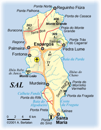
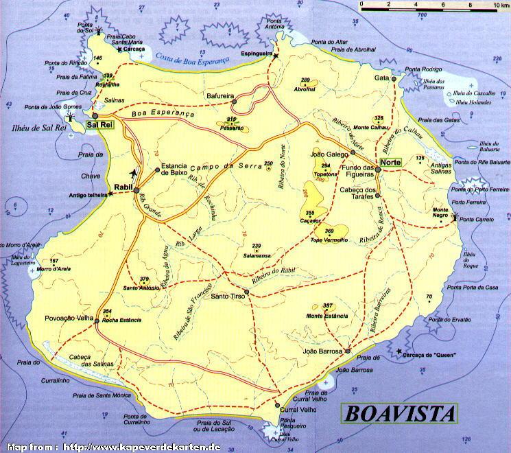
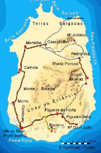
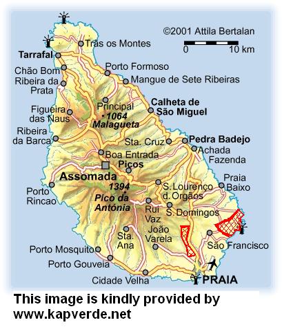
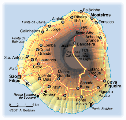
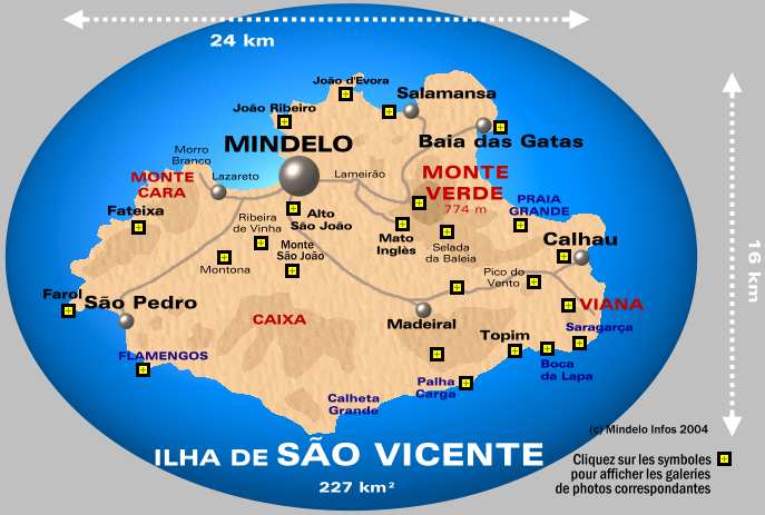
Cape Verde Facts -Factos sobre Cabo VerdeCapital: Praia Location: Group of islands located in the Atlantic, near the west coast of Africa and Senegal. Size 4033 km2 Language spoken: Portuguese and Crioulo (créole) History: Probably discovered by Ca' da Mósto in 1456. Became Portuguese possession in 1494. Became independent in 1975. *** Source: Petit Larousse Population: 2006 - Estimation- 486 000 Highest peak: Pico 9,281 ft Chief products: Cinnamon, coconuts and copra (Dried coconut meat.) Source World Book 2006General Maps of Cape Verde, Cartas das ilhas do Cabo VerdeGeneral Map, Carte de l'archipel, All the IslandsIndividual map of the islands of Cape Verde - Cartas individuais das Ilhas do Cabo VerdeSanto Antăo island - Ilha de Santo AntăoSanta Luzia island - Ilha de Santa Luzia (included in S. Vicente municipio) Săo Nicolau Island - Ilha de Săo Nicolau Sal Island - Ilha de Sal Boa Vista Island - Ilha de Boa Vista Maio Island - Ilha de Maio Santiago Island - Ilha de Săo Tiago The international airport, Praia - Mendes Airport is located on this island - O Aeroporto Mendes esta nesta ilha Fogo Island - Ilha De Fogo Brava Island - Ilha de Brava Săo Vicente Island - Ilha Săo Vicente See AlsoCook Islands mapsMarquesas Islands - Les Iles Marquises Maps of Hawaii Maps of New Caledonia - Cartes des iles de la Nouvelle-Caledonie Cartes des Iles Maurices - Mauritius maps Cara das Islas Malvinas - Maps of the Falkland Islands |
||