.Evolution of APRS in a nutshell (personal view)APRS - an 'unconnected' packet mode, that uses the BEACON frame and standard TNC based (level 2) digipeating to send position information for display on maps, and listing in table form. APRS was devised by Bob Bruninga as an emergency location system at first - giving real time position data, and each station able to act as a relay (i.e. contribute to the network) on an immediate and unplanned basis - giving greater flexibility in times of crisis. APRS grew. It developed simple messaging, began to transmit weather information, and other station details. It allowed a form of radio location to be done without directional antennas. Mic-E was a development of APRS that squashed the APRS ASCII positional data into a short burst that could be transmitted whenever a mobile used a voice mic - the repeater would then strip out the data, and transmit it on the APRS frequency - each and every repeater operator could send their current location. The internet (as it does) threw in a challenge, and a spanner. APRS was essentially a reactive local area network. By building internet gatewayes (IGATES) local data was appearing on screens thousands of miles away and then being retransmitted into other local networks. Whilst massivly expanding communication range and interest, the IGATE meant that local networks had to police local activity to prevent reports of distant QRM (interference). By using IGATES and an email gateway it is possible to send email from a handy to the internet. Bandwidth on the APRS frequency then becomes an issue when foreign station position reports flood into a local patch and delay or collide with local traffic. The effect is that APRS moves further from a local live position system, to a monitor when Im not in the shack, system. This is a shame - and if it goes the same way as regular packet did - this will dampen interest I suspect. People like to have something to watch... New developments include moving the APRS onto HF where it becomes an excellent propagation measure (and is real time once again) and tracking satellites nicely by combining HF, VHF, UHF and IGATE technology. Go to contents list |
You do not need APRS software to show up on an APRS map!
If you have a packet station, and can type strings directly into your TNC in command mode, or set up a BEACON string - then you can appear on APRS maps and offer basic DIGIpeating facilities on an ad-hoc basis.
Why might you want to?
One example might be to mention that APRS coverage in Wales is at a very low level, when driving in the hills I can find stations with decent 2m FM coverage, and packet facilities (often unused).
What I try and do, is get a local station to set up a temporary APRS compatible set up, to see if I can be digipeated into the network.
One day...one day...
| Bob Bruninga (the author/inventor of APRS) explains about APRS beacons using a terminal program here- he goes on to explain how digipeating through the International Space Station is easy to do, and doesn't need special software. http://web.usna.navy.mil/~bruninga/iss-aprs/issicons.html Go to contents list |
.
Setting up a TNC as a dumb-tracker
Click here to look at a mobile setup of a TINY2 TNC, a GPS combined on occasions with a Kenwood THD7 and a laptop PC all working through a home-made variation on a Null Modem adaptor..
Build your own NULL Modem- the GW0TQM 'Chewy' solution
I needed a null-modem connector to join a TINY2 TNC (the serial port being wired as a receiver or DCE device) with a Psion Series 3a handi computer - as the serial port on that was also wired as DCE-receiver so it would connect easily to a PC. DCE to DCE connections need a NULL MODEM cable or adaptor to swap the TX and RX lines (amongst others).
However - I also wanted to 'tap' the serial line to extract the GPS data and send it to my THD7 kenwood in the car. Hence the chewy null modem - a home made null-modem with a 2.5mm stereo socket in it for tapping one of the TX lines.
Click here for the CHEWY NULL MODEM

Go to contents list
.
Garmin GPS12 and APRS
The GPS12 is compact, and a convenient size to interface to mobile or portable APRS stations. Battery life has improved with the latest version of the flash ROM available to download from www.garmin.com.The essential connector however is expensive if purchased ready made with a 5V adaptor for 12v supplies- but available more cheaply on the web at www.pfranc.com.
Go to contents list
.
UI-VIEW on a PC
. UI-VIEW was initially launched as a local chat/positional system, but has rapidly expanded across Europe and the States.Here I mainly list some links for further information. I have run UIVIEW on a 486SX at 25MHz (but it was an effort). Anything bigger and you are sorted.
http://www.packetradio.org.uk/
G4IDE Roger - Author of UI-VIEW.
Go to contents list
.
FDK 750e Wiring for APRS
Although unreliable in it's day, if it's working..its fine for APRS.I have some service sheets on-line here
Click here for FDK750 microphone pin wiring details (Use BACK to return)
Go to contents list
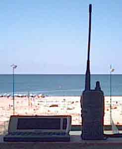
.APRSCE On the Pocket PC
A tiny colour screen device that doesn't run windows at all, but is powered by the Microsoft juggernaut so will do fine, thank you very much....This program which is now out of Beta, is an excellent implementation and great fun when out travelling.
 Click here for more information on aprsce in action. Use a Kenwood radio with it for a really compact system, or just a mobile phone with internet access for APRS from (nearly) anywhere
CYBIKO TOY - and a 900MHz APRS Home network
KR1ST has done an amazing thing with a Cybiko (and even more if you can lay your hands on a pair of them. Note the cybiko CLASSIC is the thing to get, not the more expensive Xtreme.Cybiko now has an APRS program for direct linking to a KISS TNC, as well as a sister UIGATE program that allows the UIMESSENGER to talk to the TNC wirelessly.

CLICK HERE for more details and links to the authors pages.
Go to contents list
.
THD7 and TMD700 Kenwood APRS
Kenwood built APRS in on ROM to their handi the THD7 and the mobile radio TMD700. This makes mobile APRS very simple to do, and is a great improvement on the spaghetti bowl approach needed initially.
For details on running APRS/CE with the THD7e click here
Go to contents list
Am I near you? You can examine live APRS maps over the internet.
If an IGATE has seen my mobile station, when you click this link you will see a list of those APRS stations nearest my last spotted location. At the bottom of the LIST click the map link to plot me and local stations on screen. Use BACK (TWICE) to return here!
Go to contents list
For more detail on what APRS is and what it can do, visit http://welcome.to/uiview
APRS software is available for Microsoft Windows (WinAPRS),
DOS (DOSAPRS), the Apple Macintosh (MacAPRS),
the Palm PDA (PocketAPRS) and (confusingly) the new PocketPC (APRS/CE).
There is a JAVA version for accessing IGATE (internet gateway) APRS traffic over the web, and of course links from http://www.findu.com allow all sorts of APRS information to be retrieved from the internet. For a while there was also a WAP enabled phone gateway, but that experiment seems to have ended for now.
Go to contents list
Email Lists
There are a number of email-lists that are worth subscribing to for latest information on APRS. For information on UI-VIEW click mailto:ui-view-subscribe@egroups.comFor general APRS use in the UK look at mailto:aprsuk-subscribe@egroups.com
For using APRS with one of the Kenwood radios click mailto:htaprs-subscribe@egroups.com
And if you use a PocketPC with amateur radio (APRS/CE is in beta) click mailto:hampocket-subscribe@egroups.com
[top of page]
Go to contents list
Weather Data via UIVIEW
The UIVIEW program will take weather data that is stored on the hard disk as a simple text file, and then beacon it with a special blue WX icon.
You can write the data file with a simple text editor - but the windows
program WXPRS will do it for you. WXPRS v2.2 runs under windows 3.1/3.11/win95/win98 (it isn't a complicated program, but I am not supporting further development presently)
WXPRS

This is the final data display screen before you save and create the wxprs.txt data file for UIVIEW to read.
Click to
download wxprs v2.2
You need
VBRUN300.DLL and THREED.VBX in /windows/system to be able to run WXPRS. (You are
quite likely to have these already) but click here if not.
Go to contents list
Wiring up your TNC and Radio?
http://www.packetradio.com/tnc2rad.htm
Can't beat this site for wiring information.
Return to my homepage

 |
This RingSurf APRS Webring Net Ring owned by Carl GW0TQM . [ Skip Next | Next 5 | Random | List Sites | Join] |
 |