
|
 |
Banks Lake, Eastern Washington

Click on thumbnails to enlarge photos
Early Summer 2000
Hoping to find some hot weather, we load up the westy, and
drive east. Get on I-90, cross Snoqualmie Pass, and by dark the bus
takes us to the small and blustery town of Vantage. Pulling into the
nearest place that looks like a campground, we notice several
tent campers struggling to tie down their shelters in the high wind.
With the westy’s back turned into the blow, and the poptop up,
the wind is hardly noticeable.
Next morning, after bagels, fried eggs, and coffee in the camper, it’s off
to visit the Gingko Petrified Forest in Vantage. One of the attractions
is the stone wall, covered with petroglyphs of early inhabitants of the
area. After purchasing a couple small gingko trees in the visitor center,
we drive on northeast.
 |
Some photos of the petroglyphs carved by the early inhabitants of Columbia River valley. |
 |
 |
 |
 |
At a crossroads in the desert. |
The terrain is very dry and barren,
and it's definitely not
the western part of the state anymore.
Stop for groceries in Ephrata, and then take highway 155, which
winds its way along the blue waters of Banks Lake.
The lake is basically a huge desert canyon, filled up with water.
There are many sandy beaches, and places with easy water access.
The biggest and most popular campground is on the Steamboat Rock
peninsula. All sites were taken. By now it's 90 deg, and couldn't resist
spending some time swimming in the warm lake water before finding
a campsite in a private campground.
Saturday morning, launch the Aire kayak and push off.
Once on the water, the hectic pace of the campground is left behind,
and we feel more in tune with the nature around us.

The Aire Seatiger II kayak is almost 20 feet long, but folded up
fits in
the front luggage space on the vanagon westfalia.
The paddle takes us to Eagle Rock, with steep basalt cliffs and
hollowed out canyons. There are many colonies of cliff swallows,
their nests hanging precariously over the lake water.
 |
 |
Paddling into a secluded cove, where the motor boats and jet skis
don’t dare navigate, we eat our lunch and soak up the sunshine.
A short evening drive into Grand Coulee, a tour of the visitor center,
and later watch the Laser Light Show, reflected on the concrete
dam.
Sunday, on the way back home, we stop at the Dry Falls,
a deep basalt canyon, carved by a waterfall 12,000 years ago.
 |
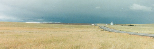 |
Heading west on Hy 2 takes us through endless and lonely farm country.
A thunderstorm is approaching, and we pull over, and watch the
lightning as it hits the earth in the distance.
The wind makes waves across the wheat fields, reminding one of the sea.
Past Waterville, the road becomes steep and windy, descending through
rugged canyons towards the Entiat valley. A quick stop at a fruit stand to
buy fresh cherries, and the westy takes us back home.

Click for more Trip reports