Does anyone know the story behind Pompey
Pillar in South Australia's Flinders Ranges?
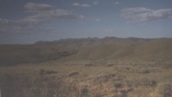
In these ranges, about 400 km north of Adelaide, lies the mysterious natural
phenomenon known as Wilpena Pound. This huge natural basin is about 80sq.km
in area and offers excellent bushwalking opportunities through its almost
lunar landscape. The Pound is surrounded by huge cliffs and mountains, one
of which is known as Pompey
Pillar.
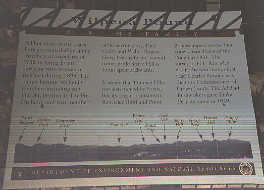
"All but three of the peaks here are named after family members
or associates of William Grieg Evans, a surveyor who worked in this area
during 1895. The names honour his family members including son Harold, brother-in-law
Fred Orchard, and two members of his survey party, Dick Crabb and Walter
Rogers. Grieg Peak is Evans' second name, while Snave Hill is Evans spelt
backwards.
It seems that Pompey Pillar
was also named by Evans, but its origin is unknown. Rawnsley Bluff and Point
Bonney appear on the first known map drawn of the Pound in 1851. The Surveyor,
H. C. Rawnsley was in the area during that year. Charles Bonney was then
the Commissioner of Crown Lands. The Adelaide Bushwalkers gave Illuka Peak
its name in 1959.
L-R: Point Bonney, Illuka Peak, Rawnsley Bluff; Fred Nob, Walter Hill,
Bridal Gap, Dick Nob, Snave Hill; Grieg Peak, Harold Hill, Pompey Pillar."
I asked around in the Wilpena pub, but none of the locals could provide
me with an answer. Maybe it was a stray Pompey
fan, a bit lost on the way to an early away match?
If anyone knows the answer, drop me a line. Tony Hardy