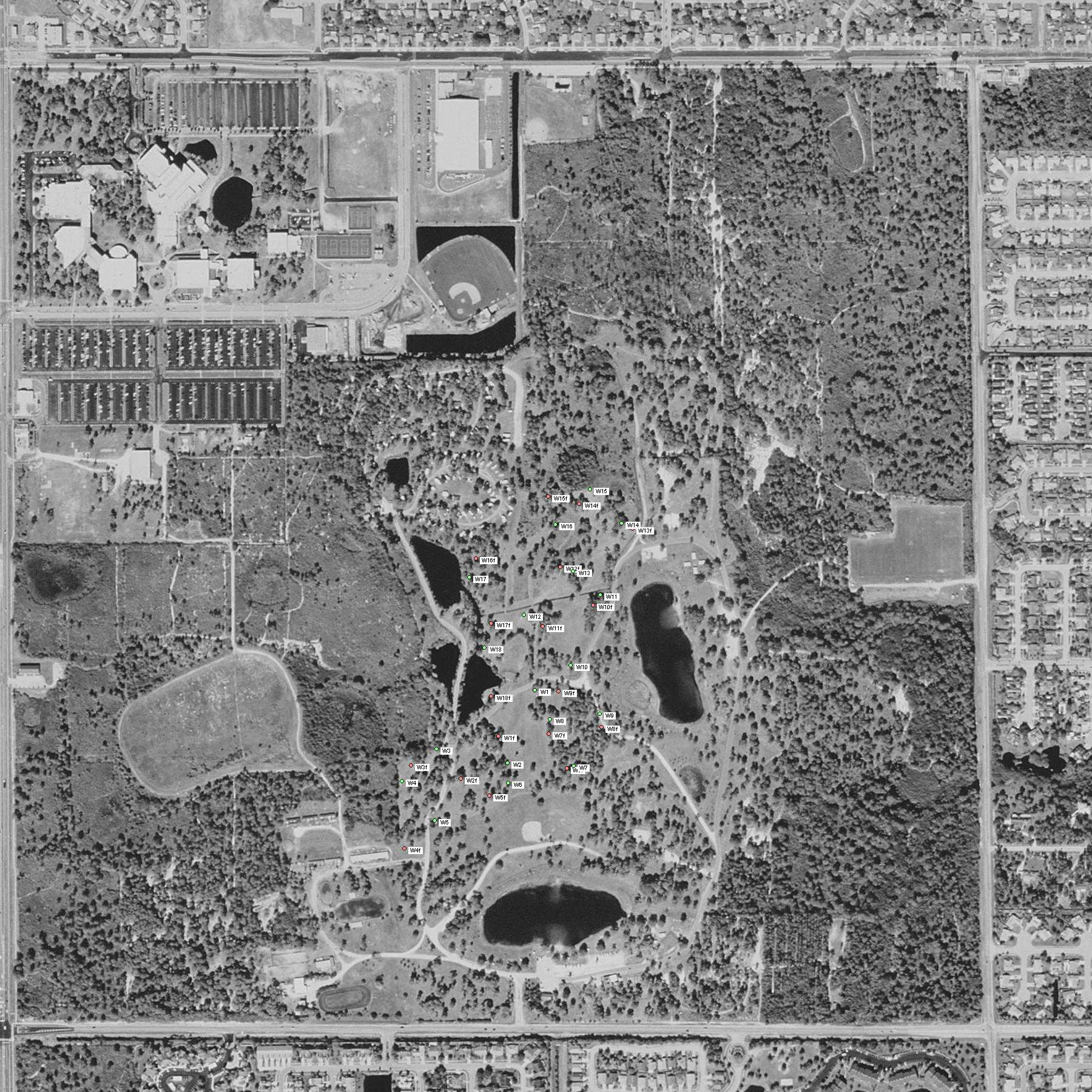
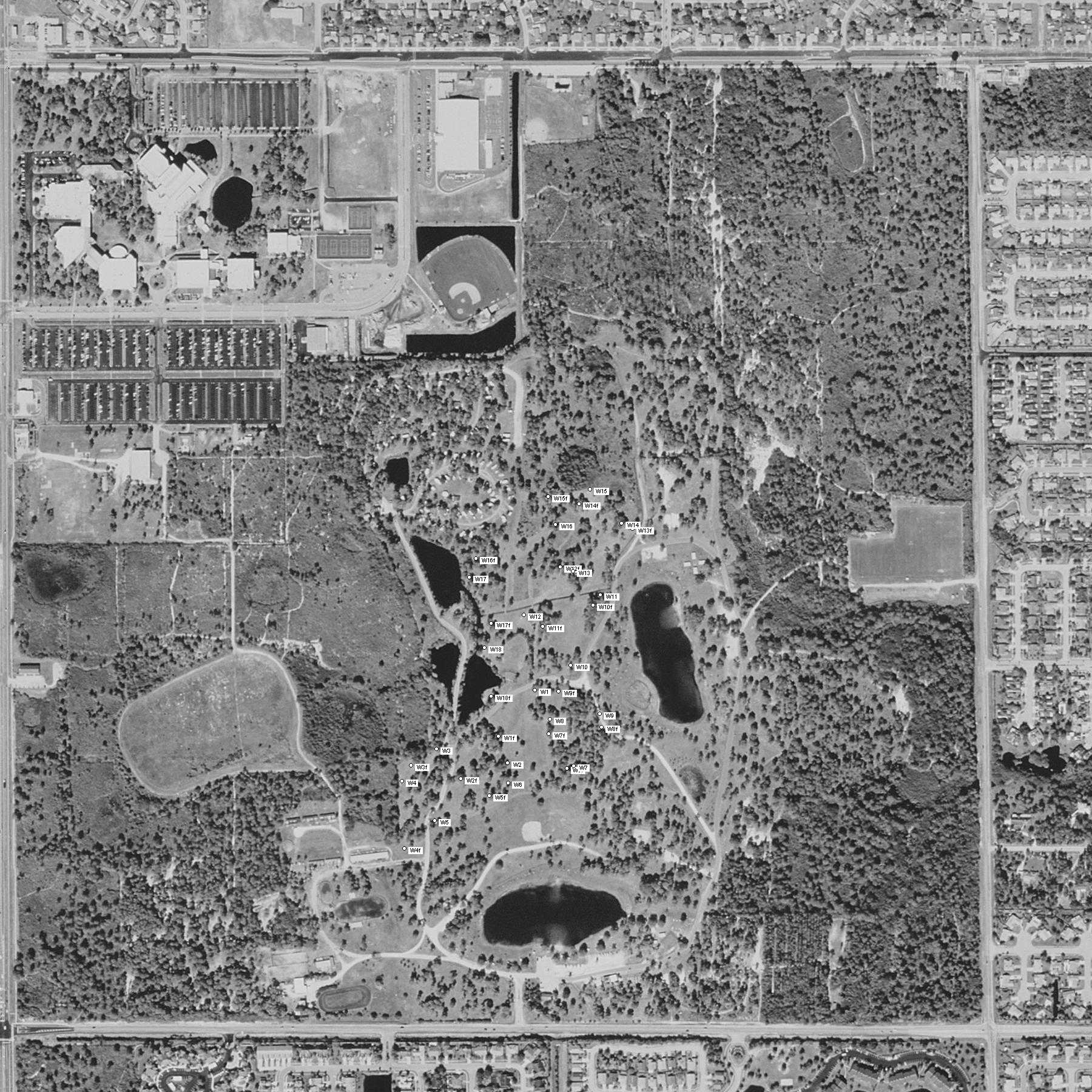
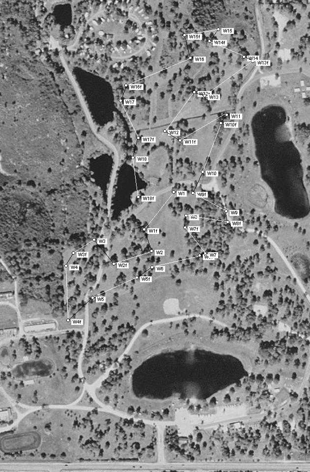
I took my GPS with me when I played frisbee golf at Wickham Park in Melbourne, Florida. Then, I ran the coordinates through a PERL script that I wrote, which generates a URL to create a map from www.lostoutdoors.com (this site is highly recommended). This plotted the locations of the holes in the course. Then, I use a paint program to "connect-the-dots".
How to read the maps
The entrance to the park is at the bottom of the map, right below the wide lake.
Supposedly, every hole at the course is available in an "a" version, and a "b" version. I only saw one version. I suspect that you can only get both during tournaments and such. What you will find on my map is the hole locations on a typical weekend.
The course begins at the point marked "W1" and throw your frisbee to "W1f". Then, you walk to "W2" and throw to "W2f". Simple enough. The "W?" to "W?f" line segments are either colored white or green, depending upon the map version that you download. The lines "W?f" to "W(?+1)" are either red or black. It sound complicated, but you will figure it out once you look at it.
These maps are available in two sizes: big and small. The small maps have only the area of the park which contains the golf course. For printing and carrying with you, I recommend that you get this. The large map has the entire park. Note that the full-size versions do not have the "connect-the-dots" lines.
You can also get a color or a black/white map. The colored lines do not look so good when printed in a monochrome (laser) printer. Get the version to match your printer.
The Maps
The Coordinates
And finally, for those of you who own a GPS, here are the coordinates, in a nice little text file. Note that this is a unix-style text file. Windows Notepad will probably choke on it. I recommend getting a better text editor.
Your Feedback
I am curious if anybody will even use this. If you find this helpful, or if you have comments, please send mail to -=> kevin AT harrelson DOT com <=-. Thank you.