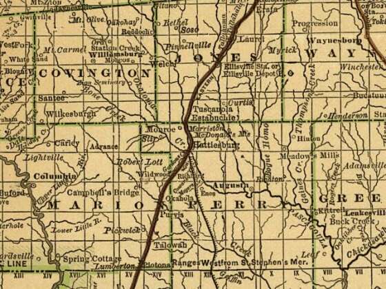
Railroad commissioner's map of Mississippi.
From the Library of Congress archive.
By Rand McNally and Company.
|
Hattiesburg Area ca. 1888
[Not the full map.]
CREATED/PUBLISHED
Chicago, 1888.
NOTES
Scale ca. 1:1,150,000.
LC also has an 1898 edition.
Description derived from published bibliography.
SUMMARY
Shows drainage, cities and towns, township and county boundaries, and the railroad network with color coding.
REFERENCE
LC Railroad maps, 243
SUBJECTS
Railroads--Mississippi--Maps.
United States--Mississippi.
MEDIUM
col. map 52 x 32 cm.
CALL NUMBER
G3981.P3 1888 .R3 RR 243
CONTROL NUMBER
98688503
REPOSITORY
Library of Congress Geography and Map Division Washington, D.C. 20540-4650 USA
DIGITAL ID
g3981p rr002430 urn:hdl:loc.gmd/g3981p.rr002430 http://hdl.loc.gov/loc.gmd/g3981p.rr002430
|
[from
http://memory.loc.gov/cgi-bin/query/r?ammem/gmd:@field(NUMBER+@band(g3981p+rr002430))]
|