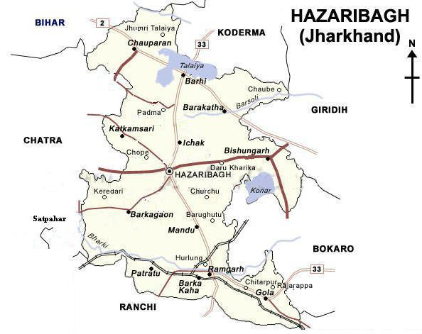
Approximately three hundred and twenty kilometers west of Calcutta, the
plateau of Hazaribagh forms the northern part of Jharkhand and lies between
23. 25’ and 24. 48’ North Latitude and 84.29’ and 86.38’ East Longitude. Its
area is approximately 7,0l6 square miles, and the principal center of
administration is Hazaribagh town which is situated at the highest point of
the plateau at 2,000 feet altitude.
Hazaribagh
Map & Location
Background