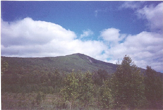
Greylock from West Mountain Road
Mt. Greylock
Elevation: 3,491 feet
Date completed: 5/29/04
Hiking Distance: 6.5 mile round trip
Elevation: 3,491 feet
Date completed: 5/29/04
Hiking Distance: 6.5 mile round trip
Mt. Greylock is deserving of its title of Massachusetts highest point, not just because it is the highpoint, but because it is a real mountain that dominates the skyline, and provides a solid day hike to the summit. You can drive to the top of Greylock, but hiking is a lot more fun. You can access Greylock from various routes. The route we took we accessed from rt. 8, and drove out to the 3 1/4 Cheshire Harbor Trail, which leads directly to the summit, with about 2,000 feet of elevation gain. The trail was an old logging road. It was pretty rocky, and wet at some points. It got steep after 2 miles, and then crosses the road a couple times. It got less steep when we reached the Appalachian Trail near the summit. Although the summit is not tree covered, the summit area is huge and you need to walk around to get views from different directions. Don't bother climbing the observation tower, because it is indoors, and you can't get any decent photos, nor decent views through the small windows. A better suggestion is to walk around the summit area and enjoy the views from outside. At the top, you have decent views towards the Catskills and Adirondaks in New York State, and exceptional views of the Green Mountains of Vermont.
See the summitpost site for directions to the Cheshire Harbor Trail
![]()