Blue Hills map (western section, b&w version)
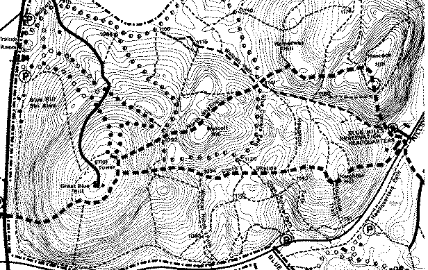
The Skyline Trail is shown by thick rectangles.
The N Skyline (Headqtrs area, Hancock, Hemenway, Wolcott, Great Blue)
and S Skyline (Great Blue, Houghton, Headqtrs area) form a 3 mile loop with over 1000 feet of gross elevation gain. To the west, the Skyline Trail drops 420 ft (42 contour lines) from the top of Great Blue to Rte 138.
A color map of the entire Blue Hills Reservation is available for $1 at the Trailside Museum on Rte 138 (far left on map) and at the Headqtrs Bldg on Hillside St (far right on map).
| Return to
| 
|