Municipality Lot Management
This project is defined in 1998 for Tehran municipality (Client Server), the main reason was showing the capabilities of GIS system in issuance of building permissions for applicants who want to build a new construction or renewing their apartment. The project has developed with Ms Visual Basic 6, Microsoft SQL Server 7, ESRI MapObjects 1.2.
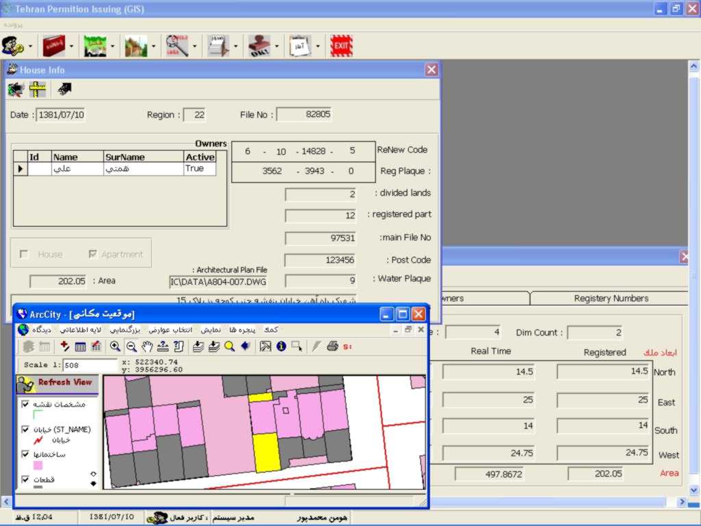 In this image you'll find out about apartment information form & GIS
view of house location and some more...
In this image you'll find out about apartment information form & GIS
view of house location and some more...
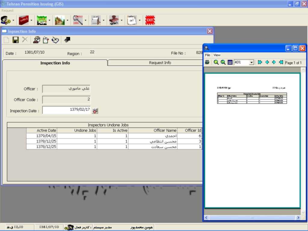 This image shows the Inspection Information form & print out form.
 In this picture you'll see some details in gathering information during
inspecting the building in different levels of construction.
In this picture you'll see some details in gathering information during
inspecting the building in different levels of construction.
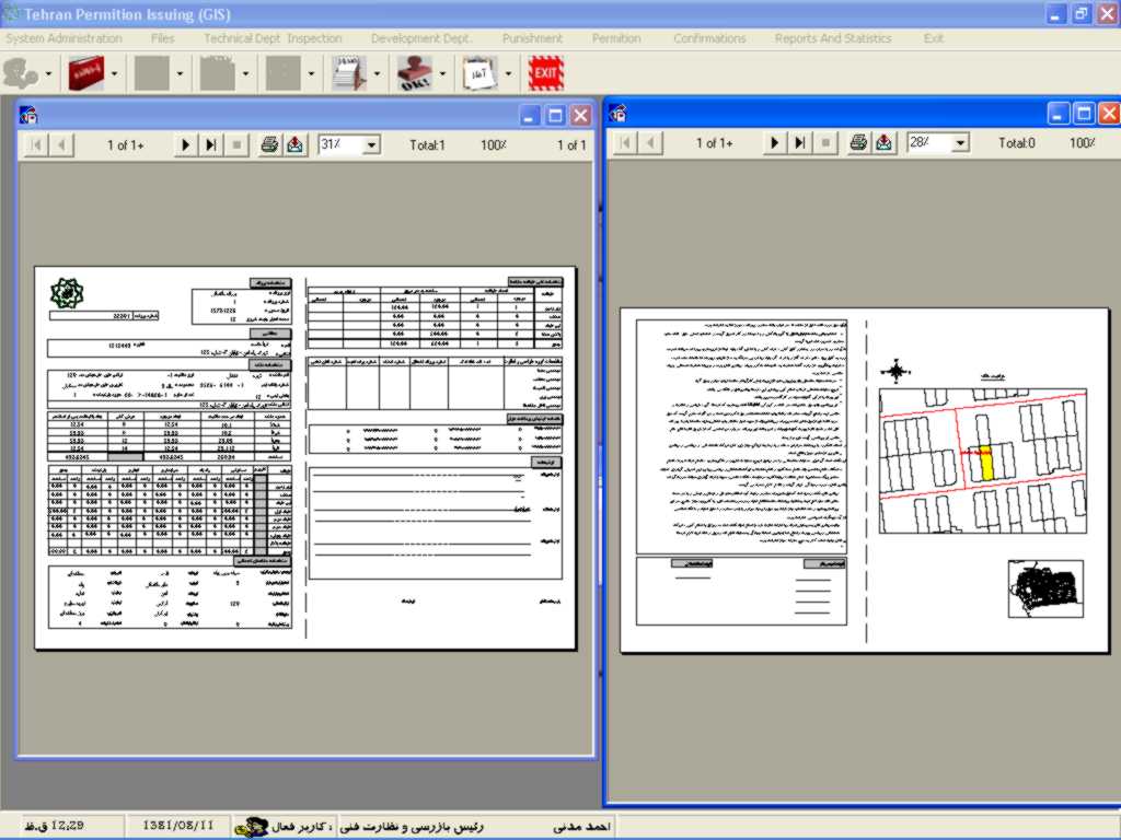
 This picture compares the existing status of the land & compare it with
new plan in municipality. in this case there should be some corrections
for land...
This picture compares the existing status of the land & compare it with
new plan in municipality. in this case there should be some corrections
for land...
![]() This picture shows permission menu.
This picture shows permission menu.

 These two forms identify the penalty information during the building
process.
These two forms identify the penalty information during the building
process.
 This form calculate the regular fees for applicant.
 This form shows the confirmation status of each request.
 This is the final issuance which will print out by CR8.
 This is some statistics for the application
