Photographs of Fire-Control Towers
of the Chesapeake Bay Harbor Defense Command
(Northampton County locations)
1941-1946

CHEAPSIDE
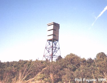
This tower is located at Picketts Harbor, near Kiptopeake, Virginia.
This location was known as Cheapside: N 37Ḟ11.332 W075Ḟ59.880 (USACE)
This tower served Fort Custis and Fishermans Island.
An azimuth instrument pedestal from this tower is now on display at Ft Mott, NJ (Battery Gregg).
A searchlight was also located here: SL 21 (previously 19) - site not yet determined
SMITH ISLAND
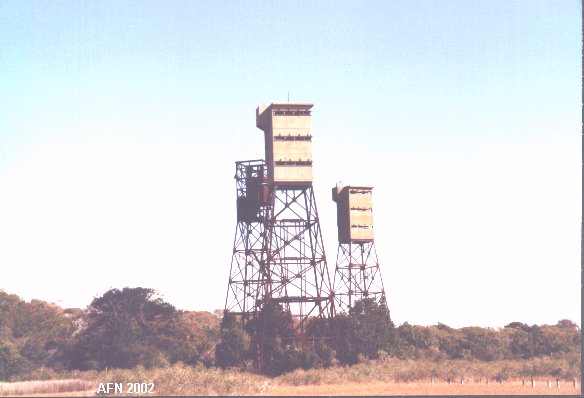
There are three base-end stations on Smith Island, next to the Cape Charles Lighthouse.
Two searchlights and a radar tower were once located nearby.
A - N 37Ḟ07.338 W075Ḟ54.346 (USACE), SL 29 (previously 13) - site not yet determined
B - N 37Ḟ07.337 W075Ḟ54.367 (USACE), SL 30 (previously 14) - site not yet determined
C - N 37Ḟ07.328 W075Ḟ54.382 (USACE), SCR - site not yet determined


Tower C (left) was for Ft Custis and Fishermans Is.
Tower B (center) served Ft Story.
Tower A (right) served Ft Custis and Fort Story.
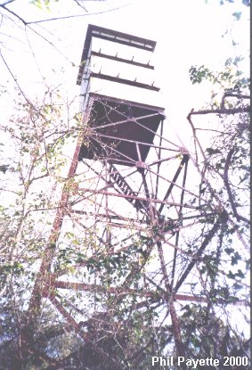
MORE PHOTOS - click here
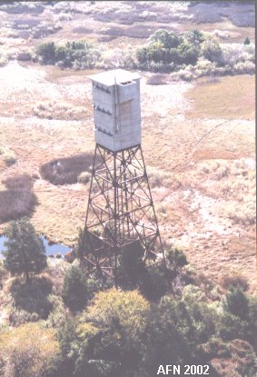
MOCKHORN ISLAND
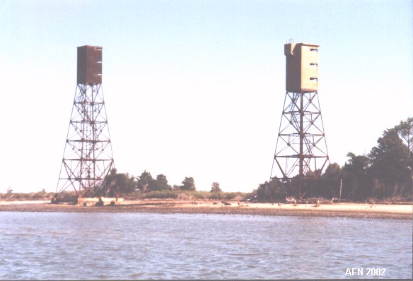
These two towers are on Mockhorn Island at the Eastern Shore.
Both towers served Ft Custis and Ft Story.
A - N 37Ḟ11.910 W075Ḟ54.296 (USACE)
B - coordinates unavailable (USACE)
MORE PHOTOS - click here
WISE POINT
Only foundations exist of the three towers at the former Fort John Custis.
(sorry, no photos)
A - N 37Ḟ07.350 W075Ḟ58.119 (USACE)
B - N 37Ḟ07.210 W075Ḟ58.098 (USACE)
C - N 37Ḟ07.209 W075Ḟ58.077 (USACE)
SCR - site not yet determined


