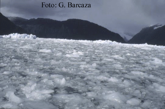
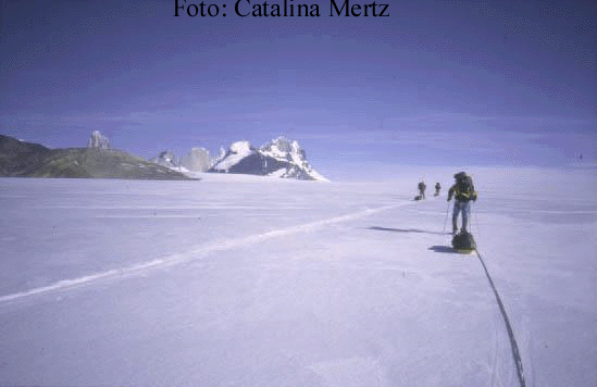
Lake O`Higgins and Cordón Martinez de Rosas in Banquisa in the fiord Falcon, loss of mass for calving,
the oriental sector of Southern Icefield (Feb/1997). Southern Field (April/2000)
The Mountain Andes range of you them one
of the linkages more orographic it constitutes
important of the world, their space continuity
recognizes diverse local names. The district Patagonia is located in the
southern part of the American continent and goes from those 39º south
until Magellan's Strait, among the oceans Pacific and Atlantic. The sinking
of the Mountain range in the sea differentiates two very defined geographical
regions: the Western Patagonia is characterized by an uneven relief conformed
for mountains englacied, fiords and valleys with native forest, being all
their forms modeled by the ice; while the oriental Patagonia has an arid
climate, with extensive pampas and ice dammed lakes.
Their characteristic feature assigns it the extensive Icefields, plateaus of snow and ice that are located to an altitude of 1500 m.s.n.m. and they extend for hundreds of kilometers. In these highlands mountainous linkages emerge whose summits they reach maximum altitudes of 3.900 m.s.n.m., and outlets glaciers that descend toward the fiords of the Pacific and toward the big oriental proglacial lakes.
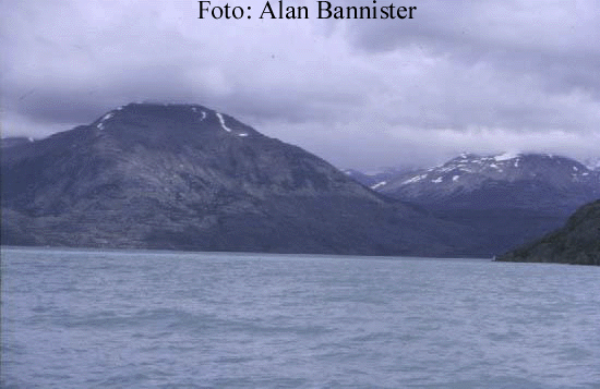
Lake O`Higgins and Cordón
Martinez de Rosas in Banquisa in the fiord Falcon, loss
of mass for calving,
the oriental sector of
Southern Icefield (Feb/1997). Southern Field (April/2000)
Located among the fiords of the ocean Pacific and the Cold Steppe Trasandina, and configuring a relictic glacial system inherited of the last quaternary glaciation, those Icefields have been conserved due to the high annual precipitation associated with humid winds of the Pacific that cool adiabaticly when being ascended and they precipitate in it solid forms for orographic effect.
In such a sense, the structure of a glacier recognizes a high area or of accumulation, where the glacier has a positive mass balance, while the area of ablation you finds in the low parts and it is where the glacier loses mass for several mechanisms. This way, a ' Icefield ' its a certain glaciation type and it corresponds to a 'convex accumulation area', which is in certain highlands and that there is been widespread for the regional glaciation.
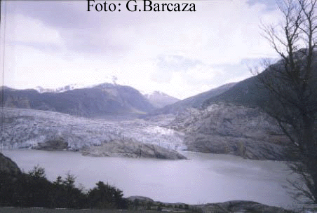
Front of the Chico glacier.
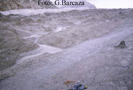
Superficial runoff on ablation Area of Accumulation
type Icefield, Paso
area on Chico glacier
de los Cuatro Glaciares.
Contrary to continental and subpolar glaciers, the thermal regime classifies them as tempered glaciers, since coexists water and ice, being its temperatures near to the fusion point. This fact makes them to have a fragile dynamic balance and variations in the time and space.
The region is inserted in the contact area between the Anticyclone of the Pacific and the drops press subpolares, fact that one manifests in the constant encounter of opposed masses of air. This way, the polar front ' added to the oceanic influence, it characterizes a climate with high precipitations (2500 mm), evapotranspiration and temperatures (for an englaciated area) that are expressed in sensitive and latent heat; elevated relative humidity; and advección fog, among others. In general terms, those condition meteorological they are characterized by an express and sudden change. The winds predominant they are of the werlies and they develop speeds of 8 in the scale Beaufort, that that it is equal to winds of extraordinary perseverance and it forces.

Advection Fog in the Fiord Falcon
(april/2000)
The glacial ice has had an important paper
in the development of the local morphology. Types of glaciers, proglacials
environment and landforms harbor virgin landscapes of closed vegetacionales
formations of nothofagus forests, peat-bogs and mallines, and ecosystems
of faunistic species.