|
Cyclone Heta Recon & A Journey To Faiava
May 2004
Terry Skaggs
tlskaggs@dcsqc.com
The old maps indicate an area called "Faiava". On Thursday May 27th I decided to go deeper into the ruins of Sili village and see how far I could walk to Faiava and beyond to Leaumasisli Point at the extreme north end of Olosega Island. This was my ninth trip to Manu'a and, hard as it is to believe, there are still parts of the islands I hadn't explored and soon I was touching new ground again.

Sili Water Drop | 
Sili Road Damage |
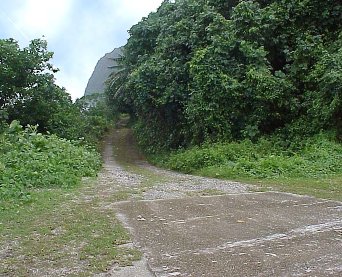
Three sections of the road to Sili had vanished utterly. Six months earlier I'd easily driven a truck into Sili, now the road was gone. "Sili Water Drop" shows fresh water waiting at the end of the remaining road for the remaining family in Sili to carry it the half mile to their home. The picture "Sili Road Damage" shows the second section of missing road. Two sets of tire tracks vanish into coral rubble and rocks. The line of trees and vegetation which formerly followed the beach side of the road was gone too.
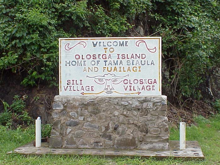
Sili itself is sadly damaged. Although Lata's house is intact, the road and everything in front of the home is gone (including the village's sign) and is replaced by the same rocks and coral which have swallowed the road. Lata is nowhere to be found today, so I continue my journey alone.
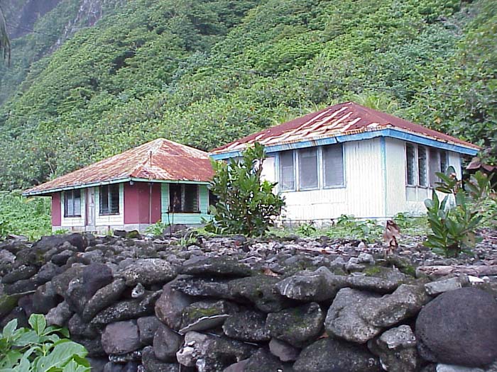
The storm damage to the homes in Faiava must date to the cyclones Tusi and Val. If anyone who lived there can tell their story of the abandonment I'd love to hear from you. The photos in Faiava show the ruins. Inside one of the houses I find a strand of Christmas lights still hanging. The sight of them makes me sad as I imagine this place was once a place of smiles and laughter. Someone grew up here. Someone died here. Someone's mother waited for them to come home to dinner here. This was once the safe place in someone's mind when they thought of "home". Inside one of the homes I get out my recorder and microphone and record several minutes of the ghosts that now live there with the holes of old windows, the gales, the crabs, and the sea.
Headstone
Then there are the graves. All are over grown by the ever-reclaiming jungle; some have long since been robbed by storms. I photograph the headstone of the Reverend Opetaia Tamasili Opetaia. His picture is still on the grave, but rust has covered his eyes. I wonder what kind of a man he was. If someone knows of or is related to this man, please write me. My only wish for taking the photo was to preserve something which is being taken away by time. I suspect he is a man who shouldn't be forgotten in this place.
Moving on, Faiava is left behind and I make my way to Leaumasisli Point. As I walk I notice the coral rubble getting ever larger and is finally replaced by stones which soon become the size of houses. Upon reaching the point, Ta'u Island is visible as is the knowledge that I can go no further. Sheer cliffs and crashing waves erase any ideas of continuing on foot. I take a picture ("Tau From L eaumasili Point", retouched here to make what was a gloomy day a sunny one) and make my way home to Vaoto, a good two hours' hike from here. Thankfully, as I cross the bridge, I'm picked up by a friend and don't have to walk the distance.
On another day, I stop in Ofu village to photograph the new road damaged by cyclone Heta in January of 2004. I hope the people of Manu'a can hold onto their land and culture and do not loose it to not only the storms of nature but the cultural cyclones of bright cities and money which empty houses as effectively as wind and wave.

Tau from Leaumasisli Point
Terry Skaggs is a frequent visitor to American Samoa. He has made many friends in Manu'a and passionate about Manu'a's future prospects for tourism. You can see his environmental recording of his website Trecento Music,
http://www.trecentomusic.com/lifescape1.html. You may contact Terry at tlskaggs@dcsqc.com
|
