|
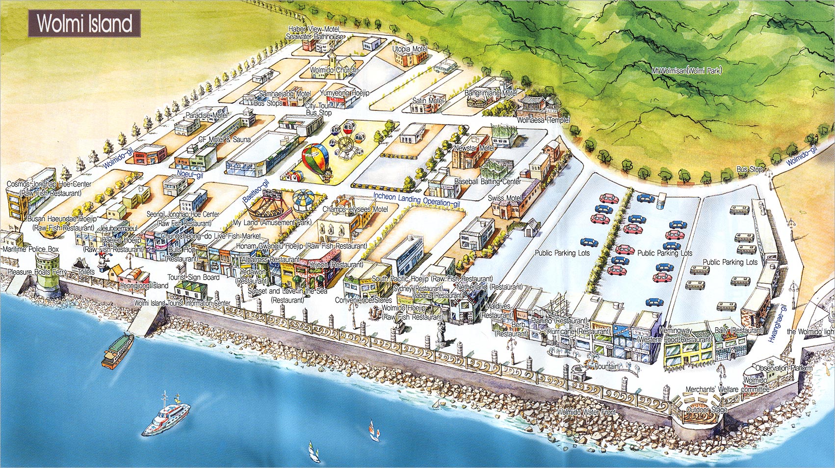
IF YOU HAVE GPS
All points are given in WGS 84:
- "Incheon Station" (1-st line of subway or bus-stops for buses 2,5,15,23,28,32,45). Here there is an Tourist Information Centre with maps - 37°28,559'N, 126°37,017'E
- "Wolmido" bus-stop of buses 2,15,23 and 45 - 37°28,574'N, 126°35,976'E
- Tourist Information Centre in Wolmido - 37°28,519'N, 126°35.845'E
- Amusement Park in Wolmido - 37°28,506'N, 126°35,930'E
- Ferry mooring and ticket office - 37°28,535'N, 126°35,843'E
- Lighthouse at the end of Street of Culture - 37°28,599'N, 126°35,872'E
- Park on Wolmi mountain. Entrance in the park from the coast - 37°28,261'N, 126°35,825'E
- Mountain Wolmi (Wolmi San) - 37°28,330'N, 126°36,158'E
- Observation Tower on Wolmi mountain - 37°28,190'N, 126°36,304'E
- Mole with lighthouse - 37°28,138'N, 126°35,688'E
|