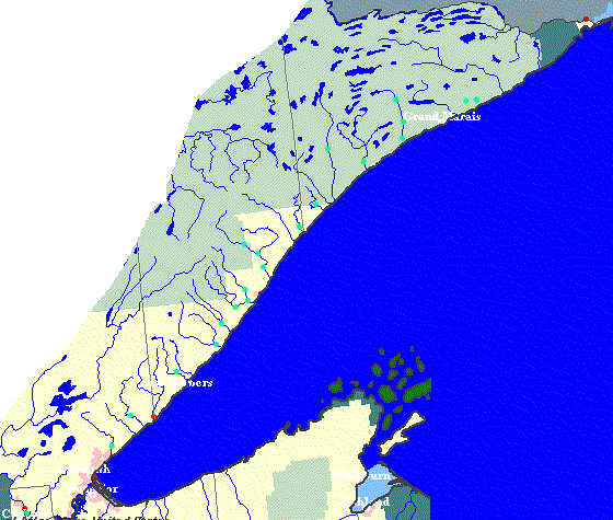
MRI-logo

Clickable River Map 'Hover' on any green dot to see the run name. Click on the dot to open a new window with photos (and minor descriptions) of the run. Close each such window to return here. (Note: Links on a given river all link to a common photo page. ) Red dots indicate locations of USGS gauges, and are not clickable links.
St.Louis River, II-III Lester River, III-V Sucker River, II-IV Stewart River, II-IV Gooseberry Falls Split Rock River, III-IV Lower Beaver River, III-V+ E.Br.Beaver River, III-V W.Br.Beaver River, III-IV Baptism River, II-IV(V+) Upper Baptism River, II-III(V) W.Br.Baptism River, II-III Caribou River Two Island River, III-V+ Temperance River, II-III Cascades of the Cascade River, V Lower Cascade River, III-V Upper Cascade River, II(IV+) Kadunce River, IV+ Kimball Creek, II-V Poplar River, II-IV+

One additional photo page, for a river just off the map to the south: Kettle River, II-III
For questions, constructive comments, additions, corrections, and concerns click here. (Will open a new window . . . close it to return here.)