|
|
The Republic Of Malta
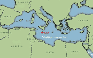
Malta is an archipelago of islands in the centre of the Mediterranean Sea 90 km down from Sicily with an area covering 316 km2 .The archipelago consists of Malta, Gozo, Commino, Kemmunett, and Filfla.
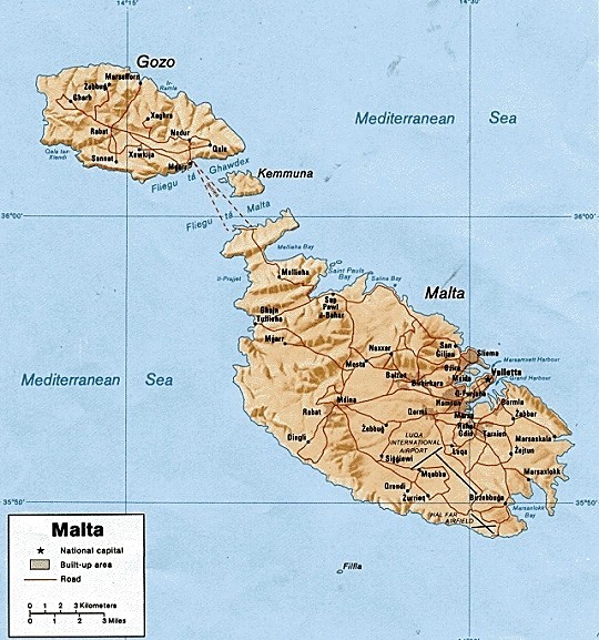
The largest island is Malta with an area of 246 km2 , Gozo which covers an area of 67 km2,and the little island Commino with 1.1 km2 with the 3 island having a population of 375,000.
The Capital city and chief port of the island is Valletta ,in south-east of Malta . It occupies a rocky tongue of land, on either side of which are fine harbours. One is known as the Grand Harbour and the other as Marsamxetto Harbour. Valletta is the administrative, commercial, and cultural centre of Malta. Its principal architectural features are the residence of the president, formerly the palace of the grand masters of the Knights of St John of Jerusalem (also known as the Knights of Malta), St Jhon's Cathedral containing tombs of the knights and grand masters and the bastions built by the Knights to defend the city against the Turkish attacks.
Maltese History Timeline
cc 5000 BC - Neolithic Era
cc 1000BC - Phoenician Era
736 BC - Carthaginians Era
218 BC - Roman Era
60 AD - St Paul is shipwrecked on Malta
870 AD - Muslim Era
1090 AD - Norman Era
1194 AD - Hohenstaufen Dynasty
1266 AD - Angevin Era
1282 AD - Spanish Era
1565 AD - Knights of Malta
1798 AD - French Era
1800 AD - British Era
1939 AD - World War II
1964 AD - Malta gains Indipendence
1971 AD - Malta is a republic state
1979 AD - The last British naval ship (HMS London) leaves the island.
Link:
Official Site Of Maltese Government