An Account Of 9 Days Spent Travelling In The Sandwich Islands
Friday, May 25, 2001: Day 1
The flight was at 9am, and we had a huge Jannd Mountaineering backpack to check in, and this being Memorial Day weekend, decided we needed to get to the airport early, by 8.00 at the latest. So I arose at 6.15 (S being up customarily at 4), dropped off S with the luggage at Western station, handed the key to neighbor Bill, walked down, got a champurrado and 2 fresh tamales from the Mexican vendor for breakfast, got into the blue line bound for O'Hare and then exhaled in relaxation.
The flight took off on time, a big Lockheed L1011 airliner, and headed west across the corn fields of the midwest. I sat glued to the window, reveling in the isolation of being 36,000 feet up, gazing down at the earth, looking for topographical features, trying to guess what state we may be passing over, all the while taking notes.
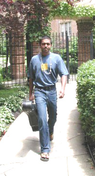
Test caption: PTom with guitar
"On ATA.. you're on vaca-aaay-tion."
Now based on significant earlier experience ATA is a cheapskate on in-flight refreshments, although by no means alone in that trait. But on this flight they went overboard in the other direction. Barely had we taken off and leveled on to a cruising altitude than the flight attendants came around with a tray of hot moist rolled face towels. Beverages followed in quick succession, including a malibu rum and coconut cocktail. A hot breakfast, two movies, more beverages, more towels...
and we flew on towards the sun. less than 4 hours and we crossed the west coast over Oakland CA. The blue Pacific below, the blue sky above. Soon the ocean was covered by an unbroken cloud layer.
We droned on for 5 more hours till we reached the islands in mid-pacific. A crossroads for travelers from all around the Pacific Rim.. these islands, tops of the volcanic lava mass mountain range protruding above sea level, lying in the sun, fringed with coral reefs, trapping moisture from the trade winds that have created rain and cloud forests on the windward side, desert on the lee.
6 pm Chicago time, 1 pm Hawaii Time.. and the sun shone overhead. We were south of the tropic of cancer. The plane flew over part of the island of Oahu, in which I recognized Pearl Harbor's distinctive outline from the map. An aircraft carrier steamed in the ocean, while other gray navy ships were at anchor within the harbor. Then a cluster of high-rises and beaches. Mountains in the center appeared velvet green in the distance, wreathed with low clouds. By now the ground rushed up towards us, and we landed with very little bumpiness.. big jets appear much smoother for some reason. Taxiing towards the terminal, I saw many other huge long haul jets.. ANA Nippon, JAL, Qantas, Korean Air, Air New Zealand, and more airlines from the Polynesian islands and elsewhere.
Emerging from the arrival lounge we came into an open-air passage where many people lounged about smoking. One side lay the tarmac, the other was a tropical garden with a few benches. And the first whiff of slightly humid tropical breeze, laden with the odor of vegetation and moist earth. We collect the backpack and then head to the public bus stop. Honolulu's transit system, TheBus has won acclaim as being one of the country's best bus systems. We stood at the stop, hoping the backpack would be allowed inside. It would fit on my lap, but sometimes its difficult to convince the bus driver. 19 or 20 Waikiki Hotels and Beach .. that’s where the Hawaiian Seaside Hostel was. A number 19 arrives, and the driver was cool about the luggage. from the usual back seat corner, the streets fly by.. the airport hinterland with warehouses, then downtown - quaint old districts of Chinatown and other old houses, immediately followed by the central business district of glass, chrome and steel towers. The streets teemed with folks..many in rubber slippers like the ole ITI days.
The King's palace, library and other impressive buildings in an old architecture style followed, set in spacious grounds with bottle palms and other trees with wide canopies, quite possibly exotics from Africa.
After that came the wide Ala Moana blvd, rushing by more high rises, crossing a canal onto the Ala Moana park and the hotel zone. Touristy shops start lining the streets. The bus makes its way thro Kuhio Ave, and at every cross street one can see hills rising at the end, with houses clustered on the hillsides appearing greeny blue purple with the clouds. At seaside ave we get off and make our way to the hostel, a rambling two-story affair amidst the glass and steel towers, its name painted on to a surfboard.
An Aussie girl checks us in, she's the same person with whom I'd spoken just the day before from Chicago on the phone. $20 per dorm bed per night. two dorm beds in a room with 6 bunks, 6 lockers and a bathroom. curtains on the windows were drawn, the room appeared cool, and was maintained cool with the aid of a big pedestal fan. the floor was cement tiles, cool to the touch, just like Bombay. We unloaded our stuff, Sonali had a shower. The sun blazed outside, I was stiff from sitting 9 hrs at one stretch. We decided to go for a walk to the beach. I pack in my swim trunks, get out the old rubber chappals and saunter out, feeling like a local in the flip-flops, ;-), not because they are flip-flops but because they look old and worn.
Palm trees, bougainvillea, a variety of tropical and subtropical trees, most of then exotics, one sees the same in India. Turning left from the lane onto seaside ave, we passed a shop selling beach mats for 99 cents, then a local bike and car rental stand.. there were no cars there, only a small cabana with a couple bikes. At the corner of seaside and kuhio was a restaurant, 2.99 breakfast special -- 2 pancakes, 2 eggs, 2 bacon..
we crossed kuhio that was crawling with tourists, travelers, hustlers and others, to proceed along Seaside till Kalaleua, where there are even more tourists. every 5 meters there is a cluster of boxes with free publications for tourists, 101 things to do in O'ahu and such, with as many publications in Japanese as in English. Japanese tourists moved about in couples (Hawaii is a big honeymoon spot for them as well) as well as in big tour groups, all of them looking at the world through the lens of the latest sleek video cameras, which have still a year or more to arrive at US markets. People stood on the sidewalks, handing out pamphlets for restaurants, nightclubs, saloons...some of them exclusively targeting the Japanese tour groups. Some of these would look at me and then look at the next person coming. perhaps I looked too poor. I preferred to think they took me for a local. The shops on both sides of the street were hi-fashion boutiques, interspersed with the numerous ABC shops, general purpose shops the equivalent of seven elevens on the mainland. Swank buildings with waterfalls and other glitz had an unending stream of the classic tourist types entering and exiting. Finally the beach came into view. At first glance, it was just a narrow beach, with people sunning themselves, and a few surf/boogie board rental stands, and some outrigger fitted canoes for rides. A row of Palm trees separated it from the wide sidewalk. At that moment the sun was behind some clouds, and the sea was greenish gray, and the spectacle was anticlimactic considering the hype surrounding waikiki beach.
We sat and had sandwiches, some made at home in Chicago, one from the plane. A man read a book, girls snoozed on their stomachs, tanning their backs, kids jumped and danced in the waves. Tourists took pictures. We moved on along the boulevard, lined with more trees and interspersed with statues of Hawaiian chiefs. Waikiki has a series of beaches, each with a slightly different feel and crowd. The tourist zone thinned out to a park to the left of the boulevard, after which lies Honolulu zoo, with the well known landmark Diamond Head in the backdrop. Diamond Head is an old volcanic hill with a crater, from which there is a popular hike to the top thro a tunnel (flashlights needed). By now it was time to get baptized in the midPacific. And what better way to wash off the fatigue of a long flight ? I got into the swim thongs and waded in. The water, cool at first was silk after immersion. S went for a walk further along the beach and beyond. I floated and paddled most of the time, swimming a lap every now and then. The sun squinted thro the clouds, and at times came out full force. so this is waikiki, I sez to meself, as I floated on my back, rising and falling with the waves, some of which were rollers crashing onto the beach. By and large the waters were calm. The sun, low on the horizon by now, glowed on the pink and orange multi stories to my left, the hotel complexes. The buildings were just like Bombay, 20-30 stories tall, with series of balconies. Flanked by palm and other spreading canopy tropical trees (tamarind, schleichera, mango, gulmohur, monkey pod, cashew..), the vibe was that of a very clean Bombay city, with super roads and no visible grime.
there were a few surfers about, paddling out lying flat on their stomachs on their surfboards to where the waves formed, about 50 m offshore, catching a wave, standing up on the board and cruising back, sheer bliss on their faces. The feel of the glide is the crux of the action...i put the goggles on, and looked underwater, into general murk, although the water was quite clear, considering the seabed was sandy. Absolutely no comparison with the clarity of water off Bombay's beaches, where the visibility is perhaps 1 foot max.
I let the waves carry my weight, feeling vastly refreshed. Supposed to meet S at 5.30 by the shower. I emerged from the water after an hour, felt a little chilly, went to the outdoor shower, a stalk with taps on 4 sides and rinsed off in the sweet tasting water. Yeah !
Banks of clouds on the western horizon let the sun through every now and then.. still a couple of hours at least for the sun to set. We moved back along the street, back into the thick of the tourist zone. Back into the midst of the hordes of young Japanese couples, of American tourists wearing clean blinding white shorts and shoes, of members of the international traveller community -- dreadlocked, hurrying along, disdaining to be where they are, waikiki, which to them of course is way uncool. It is a circus really, with all the pushers, peddlers and hustlers on the wide and clean sidewalks. We pass the International Market, to see its a high-priced collection of shops selling souvenirs supposedly from all around the Pacific, especially Polynesian islands.. I would not be surprised if most of the articles were made in China or the Philippines.
The sound of live music somewhere... up ahead was a group of 12-14 young musicians playing jazz tunes with a conductor ! Twas Night train, then the Manhattan xfer's birdland, then one note samba by jobim. we considered hanging around and returning to the beach to watch the sunset, but it was already like 11 pm Chicago time, moreover we had a rooster-early flight to catch the next day.
The next stop was to get a little food... wandered into an ABC and scored some iced coffee cans and a muffin. Our jet lagged bodies told us it was midnight, way past eating time, and what with the constant feeding of knickknacks on the flight in, hunger was not keen and sharp.
Back in the hostel, the level of activity was higher. The TV was on in a corner of the big courtyard with a group of fellows sitting at tables watching the NBA basketball game. Half of this courtyard was covered with canvas tarp like a shamiana, letting the sunlight and fresh air in, keeping the rain out. A banyan tree spread its branches in one end. Some other people sat at tables near The Tree, having dinner that they'd cooked in the communal kitchen, one of the many nice things about hostelling. Adjacent the courtyard lay the 'bar' area, a platform table with stools on either side and a roof on top. Corona Ave sign lifted off some street seemed like. S gets the idea to have a shot of the Malibu rum I'd gotten from the plane, gets a coke from the vending machine and fixes a drink in a tall glass borrowed from the kitchen. A longhaired blond Aussie kid drifts over and parks on one of the stools, wearing just a pair of shorts.
"hi mate"
I take out a bundle of bidis I happened to be carrying, and his eyes light up. "Bidis, hey". An English bloke drifts up, and talks about the bidi factory he visited in Mysore, India. Mark, the Aussie issues a general invitation to get beer from the fridge.."this corner shop sells a 12 pack for like fuckin’ 12 bucks, but I found this shop down the street that sells it for 7.50". Hmm, something to remember. Some more guys come in to the 'bar' area, and conversation buzzes, starting from what’s in bidis, to the situation in south Africa, a grim one for whites now..someone " yeah the blacks were screwed by the apartheid system and all, but its no use if they start killing the whites indiscriminately.."
some one else.."yeah, but look at the way they been ill-treated for generations.. there is no righting such a scene.."various perspectives in various accents.. Aussie, English, welsh, American, Indian flowed around corona ave. Talk then turned to another classic traveler topic.. finding short-term jobs to get cash for the next few months. One guy starts tomorrow on an interisland cruise ship, as a deck attendant , getting 10K for 12 weeks, one half day off per week. "10K is sweet man, you got the next 6 months made"
a beer later, tis bedtime for S. She's the stressor " Ptom, we got to sleep now, we gotta get up real early to go to the airport in the am"
yeah..but I'm in a zone and its hard to leave beer and conversation tonight. although the body clock believes its frickin 2 am. I retire to the bunk, but the corona ave that is just adjacent to the room is all abuzz with more accents coming in, getting louder, there was one girl who had a loud laugh that rose in pitch..add that to the general noise and buzz from the streets outside ... jeez don’t' no one ever sleep around here ? Oh I remembered it was just 10 pm, that too on a friday night, in waikiki that is famed for its nightlife, although to travelers, weekends have no special significance.. negative if any, as that’s when weekend revelers with jobs descend for noisy partying.
Sleep was ragged.. I was too wired to sleep and the heat contributed to the tossing and turning. The noise finally died away after an eternity, and sleep arrived in waves. Just then there was a light knock -- the desh in charge arrived "Good morning, your wake up call".
Saturday, May 26 - Day 2
We got ready in the light from the bathroom door that was ajar, not wishing to cause excess noise for the fellow sleepers more than we could help it. Gently closing the door behind us we move out into the pre-dawn night, still humid, a very mild chill in the air. A few remnants of the nightlife still lingered in the street, which throbbed with neon signs but was quiet at this predawn hour. We sat down on the bus stop, and then S began to stress about what if the bus disallowed luggage, and what if it came late, and that it takes an hour to get to the airport, and we may miss the flight....
*--------------
taxi, flight, arrival, drive to Ke'e continued in laptop.
*--------------
On reaching Ke'e beach. As noted on someone's webster, the parking lot at this trail head for the Kalalau trail gets full by midmorning, so we backed up about 100 m along the road and found another small field that served as a lot. By now it was about 11 am, the sun gloriously blazing away. On the south (mauka = mountainside) side of the road rose a steep wall of rock, a cliff, at the foot of which were two caves.. a dry one and a wet one. we decided to look at these caves later, and go ahead with the hike.
Now, the Kalalau Trail hike is supposedly one of the classic hikes of the planet. 11 mile one way, it traverses the Na Pali coast on northwestern Kaua'i, an extremely scenic and impossibly rugged series of cliffs and narrow fluted valleys, with no roads. The ancient hawaiians used to canoe there if they wanted to make a landing on this section of coast. The trail starts at Ke'e beach, and climbs up the cliff and proceeds 2 miles to Hanaka'piai beach. After this the trail is supposed to get more strenuous and hazardous ..many places it takes one on the exposed rock face with a very narrow path, and a steep drop-off thousands of feet to the rocks and crashing surf below. The trail ends at Kalalau Beach in the Kalalau valley, with a small freak community staying there, reveling in its isolation. One requires permits to camp there, for which there is a waiting list over a month long.
Having just three days in the emerald isle, we decided to do just part of the trail, so as to get a taste, and leave it for some other time.
It was a hard decision...i kept thinking, we could do the 11 miles in a day, camp the night (without a permit, but quite a few folks do that.. if a ranger ends up checking, one gets issued a ticket of $100 but that’s all)..and return the next day. But that did not jell well... it would have left just one day to look at other parts of the island, and there were many other parts worth visiting.. also Kalalau beach sounds like a state of mind, where one spends a few days .. at least 2, just being.. no roads, no shops, no conveniences, no electricity.. although they have helicopters buzzing overhead and boats landing now and then in the day time. and now the cell phone..
anyway, we decided to press on to Hanaka'piai beach, and then take a 2 mile hike inland right up to the base of the valley to the Hanaka'piai Falls.
After cracking the windows open a wee bit, to decrease overheating inside, I stretched, filled the bottles with water and then we hit the trail. At the foot was a map and a sign "Proceed at your own risk".. not so much for the riskiness, as I guess to avoid possible lawsuits in this litigation-wracked land("The park service did not warn me that falling from a vertical cliff edge is dangerous... sue them for 10 million US$").
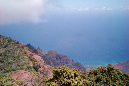
Test caption: View of kalalau beach from the other side
At last, hitting a trail after a long, long time ! The tree-root strewn red dirt path climbs steeply in a series of switchbacks thro a forest, and then abruptly comes out in the sunshine with "one of those views"..blue sky, the ocean deep azure stretching away to infinity, seemingly very calm on the surface except for the waves that pounded the vertical cliffs ahead. Just below, thro the forest of pandanus was Ke'e beach, a crescent of white sand, and the reefs offshore made the ocean color purple and sea-green. A cool breeze blew from the Pacific vastness. Breathe deeply !
Small wildflowers grew in profusion along the trail, as did pepper plants, kahula ginger and ti plants (from which the hawaiian girls of old used to make skirts out of). Pandanus trees are the dominant trees on these cliff-sides. More botanical info from books and Sonali.
The trail wound around rocks, now climbing, now descending. Then at times going level thro cool forest, most of the time exposed to the sun on the cliff-side, by the ocean, that appeared indigo on the horizon and sea-green directly below. Birds twittered and a skink scurried into the undergrowth.
I kept clicking away, fully knowing it is not possible to capture that feeling of immense space on a photograph. So I took quite a few of the multi-frame shots. At times the path would round a vertical ridge, the edge of a valley, and give a good view of the coast ahead. Vertical cliffs with knife-sharp ridges covered with a velvet green forest dropping down to the blue ocean, with surf foaming at the base. here and there were small slivers of light gold.. isolated beaches with no easy way to get down to them. Proceeding, the path would enter the next u-shaped vertical valley, go along the u to near the base and then back out again to round another ridge. it felt like hiking along the side of a giant beer bottle cap with its ridges.
Nearing two miles, the path now started to descend back to the coast. we came upon some signs indicating that swimming was hazardous along a sign listing some of the people who drowned off Hanaka'piai beach. The sea in this part of the coast is supposedly very dangerous owing to rip currents that run underneath the surface and can carry one away far out to the ocean. There are instructions (what to do if caught in one) everywhere, from free tourist publications to signs on the beaches.. "do not try to fight the current by swimming back, let the current take you out (2 miles !?) , then swim back from another angle, outside the current!" Calls for a lot of presence of mind, especially the first time..
Finally the path came to a stop beside a stream bed about 10 - 20 m wide. A cool freshwater stream ran from the valley towards the beach. I crossed the big boulders and reached the beach, following the stream, curious to see where and how it entered the ocean. The stream channeled its way thro the sand, ran parallel to the sea and then curved at a right angle at the end of the beach (bounded by a rocky wall) and flowed quietly and swiftly into the waves. I was rather amazed at this, being the first instance I had seen of a freshwater stream flowing into the ocean, without any estuarine vegetation, swamps or mangroves. There were some fish in this stream on the sand, and they looked like marine fish. Probably brackish water fish.
The beach itself is sheer bliss. Not too big, not too small, its bounded by the valley of Hanaka'piai that goes in 2 miles inland. On either side are sheer cliffs rising vertical, with some pandanus trees clinging on here and there, The valley inland is lush forested, tropical. Mist shrouds the upper regions of the cliffs. the waves are rollers, however they are not too big and its very tempting to enter the ocean,, especially after a hot hike under the blazing sun.
I filled the bottle at the freshwater stream and drank deeply, although there may have been animals and even people upstream. Who cares.. its good to drink fresh stream water --superb taste, minerals, the right temperature and if any germs, they are like a vaccine, and keep that system from becoming too sterile and susceptible to the slightest bugs on travelling in foreign locales. I have been doing this in national parks across the US and so far nothing has happened ! Maybe part of its in the mind.
This beach is as far as the day hikers come. Some carry on 2 miles more inland into the Hanaka'piai valley, all the way to the falls. We decided to do the same. The trail moved now thro cool forests of various tropical trees, about 10-15 feet higher on the right bank of the same stream. Birds chirped, and flitted around. Several bamboo clumps came on the way, each beautiful liquid bottle-green culm scratched with countless "We were here" graffiti over the years. The breeze blew at the tops of these 25-40ft high bamboos-- a gentle rustle, an instance when sound can cool temperature ;). The stream was crossed a couple times. After about an hour and half, the path climbed a little, and thro the trees we got a glimpse of the head of the valley, and the waterfall...a white curtain of spray. There were several spots on the stream bed w/ a good view of the Falls, which was still some ways off. Further on, at one of these spots there was a sign saying end of trail, and danger of falling rocks. But everyone proceeded forward. Better view, I thought and went ahead, clambering over the giant boulders on the stream bed. By now we were close to the bottom of the U-of the valley, the place where the two bordering flanks met, that was graced by the Falls. And then, all of a sudden, the stream bed gave way to a large pool of clear water, into which the falls sprayed in !
What a spiritual locale ! To the east, south and west rose giant cliffs, with ferns growing in cracks and grottos. One has to crane one's neck 60 - 70 degrees up to see the tops. From the south wall fell the water .. so high that after falling a while, the breezes in the canyon turned it to spray, that moved with gusts of wind. Free falling into the pool, in which a number of hikers swam. I stripped down to the jocks, and waded in over the moss-covered round stones at the edge, on which loaches and darter-like fish sat. Ahhhhh the water was smooth velvet, with the magical property of soaking away all stress and refreshing every pore. After a few strokes I floated on my back, looking northwards where all this water flows on down the forested valley we just came up, to enter the Pacific. And then evaporate to form clouds that drift on in the trade winds to shroud the cliffs in mist, nourishing the cloud-forests, and disgorge the drops that flow down into the ground, join each other to form trickles, that in turn come together as springs and streams to fall over the cliff side... and thus the wheel of life. Such pop philosophy is automatic in such a spiritual place ! Dragonflies flashed in the sun against the dark walls. Other hikers had their own moments.. some sat cross-legged atop a rock in the sun, some swam right under the falls, a woman swam with her year old baby astride on her back, a guy dived from some rocks into the part of the pool where the falls fell, probably the deepest part of the pool, being hollowed out over a million years by the force of the water. All this under the rainbows in the spray.
S said this is the Falls used by Kodak in their ad.
A light lunch of a peanut butter granola bar (every morsel chewed and enjoyed as though its the last morsel on earth) and a bottle of the water, the same water that I bottled on the beach. Here I filled it up at the source ! yeah !
After being there a couple hours, tis time to retrace our steps. We still have to find 'Anini Beach Park where we have campsite reservations for the next couple days. Heading back the forest looked very different from the way in. It always is that way, even in familiar paths. Even walking on the other bank is like walking on the other side of an oft-traveled street.. the perspectives and views are different.
We reached the beach where some guys with backpacks relaxed, coming in from Kalalau beach. I filled the bottles once again, and hit the trail back to Ke'e beach and the car. While the falls trail was thro forest in a valley where clouds alternated with sunshine, this trail, being for the most part along the exposed cliff faces was way sunnier. Every little shadow of a pandanus was welcomed, and it was cool in the shade. The ocean directly below us was an impossible aquamarine, that combined dizzily with the bright green of the pandanus leaves. With the glare of the sun, the color started to seem unreal. We came across one spot where there were a bunch of hikers resting, around a bend of a ridge, and cool breeze blew there continuously. Five minutes, and a lot cooler, we carried on.
The ocean stretching away... the old days when polynesians arrived in their outrigger canoes...vast immensity of the Pacific..from the crashing waves on the rocks below, to breakers on reefs, to the calm surface pocked with thousands of little (from this high up) waves, like a breeze ruffling the surface.
Back at the trail head, we gazed at the map once again. Maybe the next time Kalalau beach. Walking back on the road was the wet cave at the base of the steep rock wall, a huge hollow the width of a 4 car garage, its floor a pool of water. In the musty coolness, I saw that tunnels branched off into the gloom, into the insides of the mountain. Some fish swam slowly in this pool.. even in this darkness there was life.
Got an urge to take a small kayak and explore..
further along the road was the dry cave, another wide cavern with a low ceiling from which dripped water.
Back on the road, we headed towards 'Anini Beach to set up camp. Still needed to find directions to the place.. figured stop somewhere for some coffee/food and get them. I had of course forgotten to pack the printouts of the directions I'd taken. The road curved past Hanalei Bay with beaches, resorts and private cottages. Most houses on the island are have nice verandahs, several of them on the upper floor like a wraparound, lush gardens. Past Princeville. The mountains formed a very rugged purple outline, softened by their green velvet cover.
An overlook beside the road had a nice view of a quilt of taro fields lying in a gentle valley. An exhibit gave the foll. info: Taro root (tapioca, kochu/arbi in India) used to be a staple diet of Hawaiians, most commonly used to make poi, a purplish gray fermented mash, that accompanied pork/fish in a meal. This was introduced by the polynesians when they settled on these islands. Taro root is a wetland plant, with arrow-shaped leaves commonly seen in many ornamental plants. These wetlands also act as refuges for many species of seabirds. Of late a lot of land has been shifted to cash crops like sugarcane and other uses from Taro root, thereby reducing wetlands and habitat for many birds like...? (see foto). Looks like the use of taro has shifted from being a staple amidst the current generation. The valley below is a joint efforts between the Hanalei Taro growers cooperative and the US Fish and Wildlife Service.
the town of Hanalei came by, with touristy stuff on both sides of the road -- fancy restaurants (postcards cafe from where a fantastic aroma of fried fish emanated) and dive shops. An open-air stall had fruit smoothies, coffee and butter mochis, a pie-shaped starchy sweet dessert made from taro, that tasted kind of like the translucent Chinese rice paste sweets. got directions to 'anini beach park from the friendly owner, drove on thro the green countryside, past bougainvillea-splashed cottages and orchards and small farms, then some small roads from route 56 towards the sea, where the waves were big and surfers hung out, many local as seen from the trucks parked beside the road... on to the beach park campground.
On the left lay a ranch with the rugged hills as a backdrop. The other side was a long open meadow, then a belt of trees under which most of the tents were pitched, and then the beach by a calm sea.. this beach is protected by a wide reef that breaks the waves offshore.
We found out from some locals camping there that one can pitch one's tent basically in any free spot. S selects a site by the beach under ?? trees, just off the narrow beach, 15 feet from the waterline. Our neighbors appeared to be middle-aged folks, who appeared to be there for a longer time. with clotheslines and some camp furniture. And near us, on the open ground next to the trees was a huge camp of local hawaiian families, who had erected an entire shamiana with tarp and poles. This was a hive of activity-- women cooking, kids playing, men hangin out fishing, drinking and laughing.
I went in for the customary dip in the ocean, which on this beach was as calm as a pond. Reminded me of the gulf of Mexico side of the Florida Keys. The sun got lower, and a few of the earthmother, rastafarian and nature's children types arrived and sat down on the sand to bask in the orange glow. Purple followed orange in painting the western sky while the rastafaris turned into silhouetted lumps on the sand. S got busy in rustling up dinner on the picnic table. And we watched the stars thro the leaves that rustled in the trade breeze.
Also saw that we must have forgotten one of the karrimats at the Alamo rental counter. That became the number one thing to do next morn..ride into Lihu'e and see.. and in any case we were going in that direction to the southwest side of the island, to the cool misty highlands of Koke'e SP, the dry desert waimea canyon and the alakai swamp, together with the Kalalau overlook, to see the valley where the hike we were on would have led to.
Lying down in the tent was a luxury, with soft and warm breezes flapping it. It also rained, but the trees were there to block the full force, and it was just drip drip of fat drops. The sea was dark, punctuated by the periodic beam of the Kilauea lighthouse at one end.
Sunday May 27 - Day 3
Arose at dawn, stretched on the beach. After a breakfast of peanut butter and guava jelly sandwiches, bananas and papaya, and a shower (outdoor and cold water, read cool water), we hit the road headin south to Lihu'e. The countryside sparkled in the morning sunshine, while clouds drifted around the central mountain mass, behind which lay Mt Wai'ale'ale, the wettest place on earth receiving a rainfall of ??? inches, perpetually supposedly veiled in mist. Rainbows sparked at the confluence of the mist and sunshine. Passed the tourist shops still closed and a few tourists doing their morning run bit along Kapa'a.
At the airport, S went off while I waited at the kerb.
"You are parked in an unloading zone" went on an announcement periodically. The other side of the one street that went by the arrival and departure terminals had parking meters. Island beat music on the radio station.. mainly reggae, calypso and some oldies pop stuff, with some folk stuff all local performers.
I see S dancing and returning, karrimat in her hand. So they'd kept it .. jolly decent of them !
Now the road (Rt 56 island near-circle) heads southwest, with reggae on the radio. On the southern side of the island it gets perceptibly drier. Tropical evergreen trees give way to cane plantations, and then dry scrub. The infinity of the blue ocean on the left, the red soil land on the right, mountains in the horizon and the road ahead.. a silk band of tarmac. Eventually we come to Waimea town -- its hard to think of it as a separate town, more like a settlement. Past a school (closed for the summer), a gas station, few tourist shops selling red Dirt T-shirts, and we swing right into a road that heads straight towards the mountains, the ocean in the rearview mirror. The terrain by now is assuming a stark aspect, with chaparral and even some pear cacti. The blazing sun reinforces the dry desert effect.. most amazing considering that a 30 minute drive away lie rainforest.
The road starts to climb upward. A few deciduous trees come in about 2000 feet. We go still higher, into the mountains, around switchbacks, past a sign saying 3500 ft. Then a fork, right leading to Waimea Canyon, left carrying on to Kokee SP thats at the end of the waimea valley. we figure we'll take a quick look at the canyon and return later for some hikes in it.. there are several .. one can hike all the way down to the canyon floor, then hike around the canyon ...
Called Grand Canyon of the Pacific, or so the tourist guides are fond of pointing it out (and ascribing this to Mark Twain), it is smaller in size, but as impressive in the sheer layers of various rocks eroded over time, with a fresh green covering the red, pink and orange sandstone sides. From the viewpoint, the whole canyon (actually three systems, two rivers, each carving out a separate canyon having a confluence and then carrying on towards the south of the island. The canyon lay vast, silent in the sun.. some raptors soared in the canyons on thermals.. a sense of timelessness in comparison to our life-spans pervaded the place...
the morning wore on and we had yet to embark on a hike, so we moved on to Kokee SP. The road climbed higher, getting into cooler zones, enhanced by the aroma of eucalyptus trees on the roadside. S swore at all exotiks.
The SP is set in a large meadow bordered by a campground and hills. The visitor center is a fun place full of exhibits (which I planned to see after the hike, but by then the place had closed), a 3-d terrain model of plaster of the island and the waimea kanyon .kokee area. It gave a very good feel for the lay of the land, how the hills gradually build up from the south to drop vertically into the ocean as the impassable rugged na pali coast. There are many trails in Kokee, each with its own character, grade and things to see. Narrowing down to two was hard enough, nut choosing between the Pihea/Alakai swamp trail and the other one was the hardest. Both passed through rainforest, both had views of the rugged na pali coast, both were long. But the Pihea has an advantage in that it also connects with the Alakai swamp trail, that impassable swamp surrounding the wettest place on earth.. a road-less wilderness.
from the Pihea trailhead the trail moves along the crest of the mountains, offering stunning views of the Kalalau valley to the north-west and the forests and hills to the southeast.
The Kalalau valley looks unreal, a wide valley flanked by bowl shaped steep flanks that consist of knife-sharp ridges, entirely covered with emerald forest, that contrasts heavily with the vast azure and ultramarine Pacific ocean. The story goes of a colony of lepers who hid in this isolated, difficult to reach valley to avoid deportation to Molokai.. one by one they all died, save for a woman, who then decided to return to her village on the south side of the island, and she scaled the cliffs out of the valley to where we stood.
Ohi'a trees flank the trail, these trees with their red blossoms, and the honey-creeper birds that have evolved long slender curved beaks to gain access to the nectar in these blossoms. A textbook case of co-evolution, says S. The trail brochure mentioned that the honey-creepers are endemic to these islands, and are found nowhere else on earth, and they live in these Ohi'a cloud forests, 3500 feet and above, as that’s the mosquito-free zone, the arrival of mossies along with other human introduced life resulted in vast numbers of these birds dying of malaria and other mossie-borne diseases.
The sun shone brightly, and the Ohia trees at the ridgetop were kind of stunted (15 ft)in comparison to the ones in the valley away from the ocean that grew to 30-35 ft. Perhaps the fierce winds have a role, as well as lesser nutrients, although the latter is just an untested hypothesis of mine. The trail then left the ridge and descended into the valley forests...and a boardwalk started, to protect plants from trampling, to curtail erosion caused by a steady stream of hikers, and also render hiking easier. Streams also crossed this area. a few years ago there was no boardwalk, and although the hike on the slopes would not be difficult, the hike through the alakai swamp required hip-length waders, owing to the bogs there.
Lower and lower we descended. Bird calls, chirps and clicks were all around. Trees were dominated by the Ohi'a, apart from which there were some other trees. Huge Ferns dominated the understory, along with kalua ginger plants and other freak plants.
In time, the boardwalk reached a cross-roads..the Pihea trail intersecting with the Alakai swamp trail. We moved ahead, and on the right there was an opening in the vegetation that looked down into the huge bowl-shaped valley, covered with a closed canopy. S was salivating "what forests !" a thick unbroken woolly canopy stretched for miles, punctuated by flitting birds that would suddenly appear, a flash of red or bright green, and then disappear inside. I took three shots trying to get a pan effect.
All of a sudden some weird noises came from somewhere lower down. This hike ended at a campground on the floor of the valley, and maybe the sound was from there.. a man's voice, weirdly yelling at intervals. It didn't sound like a normal yell.. S tensed, and we decided to backtrack, and go on another trail, the alakai swamp, The brochure described the existence of a bog fairly close to the crossroads, with rare plant communities, including insectivorous sundew.
the height of the Ohia trees lessened to stunted 5 footers from 20 feet. A wide open space appeared thro which the boardwalk cut thro. This was the bog. The floor was covered with some bracken and heather, spongy and wiry plants that can withstand water-logging and the poor nutrients in the leached soils. By now it was early afternoon, and the clouds came in from the ocean, creeping in as mist over the forested lip of the valley, along with it the cool fresh feeling of being in the path of clouds. It was peaceful.. a few bird calls and the mist enveloping the trees. we searched the ground for the sundew, and then S spotted it.. the plant itself was just a couple inches high, the end of each stock had a structure like the 2 halves of a shell, the edges having fine hairs with drops of red liquid at the ends.. and these drops were sticky, to trap insect legs, then the two halves come together enveloping the insect and proceeding to dissolve and digest it. Bog soils being low in nutrients, and a general lack of oxygen, plants have to be on the lookout for diverse sources of food, and insectivorous plants are one result of these strategies..
the mist flowed, and it reminded me of days spent hiking in the uplands of the Palni Hills (berijam) in south India 8 years ago..that lies in a similar latitude, similar altitude, and the landscapes plus ecoregions are similar..
we turned back on to the trail, and proceeded. Looking behind, the mists had swallowed up the bog and the trees around. once again we reach the crossroads, sit down eat a granny bar drink water. After sitting quietly we kind of become part of the landscape as far as the life around is concerned (or so I'd like to think), as one gradually sees more birds flitting, a lizard scampering, insects crawling. A young boy came running on the boardwalk with a grinning face and " if someone comes by, tell them I've taken a right at the crossroads"
"okay.. but can you describe these people ?"
"Oh.. two elderly men, one with glasses, carrying a little boy."
"No problem."
We started again, and the trail started going steeply downhill. The boardwalk made it easy, like descending steps down the hill. Many people coming back up were huffing and puffing, taking a step and then resting, leaning on the railing. Apologetic grins..to which me says we'll be the same while coming up.
the trail reached the bottom, crosses a stream on stones, the stream has water a transparent brown.. a lot of acids/pigments from leaf matter I suppose. we then reach another bog, this one is water logged unlike the first one. S gets enraptured by the variety of plants, making observations about co evolution on seeing more flowers that are tubular with the nectar inside, requiring a bird to have a long curved bill to get at it, and meanwhile rub against the anthers thus transferring pollen grains for dispersal.
clouds come in from the ocean onto the sheer cliffs, then creep over the lip over to where we are. Magical places.
Mid afternoon. this trail thro the Ohia cloud forests and bogs is enchanting, and very interesting as well. Contemplating returning tomorrow and doing the entire length of both trails, the Pihea and the Alakai. And then there other trails in Kokee, not to mention the Waimea Canyon trails. Too little time for doing all !
The morning was sunny while we were coming in, Now everything was misty cool and grayish white. We climbed back to the ridge-top, and looked out at he Kalalau valley, that was by now fast being enveloped in mist from the ocean. Clouds billowed in, blurring the outlines of the ridges and trees, fading the bright blues and greens to a strange golden bronze color lent by the sun at 3 o clock. Standing on the crest looking down thousands of feet at the valley, we see a raptor slowly circling below, that comes closer, and its a owl !! Looks at us too.
The clouds get denser, the landscape a white screen. Gets cool, and the smell of the forest in the mist gets forwards collective memories of all other misty forests in the world. It would be hard to imagine what an amazing view exists from this point, had one not seen it. Now its just a white void, silent to the eyes and ears, occasionally punctuated by the cries of a bird or the erratic darting flight of a swallow
Back at the trail head parking lot are a flock of nene.. Hawaiian native geese that are protected. Signs suggest not feeding them, as they start approaching people and cars, and subsequently often exit the earth in a hit and run event.
The road back descended thro the eucalyptus forests, then lower down we saw a car ahead stop beside the road and kids leap out all excited. S immediately spotted guava trees laden with fruit. We jump out and get about a dozen sweet ripe guavas, pale yellow outside, pink on the inside, very refreshing !
the road winds on and on, downhill, and then we come in view of the ocean all of a sudden, and its huge, sweeping almost 180 degrees. we appear to be driving, rather diving straight into it as the road is still going downhill at a gradient. what a view. in some time a few houses appeared on the side.. what a view, what a crazy view from their porches! I suppose though for people born here this would be taken for granted.
Back to waimea and the route 56. right led to the town and Polihale beach park, supposed to be scenic, with dramatic cliffs as a background. another time..
turn left and head east, back to the few towns on the island, a long drive of about 60 miles all the way around to the north where our tent lies pitched by a calm beach. The Kokee highlands are shrouded in clouds in the rear view mirror. Sun shines on the coast. We pass Fort Alexander, a small structure built with Russian backing sometime in the 1800s. Then the port area, industrial, stark in the treeless landscape, especially so in contrast with the landscape elsewhere. Signs of towns whose names are now getting familiar flash by.. Poipu, Lihue, Kapaa, Kilauea....
The sun is once again low on the horizon, setting the western sky aflame, old trees with large leafy canopies all abuzz with birds coming home to roost, local kids playing volleyball while their matrons yell at them, fires being lit beside most tents. The now customary evening dip in the sea happens today at dusk, the calm waters reflecting the trees along the shore, the moon, a pale blue sky fading to dark ink out east, which the lighthouse beam periodically cuts through. sound of a fish breaking surface and plopping back. Once again the primeval ocean water has drawn away whatever fatigue there may have been. How many times has these molecules done that to man over time .. how old are these molecules ?
we sit on the bench under the tree thro which the breeze sighs. Smell of firewood and sea. Dinner commences, the usual mishmash of fruits and tortillas with salsa and fresh cheese, salad, peanuts, a strip of peppered beef jerky .. I forget the exact contents, although that salsa still I can taste.. raw papaya with red pepper.. a hot and sweet combination. Raw papaya was a taste I disliked in earlier days. Now having it in a exotic locale when one is hungry having hiked and swam all day in the freshest unpolluted breezes, its a diff story.
"Lean here" a tall old man shuffles to where we sit, hand outstretched in greeting. Long gray hair, half a dozen necklaces, earrings, smiling eyes creased in wrinkles. "I've been here 13 years.. thirteen years..not in this beach park of course, but in Hawaii... you can do it too.. its all in your control.. each one of us has this choice.. we can make our dreams come true.."
"hey, you read my mind !"
"yes...i feel it that you like it here.. good vibrations you know...i came to the big island thirteen years ago, after the love of my life sent me a plane ticket. In two months I liked it so much I went back to the mainland and sold all my belongings and moved out here. then one day I came to Kaua'i, and have not left since. This is the island, the oldest one, where all the kahuna came to get their powers. Where are you originally from ?"
"India"
"aah.. the land of Krishna and the avatars ! Om shanti ! You can feel the mantras here in the breeze, in the waves, in the stars...come by and visit us if you feel like swapping stories.. I'm with my friends, over there, do you see them sitting by that van, playing guitar ?"
There sat a group of dread-locked deep ecologists, sitting on the grass next to an old VW bus, playing guitar. A kid or two crawled about.
"Last December my friends gave birth to their son, in my apartment" with a beatific smile. "Om shanti my friend!"
"Peace, brother "
The stars came out and hung like lamps in the skies free of light pollution..these tiny specks of land in the middle of the vast pacific that covers almost half the globe. That’s one reason they situated the observatory at Mauna Loa on the big island.. no light pollution from cities makes it easier to observe the night sky.
Our third night in Hawaii.
Monday, May 28 - Day 4
The first intrusion into sleep was also the first indication of the waning of the night and the beginning of a new day..the entire bird community in the leafy canopies had arisen and launched straight into chattering, squaking, screeching and hooting. I parted the flap of the tent, and some fat raindrops fell.
A shower of rain in the morning, that too from a single dark cloud overhead, else the sky to the north is blue over the sea. Then a rainbow breaks out over the sea, and the air is fresh and sweet as a cool morning in the tropics can provide. a man does some tai chi on the beach. we do some yoga.. sarvangasana on carrymats on the beach, watched by the polynesian kids to their great raucous amusement and subsequent copying.
So..after breakfast (the same fruits and peanut butter-guava jelly sandwich) we hit the road once again. Today the primary aim is to spend some hours snorkeling in a coral reef. The various publications suggest the popular Poipu beach on the south part of the island as having good snorkeling. Back on the road, whose turns are now very familiar. The sun is up, its about 8 am, and the dew glistens on the hedges and trees. Waves crash against the shore. back ON the circle road, once again headed south. Kapa'a arrives and we see a sign hit fresh donut and coffee. S has to stop, so we walk down the rain washed street, life stirring in the morning freshness in the form of some sleepy locals and some sprightly mainlander tourists out for a run or a brisk walk. Score a book of 20 postcards with scenes of Kaua'i, some lemons, grapefruits and a papaya. Have barely enough cash, so the shop keeper suggests w/ a grin that we pay him 5 odd cents the next time we are there. There is a fair range of fruits in these shops, ranging from the usual lemons and papayas and grapefruit to passion fruit (lilikoi), guanabana, csapotas, kiwi fruits, avocados ginat and even the freakish yellow-orange durian, that supposedly stinky yet southeast asian fruit.
ON the road again, passing by the coconut coast into Lihu'e town..i see Hilo Hattie on the left, and remember t hats a big shopping place, so we decide to drop in there. Oh yea, we were going thro Lihu'e town (instead of sticking to the circle road that bypasses the town) in order to look for a walmart we'd seen earlier, to get S a bikini.
Barely had we entered the store when a smiling woman comes forward and puts a seashell necklace around each of our necks. Aloha spirit ! How can we ever walk out of the place without getting anything ? Indeed the mind feels expansive, and more inclined to get something. Racks and Stacks of alohawear.. cotton and silk shirts, t-shirts, muumuus... other gera like plastic sandals, hats..hawaiian goodies like chocolate covered macademia nuts and kona coffee, of which there is a big brewer that is on with a stack of paper cups on the side. A sip of aromatic kona brew, the first cup of the day as well, and the caffein courses thro the nerves and further expands the mind. A CD collection by the wall, and I pick up a Hawaiian Slack and Steel Guitar disc. Then some books, notably a paperback on ancient hawaiian civilization, another one on hawaiian ghost stories to be raconted by kids. Some ukeleles for kids are also present, as are dozens of items that would be entrants for the "useless junk that one canot live without' category.
get from gabi's laptop.
Poipu beach:
on the southern part of the island, surrounded by resorts. This was the main 'vacation tourist' area of Kaua'i. The guidebooks however mentioned that Poipu has very good snorkeling and swimming, and we not having time to explore more out of the way beaches, decided to go here for the first snorkel. The parking lot is huge but scenic, along the beach, which has all services like showers, restrooms and pavilions. The shore has a strip of land --sand and rocks jutting out into the ocean, dividing the beach into two sandy bays full of frolickers and snorkelers with their brightly colored snorkel tubes bobbing on the surface. The strip of land gets rocky at the end, with tide pools amidst the barnacle encrusted rocks. The two bays were relatively calm, as reefs broke the force of waves at some distance, where a knot of surfers hung out, waiting for the next big wave.
I sat there on the sand on this strip, struggling to open the plastic packaging of the snorkel bought from Safeway. Finally managed to, and waded in the water. What a delicious feeling ! The water was clear although not crystal like as all the people in the water were churning up some sand from the bottom. Headed out, biting the valve, breathing thro the mouth.
get from homebase PC until cack with Javier.
Headed back thro the sand, showered and sat down in the pavilion, drying the swimtrunks. 3 hours of continuous immersion in water had shrivelled up the skin. A couple lifeguards went with some cones and ropes towards the rocky end. After 30 mins of hanging out, we decided to check out the tide pools. It was hard not to accede to the temptation of another round of snorkeling.
At the tide pools, there was a roped off area with the cones, and I saw a huge whitish-gray seal lazing in a small pool of water that was continually refreshed with every wave, with animated big round eyes and a russian peasants' moustache. A sign on the ropes said "Do not disturb. Hawaiian Monk Seal resting." followed by some details on the endangered status of this seal, only 1500 left in the world. The western Hawaiian islands from Kauai in the east all the way to Midway island in the west are the areas where these seals remain. Seals clamber onto the shore to rest after long swimming, to replenish energies, else they are more prone to shark attacks.
The tide pools themselves were a delight just like tide pools everywhere else... The most visible forms of life included the spiny sea urchins and fat sea cucumbers. Several times I touched the woody stiff spines of the urchins, and they'd move, just like solidified tentacles of a sea anemone. The cucumber was a fat thing, lazy to the extreme, not budging even when poked (not hard !).
There were snails and crabs hiding in cracks, emerging one claw at a time, ever watchful, ready to scurry back. Hermit crabs. A sea slug slowly crawled over the multicolored rocks.
And fish.. schools of striped fish, some copper green and blue, others in other crazy colors swam about freely. Then the bottom dwellers, some loach types on rocks, crawling with their pectoral fins, stationary most of the time, only beady eyes at the top of the head moving. Another black bottom dweller, a 6 inch long snaky flat-headed fish was very territorial, lying motionless in cracks between stones and kept chasing away other fish that happened to stray in.
There were some other people as interested in these pools. Cool breeze, the briny marine smell and me in a thin cotton towel around my waist tied like a lungi.
It was about 4.30 when we finally left the beach. On the road, S speaks of ancient Hawaiian petroglyphs that apparently exist on a hillside near Poipu, so we cruise along further away from the main road, past fancy resorts till where the road becomes unpaved, and a dusty 4 wheel drive. We chance the rental car over it, but the speed drops to max 20 mph, not so much for the jolts and bumps as for the fear of breaking an axle and then being in the soup. The red dirt strip leads to a range of hills, that at our present speed appear to be an hour away, and the day being fairly advanced, with an appetite sharpening after all the exposure to the sea made us retrace our steps, leaving this for the next time.
Back on the road S decides to have lunch at a Hawaiian diner of sorts, in Lihu'e town. We arrive there and are the only customers at that hour. A huge mural -- a roaring waterfall appearing purplish-white amidst the opulent vegetation of dark velvety green, with blue peaks in the horizon against an orange sky. A row of ceiling fans slowly revolve, and the atmosphere is one of sleep. The attendant comes in and takes our order of kalua pig (me) and tuna with garlic sauce. The former arrives with a macaroni salad, two bowls of rice, and is a huge heap of shredded pork well seasoned and fried. S gets access to the salad bar and her fish comes along with rice and the creamy garlic sauce. Dessert was a lilikoi (passion fruit) pie, a delicate flavored delight, much like a key lime pie in principle. More people started drifting in. While the food was very good and sizeable in portions, the general atmosphere of the place seemed a bit rundown.. some tables remained uncleared... On leaving the waiter asks where we are from, and then "Is India close to Indonesia ? There were some people from Indonesia last week, and they spoke of great trouble in their country.."
Clouds drifted across and it rained as we drove thro the back lanes of Lihu'e, with houses, yards and women rushing to pull clothes off the clotheslines.
Out of Lihue, past the coconut coast and Kapa'a, and the sun emerges again, a rainbow while people gather at a beach whose name I forget. We drive on northwards towards the campground thro air that is scented with a mix of flowers and veg and wet earth. very tropical. island music on the radio.
Near Kilauea there is a lighthouse, that is reached by a small side road off the main circle road. Fill gas at a small gas station beside a small church, and then carry on to the lighthouse.. and the Kilauea Marine Bird Sanctuary. Unfortunately the lighthouse closed 30 mins ago, so we see it from afar, a white squat tower with a red roof at the edge of the cliffs that dropped sharply into the surf. In the valley between the cliffs wheeled specks of white -- various seabirds..a sign identified them as tropic birds, frigates, mergansers and terns. They nested in small crevices on the vertical cliff faces. In winter one often saw whales, porpoises and dolphins from this point as well.
It is a peaceful place..sound of the waves crashin at the base of the cliffs far below, together with the cries of the seabirds. The sun in the western sky peeked out between ragged splashes of purple clouds.
As the sun hung low, we got back to 'anini beach. It was very quiet compared to the previous two days. Oh yea, today is monday.. by tomorrow morning everyone has to clear out of the campground for the next 2 days, to let the county perform maintenance.
The most noticeable absense already was the Polynesian extended family..
As the sun set, there were people untying hammocks from trees, slowly moving around picking things, packing vans.. all in quite slow motion.
The moon emerged behind the trees and cast reflections on the waves gently dancing on the sea, as the beam from the lighthouse we saw earlier cut through the darkness in intervals. Our last night on the emerald isle, tomorrow we head back to Honolulu, which I liked a lot, but its hard to get back to an urban area after the sheer langour and sense of enchantment felt in just 3 days on Kauai.
Tuesday, May 29 - Day 5
A foggy dawn..mist shrouded the trees. The tent was dripping wet from condensation. It was spread out to dry in whatever little time we could spare..a 45 minute drive halfway around the island to the airport, return the rental car, check in the backpack and catch the 10 am flight implied a rather un-hangloose morning. So far we had not paid anyone for this 3 days of camping. We got in the car and backed out onto the road, but the back and side windows were all foggy and wet, could not see anything, so I stopped and
more on gabi's laptop.
Arrival in Honolulu once again--room in hostel, Tamarind Park.
Yea, Tamarind park, a small handkerchief-sized space with manicured green watered lawns, a fountain, polished marble and granite benches and low walls on which the office goers in this central business district sat having their lunches, that they either got from home (tupperare) or more commonly, bought a plate lunch at some 4.99 chinatown shop. Eating and chatting, the corporate workers of Honolulu. There was one tamarind tree, and 9 other tropical trees, most of them perhaps introduced, casting a gentle shade from their extensive canopy of small leaves, like an umbrella made of some fine cloth that lets most of the light through. The intersection of King and Bishop hummed with traffic and activity. here the buildings all around were towers.. Pacific Tower, some other tower, very corporate. However corporate wear for men in Hawaii allow the colorful aloha shirt and tat's a very sensible thing given the heat.
I alternated between the Fodor and web site printouts on the Big Island, to get some idea about the geography of the place, the towns, the distances involved in travelling between them, the national parks and other places of interest, so as to try and plan the three days there. a cool humid breeze blew time to time, rustling the leaves. Three days involves brutal decision making -- a constant deliberation between seeing as much as poss (to get a good overview) vs spending a bit more time in some places (which is also more relaxing).
My bottle of water allowed me to keep sitting for hours at the same spot, watching the world go by. Lot of elegantly dressed women. the lawn maintenance person came in a little truck (camionetta), rolled the lawn mower off the back and added the smell of freshly cut grass to the humid air. This was great, just sitting in a strange city and doing nothing ! Wearing slippers gave me a feeling of super laidbackness. A few hrs later I felt the need to let the bottled water out, and so went in search of a suitable restroom. Across King was a mailing supplies center where I scored some postal stamps, then
a university downtown center, whose restroom I graciously paid a visit.
Crossing KIng street is scenic.. look left and you see the misty blue-green hills, look right the eye travels along a palm lined street to the waterfront and a small strip of ocean.
S finally arrived around 2, wearing a lei of fragrant fresh pink flowers. And expressed a strong wish to wander about the streets of Chinatown which we'd seen from the bus.
Just a few blocks to the north is the Chinatown area, narrow streets with old two story buildings, painted in bright colors, their lower floor full of little shops, mostly Chinese and Vietnamese, one stop shops, some selling fruit/veg/meat/utensils/videotapes. The dusty looking places were the pharmacies.. one had an array of strange creatures in its grimy window, dried bats, flying foxes, iguanas and snakes in bottles, dozens of toads and frogs in boxes, dried and flattened to two dimensions. All amidst a huge selection of dried herbs, pellets and granules. a dim light would burn in the store, and an ancient face the color and texture of old yellowed ivory behind the counter. The chinatown here is the stereotypical chinatown of 19th early 20th century sea story books. And indeed, the eastern section of the street has many seedy bars and shady nightclubs, with drunks, roughnecks and damas de noche hanging out, all minding their own business.
In the center are the big open air markets of fresh produce from land and sea. Just like the street markets of India with the same smells, and the same divisions- fish section, meat section, fruit section, flowers section, with the attendant odors.
and lastly the cafes and restaurants, small 12 table affairs. we stepped into a Vietnamese cafe for coffee and cakes. The special that day was oxtail soup and rice for a princely sum of $6.99, when the average lunch was $3.99. The special for the next day was pickled pigs feet and rice. Not hungry enough to partake of the special, or even the ordinary meals, we had some bean paste cakes, lemon pastries and some other confections. The skies grew gray and a cool breeze blew in thro the open door. a few fat drops splashed on the window pane.
S then bought some groceries to cook dinner in the hostel kitchen.
Back on the 19 bus, amidst commuters returning home..past rainy streets of downtown, the Bishop Museum and the King's Palace, the waterfront..along Ala Moana Blvd to the wakiki area and kuhio and seaside. got off there and the rain ceased.
as we passed thro the gate, a sunbeam flashed out from beneath a dark mass of cloud, hitting the surfboard at the entrance, and then a rainbow in the hills. Inside the hostel life buzzed on as usual, someone cooking in the kitchen, the Aussie girl at the desk talking to someone, three guys watching a game on TV, some travelers sifting around tables having beer, others quietly having their own dinner that they cooked. Mark and and the other Aussie were all abuzz.. they were finally leaving Honolulu for the mainland .. LA. The decision was rapid and mark had 30 mins to pack up from his month long stay at the hostel.
This time we had a room.. sadly without a view. I sat in the courtyard, a few rain drops pattering on the tarp above, back to the endless task of reading and planning. Decided that on the morrow I need to do some snorkeling while S is away at her conference, and the Hanauma Marine National Park sounded interesting. This used to be where the hawaiian royalty used to come for picnicking and snorkeling, said the guide, although were there snorkels about a century ago ? anyway, then it became a marine park as it was renowned for marine life diversity and clear waters to observe them. The practice of snorkelers feeding fish got banned recently, as this was attracting huge populations of fish into the bay, much more than the area could support naturally. So that's the plan tomorrow morning.
Il Italiano arrived with a plate of spaghetti and a huge salad that he'd been working on in the kitchen for quite a while. And S cooked up some hearty veg stuff to which was added the remnants of the beef jerky (adding jerky to the pot adds to the flavor of the stew that has veggies, cheese and assorted leftovers like tortillas hardened by exposure to air)
Wednesday, May 30 - Day 6
Woke up, hit the corner restaurant for breakfast.. they had a deal going at 2.99 for 2 pancakes, 2 eggs, 2 strips of bacon. Then we walk on down kuhio, its about 8.30 or so in the morning, and the sun shines hot while a cool breeze blows, carrying the last of dawn's freshness scented with various flowers. S heads off to the convention center, while I park at a bus stop waiting for the number 22 bus to Hanauma Bay Marine Life Park. this bus runs every hour, and a crowd built up. While waiting I realize I just have 4 dollars with me in my bag with the snorkel and swimtrunks and underwater camera. I'd left my wallet behind on purpose, as there'd be no one to look after it on the beach, so I thought. and for some reason I'd assumed that this Bay is free.. well, now it was too late, as S had the keys to the hostel.
Drat !! How silly of me not to care some more money, like $10. Anyways, too late to do anything. Just go with the flow...the bus went past diamond head, past residential areas, sunny cottages with bougainvillea, the green cloudflecked hills on the horizon, houses straggling half ways up their sides. Some slopes were devoid of any houses, either forest preserves or protected watersheds.
After what seemed like an hour, we arrived at the Marine Park. From the bus stop, we look over a cliff onto paradise ! A wide bay framed by cliffs on both sides, its waters blue
The Sandwich Is. -- this segment written at OSU 9/2/2001
Hanauma Bay
The sun shone hotter, making the water look more and more inviting. Then I saw that there was an entrance fee of $ 3. A most reasonable entrance fee no doubt, but at this time that was all I had, leaving behind nothing for the bus fare back to Waikiki. Walking back would have taken half a day, and I was supposed to meet S at the hostel at 2 pm. The transfer I'd obtained from the bus ride to the Bay would have expired by the time the first bus arrived which was at 12.20 pm. I could just sit there for 3 hours and gape at the sea and the snorkelers. That was extremely excruciating to even think of. If only I had a dollar more. It crossed my mind to panhandle the tourists for a dollar. To beg. But first I decided to join the queue and try my luck at the entrance. With a sad face I explained the situation to the girl at the counter, that all I could spare was $2 and that I'd come all the way from India, and that it was a childhood dream to see the reef up close. She very graciously agreed to put in a dollar from her pocket. Sweet angel ! I was filled with feelings of immense gratitude, and decided to mail a small contribution to the upkeep of the Park on my return.
The feelings of exasperation and gloom were drawn aside like a curtain, as I bounded down the path descending to the beach along the cliff wall. There were two major reef areas, I chose one on a whim. After changing into the old blue speedo swimtrunks at the bathhouse and placing my jeans on the sand, covered with the tshirt that id' spread to sun out, I enter the water ! Its a tad chilly. I jump into it to get over the shock, and be one with it. Ah, to emerge feeling cool and immensely fresh, into the warm sunshine ! I adjusted the snorkel, and then entered the underwater world. Sand on the bottom, the water semi-opaque w/ sand suspended, which sparkled in the sunlight streaming inside. Nothing, except the dancing streaks of light reflected by the waves on the surface onto the sandy bottom. Then, I see a foot long fish, white with electric blue stripes from head to bright yellow tail. Slowly swimming along the bottom, sniffing every now and then. Then some other fish.. three smaller fish with black vertical stripes. Some rocks loomed into view, and I swam towards them, and was over the reef. The corals here were not the picture perfect ones seen in untouched reefs, I suppose on account of the heavy traffic of snorkelers, Hanauma Bay being a very popular snorkeling spot with tourists, but there was a wide variety and abundance of reef fishes, as I saw over the next three hours. It would take too long and quite possibly bore the reader if I were to attempt to describe each fish and life form that I saw. However some sightings I feel are worthy of mention. After an hour of looking at fishes in various colors, sizes and shapes, I was floating, looking at the sea bed, when all of a sudden a chunk of the sea bed moved. Looking closer I noticed the blue eyes rimmed with gold, and realized I was looking at some sort of a skatefish, a flat fish, flat horizontally, like a tortilla. It was covered with brownish speckled markings, and as it glided a few millimeters above the seabed, its fins rippled like breeze thro a lacy curtain. I tried to keep my position to observe this interesting fish, tossing around like a piece of straw in the waves that moved on towards the shore.
Another time I was well inside the reef, looking down at the caverns and canyons formed by the coral formations, some of them 6-8 feet deep at this point, when I notice a small (6 inch long) black fish with small white spots all over, with a triangular box like crosssection, poking its snout and nibbling at some stuff on the walls of the reef. I dived headlong to get a closer look, forgetting that as a snorkeler I could not go deeper than a foot below the surface, else the breathing tube gets underwater and water enters thro the opening meant for air. That's what happened, and I resurfaced, sputtering, spitting out salty water. Readjusted the snorkel, and by then the fish had gone elsewhere.
There were spiny sea urchins in some places, and I had to be careful not to step on them, something that's quite easy to do especially as they also sat in crevices in the reef walls.
I'd heard that contact with the spines could result in a painful swelling. They are eaten by the Chinese.
I also saw a pipe fish, strangely elongated, apart from the wrasses, surgeon fish, squirrel fishes, moorish idols and other fishes whose names I know not. Sometimes an entire school of pure silvery fish went swimming by, and I swam alongside them. I suppose I'd have seen more elife had I ventured into deeper water, near the edge of the reef and the open ocean, but I didn't have much time. Also one gets chilled after 3 hours of swimming, skin shriveled like a raisin.
There were many other snorkelers. Sometimes there was no one in a particular spot for quite some time, and after drifting along, one would suddenly see human arms and legs, encased in flippers. At times several snorkelers wheeled about, trying to remain where they were despite the waves that carried them toward shore, all looking at a certain fish, usually a giant parrot fish colored bright green and blue, or a strange maroon-purple.
I had a single use kodak underwater camera bought at walgreens that I played around with. The pix came out quite good, given that the water was not exactly crystal clear owing to the churning sand, and the bright sunshine underwater.
It was time to leave the water, the bus was arriving in half an hour, If I missed the bus, then there would be an hours wait which meant missing the 2 pm meeting at the hostel.
Anyway I was fairly shriveled up. Left the sea reluctantly and lay in the sand, letting the sun dry myself, as I'd forgotten a towel. The warmth soaked into the bones. hundreds of people did the same all around...pale Japanese tourists who never seem to get tanned, pink European getting red, brown locals. Finally with 10 minutes to spare, I rose, put on the supersolarheated jeans and climbed back up the cliff face onto the top. On reaching there, I look out over the bay, and feel unreal, like as though I'm dreaming. The sheer purity and force of color in Hawaii is exotic.
I sit under a tree, in the shade from the sun blazing directly overhead. The contrast between sunny areas and the shade is very high. The bus arrives, and we all clamber onboard. I keep nodding off as it drones on through the various neighborhoods, past diamond head where some people got off to climb it at this hour.. no shade, steep climb. I left it for the next time I visit O'ahu. Arrive at Kuhio and Seaside, walk back to the hostel and sit in the courtyard. Its a sleepy time, some folks having a siesta under the canvas canopy. A couple old timers watching some movie on TV that just begun. I followed it awhile and ten started reading the Hawaii guide again. The eternal planning for how to spend the wee wee period of three days in the big island...
S arrives, we have sth quick to eat and then decide to head out again, look at the island. S wants to be at the convention center to meet an eminent ecologist at 6 in the evening, so the circle island tour now seems out of the question. This tour involves riding a bus that goes around the island. There are actually two separate routes, one along the north shore and one along the south. The north is the longer one, taking 4 1/2 hrs , touching at the well known surfing hangout on the North Shore where the waves are huge, and extra huge at certain times of the year. So far riding the bus (and sitting at the corner back seat next to the window) has been a chilled out way to spend time, observing normal life in Honolulu, the various neighborhoods with their houses, shops and people/traffic on the street, the commuters getting aboard the bus and so on.
We then decide to go to the Lyon Arboretum up in the misty rain forested manoa valley, tat's the green hills always flecked with mist and clouds that we see looking north from waikiki/ downtown. A bus to ala moana shopping center, that's the main point for connections bus routes to various parts of the island. Then a number 5 to manoa valley/U of Hawaii.
More neighborhoods we see, these are the areas outside the tourist zones. Many areas are very reminiscent of Bombay/Mexico City suburbs with their balconied millstones and the same tropical and subtropical trees and shrubs. The sky grew cloudier as we approached the mountains. The bus climbs up the manoa valley, to drop us off at the arboretum stop. We have to walk like half a mile up a path to reach the arb, and also the manoa falls trailhead, which is a half day hike deeper into the mountain range. By now a few drops were falling. We walked along the winding climbing road, now and then a house beside. To the right was a dense wall of vegetation, very tropical, with tall trees with a continuous canopy that formed a delicate intricate pattern against the sky. The smell of vegetation, of wet earth combined with the smell of sap and flowers lay heavy in the humid air. By now dark clouds lay overhead. looking back along the road, there was blues skies over waikiki where the tall hotels reflected the sun. And here it was a flashback to the monsoons in the western ghats. We reached the arboretum, a sign said they close at 4. Its was 3.45. we pressed on inside, and reached the visitor center where S went to relieve herself. The center was a small cozy cottage surrounded with gardens full of labelled plants from various other 'exotic' corners of the world, like Brazil and Madagascar and Peru. Some staff hung around some greenhouses. It was time to head back. We came down the road, looking at the wide reach of the valley covered in forest. Manoa Falls trek would be an interesting one. Another thing for the next time. S dreamed of a job at the arb. And so we walked on down the road til we came to the bus stop. we decided to keep walking till the bus arrived, thinking that the bus may retrace its route on the way back down. Every bus driver of number 5 seeming the same, as wearing the same brown aloha shirt, bald headed with a moustache.
As it happens, it didn't as we did not see any bus stop signs on this side of the road. The road led out of the valley, gradually descending, nice cottages on either side, living rooms with great views of the valley, garages, quit a few of them having rock gardens and Japanese motifs. There were a fair number of oriental people about the place. Perhaps Japanese expats staying here ? The drops decreased as we descended out of the valley. ahead was sunshine, behind us grey clouds. we walked on and on. came to a bus stop finally but then didn't have a dollar change, and the entire area had no shopping district, it was one big series of residences. So we walked on, me shuffling in rubber bathroom slippers like the IIT days (my attire in honolulu was back to the classic IIT -- T-shirts, jeans, rubber slippers with a bag in which lay a book, a camera, a bottle of water). unfortunately its been awhile since I did some lengthy walking in these slippers and I started to get another familiar feeling, the beginnings of a blister amidst the jeans sticky with humidity and sweat. the road went on and on. looking at the map we had, the manoa road go by the Univ of Hawaii to reach the ala moana canal, beyond which lay waikiki. In time we arrived at the Univ area. The buildings are modern, I suppose its not a very old university. Sat at a bus stop and restored some energy with half a granola bar and some swigs from the water bottle. we moved on, by now the road had widened from a single land suburban street to a dual lane road with more traffic. We went under a flyover, that was the H-1, the main freeway thro Honolulu. Then came across a huge collection of shops and cafes. We stepped inside a cafe, had a coFfee and a pudding and a muffin. The sun shone in thro the windows. This was a cybercafe, with 6 PCs and a couple couches with a bookshelf having a range of books covering travel, existential philosophers new age stuff and teenybopper romances. Much refreshed we moved along, and found a bus stop from where buses went to the convention center and to waikiki. Clouds moved in overhead. We stepped across the street to a shop that sold produce. We needed to get some cheese and spinach and I forget what, basically some stuff for dinner. This shop, a Chinese one had some old vegetables alongside a stack of porn in various languages. There were quite a few cheap apartment complexes, the type where students stay for a year or so. Most of the foodstuff in the shop was geared towards students, packets of ramen noodles, easy and fast to prepare.
We recrossed the street back to the bus stop, figured out what bus to catch to reach waikiki and Sonali's conf center at the village. A slim girl with striking indian/middle eastern/latin features dressed in hip sultry garb sat there alone. It started to rain fat isolated drops, while all around the traffic swished by. She chatted with some one else, very animated and strangely agitated seemingly, throwing her mane of silky long black hair around. The bus arrived and we headed for the customary back seat. The sun came out, increasing the humidity. After crossing the canal, we started to try figure out where to get off for the Village. The girl after a while asked us if we were lost.."I'm not from here either, but I figured it out after a while.. you can get off and take any cross street, that'll take you to the oceanfront"
"You've such nice faces, are you from India?"
"Yes! And you are from..?"
"Oh ! I'm all mixed.. part Cherokee, part Indian, part Irish, part German, part this , part that..from all over." with a big shake of her head, hair flying around. "I grew up on the Big Island, in Hilo, and then here and there."
Sonali's stop arrived, and she got off.
"She is really beautiful.. is she your wife?"
"Yes"
"Do you have any kids ?"
"No, not yet.."
" I have one.. a daughter"
"Really ?! You look so young"
"uh..yea..well, how long have you been here, in Honolulu?"
" a few days. tomorrow we go to the Big Island."
"Hilo or Kona ?"
"Hilo.."
"Smart choice ! Its close to the Volcanoes, and people are much nicer there than here.."
"yes, we're very excited about going there.."
By then seaside avenue had arrived, and both of us rose, she with a cigarette and lighter ready. "Its been good talking to you"
"Take care of yourself and your daughter"...perhaps she was part of the waikiki nightlife service industry. Her makeup was bolder than normal. She was a very nice and friendly person, and we hope she and her daughter are all right, wherever they are...
>>> is continued in sandwich_1 until my reaching the hostel in the evening. Time spent packing once again.. this time we had more stuff, the food and assorted goodies bought in Kauai, also unlike the last time, we were not leaving behind any bags at the hostel, as on our return from the big island we would straightaway catch a flight for Chicago and not come via the hostel, time between flights being short..>>>
Next day
It was a repeat of the scene 5 days ago, when we were leaving the hostel to catch a flight to Kaua'i. Arise before dawn, a quick wash, shoulder the backpack and walk out of the hostel. Wait at the bus stop, and who should arrive but the same Vietnamese cabbie who'd taken us to the airport the last time. He recognized us before we did, braked to a halt right in front of us, with a wave and a huge grin.."going airport ?"
"It can't be".. we think, and then the humor of the coincidence hits us, that's fate we decide, and promptly open the doors and get in. Some more stories of his life follow, he and his wife have spent 13 years in Honolulu, they like it very much here, while his son is back in Vietnam and so on. The airport arrives, I fish out the same $25 as a fare, he gets out, helps with the bags and gives us a very warm farewell, like a family member.
Inside the airport once again, the same Aloha airlines counter, and we are in the waiting room like usual.
The flight to Hilo is a bit longer than the one to Lihue, about an hour, One the way we pass Molokai, Maui and Lanai, with a recorded narrative played on the aircraft's s PA system, 10 lines for each island encompassing geographical, historical and current status factoids. The guava punch cups are cleared away and the plane starts its descent over the Pacific towards Hilo. While we are taxing towards the terminal I can see an extensive low rising hill range on the horizon, speckled with houses. This range is more like a continuous wall, the ground gradually rising in one big wave.
Hilo has a very different feel from Lihu'e. It appears much bigger for one. At the airport, we collect the backpacks, proceed to rent a car, this time we get a silver one. Then head to the county office in downtown hilo to purchase camping permits at county beach parks. Downtown Hilo has the feel of a tropical port town from some other era, most unlike the average US city downtown. No skyscrapers for one. Its all two stories buildings on ether side of the street.
At the county office, there was a folder of photographs of all the parks on the Big Island, that was being looked at by a local woman, whose kid I played with for a while. we then struck up a plan as follows..
Day 1 we'd drive along the coast, north from HIlo all the way to the Kona side, and camp at Ho'okena Beach Park. The next day proceed to Hawaii Volcanoes Natl park and camp there. The third day come back and camp very near Hilo, so as to afford ample time for breaking camp and travelling to the airport the next day. That we decide would be the a county park 18 miles north of Hilo. Accordingly we bought the permits, 10 bucks each day.
written on 9/10/2001
Hilo County Office, where one can secure the permits required to camp in any of the county parks. In some cases one can also walk into a camp and pay the ranger the next day, however that does not apply to most parks, and besides the onsite fee may be higher.
We had formed a rough plan how to tackle the island over the three days that we'd be there. The first day we'd drive north from HIlo, along the coast, all the way to the other side, the KOna side, and camp at Ho'okena Beach. The next day move on along the coast and reach the Volcanoes NP. Camp there. The third day move back to a camp near Hilo, so that the following morning we'd be in a position to break camp and make it to the airport in good time.
Accordingly we got permits for Ho'okena Beach for that night, and for another county park 20 miles north of Hilo. The lady at the counter was friendly, and so were the other staff in the building, which itself was a nice well ventilated structure.
Back in the car and the street. The streets of Hilo have a feel of an old tropical port town, old buildings, weather beaten, with much vegetation like palm trees and bougainvillea filling the gaps between the houses. Clotheslines hung in the yards, and chickens roosted around. The sun shone thro a haze of high cloud. The road led to the shore highway finally, back to the sparkling sea to our right, stretching on ahead, a smooth ribbon flanked by red vegetation enfestooned cliffs to the left. Signs showed a sped limit of 55 on this two lane road. The east coast is the rainy side of the Big Island, just like the other islands we visited. A simplistic explanation involves the trade winds that blow from the east, arriving at the isles laden with moisture, that's intercepted by the mountain flanks. Shortly after leaving Hilo, there was a turnoff for a scenic drive thro the grounds of the arboretum. The road became winding tunnel thro the vegetation, tall trees rising on both sides, their canopy forming an intertwined roof overhead, thro which a few specks of sunlight filtered thro. The trunks were covered in moss and vines with big leaves. Various flowers and shrubs composed the undergrowth. The windows were of course rolled down as far as they could go, and a smell of damp veg floated in. we cruised at a cool 10 miles per hr. 4 miles later we came to the entrance of the arboretum, 10 dollars admission, we didn't have the time anyway, so we moved on.
Now and then the sea would open up to our right. On and on the road skirted the coast, and in a couple hours we were nearing the north part of the island, the Waimea section, which is the home of the hawaiian cowboy, the panielo. The land here is rolling, ranches sweeping up to the flanks of the Waimea mountain range. The other islands being smaller have one central mountain range, the Big island has several. We took the road climbing up the ridge of the waimea mountains, ranches on either side. It got drier, trees gave way to shrubs and pines (probably planted). Vistas opened up, stretching far over the flat plains of the northwest section, the sea in the distance.
Signs in the ranches advertised accommodation and participation in ranching activities like horse riding, very touristy.
The road ascended, slow but steady, flanked by eucalyptus trees. Every now and then there would be sizeable breaks in the trees, thro which one could see the land stretching away, away to the ocean on the horizon. In time, the air got cooler, as we drove into the clouds. The color drained away, and the land got starker in terms of vegetation, one mainly grassy range and clumps of shrubby chaparral. it felt like a highway to the sky. at one place we stopped, to gape at the 180 deg view of the land below. Me also took a surreptitious piddle. a grayish white sky peculiar to when one is in clouds, whatever scant color in the landscape bled away to dusty brown and gray green. The road constantly twisted, peppered with yellow signs showing steep bends and speed limits of 15 and 20 mph.
driving in the clouds is exhilarating ! and of course, as good things end, after an hour the road started its descent to the north coast, the sun grey stronger, more color appeared, and all of a sudden we got on this road that appeared to dive straight into the ocean... a road flowing straight down the slope into the sea. The sea..the ocean.. blue and immense, especially when seen from a height. The horizon is at one's eye level, like the ridge of the opposite slope of a valley, which is the blue sparkling ocean, while the ridge one is one slopes down to the valley bottom that is where land meets the sea..
in time houses appeared scattered, each a small cottage surrounded by exuberant tropical vegetation. We rolled into a small town (see name from a map), where we pass a post office, a modern building by the sea, reposing in the blinding sunshine. about turn and we park in the lot, and go inside to buy stamps for the post cards we'd been writing over the last few days.
The PO on the north shore of Hawai'i.
No one at the counter. So we ring this bell, and a woman answers from an inner room. She emerges with a smile " not too much traffic here". She was manning the whole office by herself. The stamps bought, we move on. what a slow peaceful life this PO must entail, especially for a young woman like this postmistress. Time to fill gas, and of we go now, rounding the northern tip to the western side of the island. It starts to get drier and drier, and the sun takes on a bleaching glare. On the right the ocean, sparkling away, on the left dry grass covered ground, with the waimea range rising away in the distance, its slope in gray green shadow of the clouds clustered around the ridge. S been reading that Fodor's guide which mentions a hieau, a stone platform that acted as an altar and sacrificial site for the ancients here. This particular hieau is off the main road, near the sea, and is noted for a particular eerie, sinister atmosphere. We decide to head there, take a side road that heads towards the ocean, where there also is an airfield. The road comes to an end, and from there, along the rocky coast is a dirt road, on which rental cars are not supposed to be taken, I suppose for danger of damage to the axle. I take the car slow in low gear. The road starts to get dicey..a deep rut forms in the center, perhaps a channel cut by water in a rainstorm. The rut widens, the road is a v-cross section valley in places. I have to decide while on the move, whether to drive over the rut, the left wheels on the left slop (about 45 deg) and the right wheels on the right slope. At turns the rut shifts to the side of the road, and one slope gets longer than the other, so I drive on one slope, the car leaning towards the bottom of the rut at angles that make us feel the car could overturn. 20 minutes of this and we stop in the shade of one of the infrequent trees, and get out.
Just the sound of the waves on the rocks. There is absolutely no one here, no houses, one or two trees, leafless skeletons. The ground is dry and cracked. A wind blows from the ocean over this ground, resonating empty spaces, with a wavering howl. Still the heiau is nowhere in sight. The atmosphere starts to get spooky. Thoughts range from the practical - what if the car gets stuck or overturns ? to downright eerie -- what if someone were to emerge with some ulterior motive, take advantage of the utter isolation ? What if the ghosts of the sacrificed humans in the past still hung around. It certainly seemed the abode of restless spirits. There was something unreal about the isolation, the sunlight and the ocean. We hadn't seen any cars, any people ever since we left the main road, 45 minutes ago.
Should we go on ? We do not have enough time to explore, as we gotta get to the southwestern part of the island by sundown to camp, and its at least a 3 hr drive from where we left the main road. But then again it may just be 10 minutes ahead, this especially spooky heiau.
We locked the car, and walked on a bit ahead, where the road rose. Far away, one could make out a gigantic structure of rocks.. probably a half hr walk at the very least. distances in big sky areas are deceptive. shimmering like an OLD FORT..perhaps the spirits of the condemned still haunt the stones, and the solitary trees, and rocks. perhaps also prevails the spirits of the kahunas, the wizards of ancient times in this group of islands...connected with dozens of other such island groups scattered far far away, a world away, across thousands of miles of trackless ocean... With reluctance mixed with relief, we decide to turn back. Another time. Head back to the main road, and then cruise on, heading south.
Coming up in the stark sunny landscape is a restored ancient hawaiian village, the Lapakahi state Historical Park.
The approach leaves the highway, and snakes down to the parking lot. Only one other car is parked there. we enter the visitor info center, a small hut with natural history and anthro-cultural exhibits, and a young man sitting in there alone, reading a book.
"Afternoon" He gives us a map of the self guided trail thro the remains of the village, and explains that this was a big village which was abandoned more than a 100 years ago, probably as the water table went down, drying up their drinking water wells.
The village began as a small settlement of fishermen. Some of them in time moved inward into the island, up into the hills and started farming taro and other foods. This village then became the meeting point for farmers of the land to exchange goods with farmers of the sea. The market grew, a focal point for settlements from miles around, and so the population went up. In time, it is thought that the ground water must have gone down due to over extraction and wells dried up.
The trail wound its way on what seemed one of the original paths, bordered with a row of stones, around and beside which were different structures that were houses once. walls of stone. Houses for various purposes.. canoe shed, fish drying shed, the chief's house that had its thatch restored, along with some tiki, fantastically grotesquely cool wooden sculptures of past chiefs standing guard, facing the sea. Beside the chief's house was a small shingly sandy beach amidst the otherwise rocky coastline, where boats would land. In the crystalline waters one could see colorful reef fishes, six inch long (and wide) yellow and black fish, swimming about in the waves that rolled in and out. People would also spear fish from this point. We walked on, past salt pans, large stones with hollows, where they'd place seawater and allow it to evaporate, leaving behind crystals of salt. A game board.. a flat rock about 3 feet in dia, with holes in each of which one could place white and black pebbles. This game board was on a slight elevation, a small cliff rising perhaps 10-15 feet above the sea, fringed by palms. This was also the lookout point, where people would hang around, playing the game, and also keeping a watch on canoes arriving, and weather conditions serving as indicators of presence of fish,, as the publication noted, at the first sign of favorable fishing, they'd drop the game, race down into their canoes and take off to the fishing banks.
This trail guide leaflet we were given is an exceptional publication, in making one imagine how life went on in this village. Evocatively worded, it transports one to the time when men, women and children ran about the streets, busy in day to day activity, played games in the ball court, mended their nets, tapped at canoes, cooked, traded, prayed, danced, feasted... one could imagine all this, amidst the present day reality of just the wind, the sea and a few birds chirping.
An aside.. here are excerpts from the leaflet. The full impact of the writing is felt onsite, amidst the sparkling ocean, the sunbaked land and the sigh of the wind, however I include some passages to give an idea.
" Come inside our village. all around you life exists. You see and touch it in the people of Kohala and the plants along the trail. It encircles you in the black stone walls. Hear it beating in the waves along the shore. Lapakahi has absorbed 500 years of living. OPen your mind to the things about you -- walls, plants, wind, surf. Perhaps you will find those lives accompanying you.
You are discovering as they did on the first day, more than 600 years ago. The found the gleaming coral beach and rejoiced at the opportunity to safely land their canoes. As they neared shore rolling hills and gulches could be seen -- shelter from the KOhala wind. The sea was rich with food, and the soil raised good crops. Soon in the high and low places stood black stone walls and gold thatched roofs. Smoke from cooking fires filled the air. Canoes darted from the beach, returning slowly, laden with fish.
As the village prospered the families moved into the mountains to grow crops. Ohana traded taro for fish; precious salt from the sea went to the uplands, olona from the mountains was brought to the coast for netting and fishlines. A trail curbed with stones was built, and the people of Lapakahi traveled upon it, weighted with the richness of the land and sea. Lapakahi had become an ahupua'a."
"A voice of the past. What is the presence that is felt amongst these abandoned homes ? Who is watching you pass between them? Those who feel it disagree...perhaps its the spirit of my people, of the God that the missionaries brought; maybe the eerie sound of wind through trees and around stone and the restless pounding of surf echo the chanting fishermen and the beating of kapa and poi.
Find a shady rock and rest. close your eyes and focus your mind on the shapes of stone. Surround yourself with the walls of lapakahi as they are now -- as they were centuries ago on the path ahead. you will feel the presence -- you will look for things which are but cannot be seen."
< Insert scanned image of the brochure.>
By the time we'd done the 1.5 mile trail and returned to the visitor center, a few other visitors milled about. Back in the center S had a few nat history questions for the person incharge. I spoke about what a peaceful existence this must be, this assignment. He said he grew up in O'ahu, and that became too crowded for him, so he came here.
We waved goodbye and drove back to the main road, the visitor center growing smaller in the rearview mirror, the man left his book aside, walked to the porch and gazing at the hills.
Back on the road headed south. In some time we came to another heiau site, this one well maintained as this was where King Kamehameha I took the vow to unite all the Hawaiian islands under one kingdom, a vow that he carried out to success. This hieau was huge... atop a small hill, where a wide paved cobblestone path led up. A sign proclaimed the path was kapu, that is taboo to all but native hawaiians who still come there with offerings, its a sacred spot for them. }Please
This site is maintained by the National Park service, and we go a leaflet from them as well. By now, it was mid afternoon, and sadly we didn't have much time, to explore, to sit and gaze as all these sites richly deserve.
The road led on southwards, down the northwestern coast. We passed a port, with industrial structures, and indeed the whole area here looked stark, desolate, as if the port had carried away all the trees and life from the barren expanses. Just a few dusty shrubs grew here.
Half an hour further and even these few shrubs disappeared. We now entered a zone of relatively recent lava flow, all the way from the slow rising hill range to the left, to the ocean on the right. Just a flat expanse of chocolate brown - black rock, cracked and fissured, waves of once-liquid lava now frozen into stone. Curiously the color had bled from the landscape, the sun glowing behind a thin cloud haze, the ocean lead-gray, the road ahead a lighter strip amidst the solidified lava all around. Signs dated the lava flow as having happened sometime in the 70s, then some in the 80s. Cruising down the road, one could not see any vegetation that as yet had established, the precursor to ecological succession of plant community establishment.
On through this otherworldly desolation, the only signs of civilization being the red brake lights of occasional cars ahead on the road. In another hour, signs of vegetation returned. In the spaces between boulders, in fissures and clefts in the lava, grew a profusion of ferns and some other plants. The beginnings of life once again, on bare ground.
More shrubs appeared, then the hills in the background turned green, and we saw for the first time the end of the stripe of black that was the 80s lava flow down from the hills. Meanwhile the clouds had thickened to low gray, blotting out the sun, a smell of damp rain in the air, that whooshed in thro the rolled down windows. A green road sign announced Kona town coming up. To our left, that is east of the road the ground slowly rose to the hills, dotted with houses, specks of white against the dark sky. An intersection appeared, red lights on the first intersection after leaving KOhala, on the northern part of the island. By now we were in the central part of the western coast. More intersections followed, the traffic heavy. It was 5 o clock, the rush hour in Kona. Signs of American suburbs appeared -- Target, McDonalds, Sam's Club and other chain stores. We saw a walmart, and decided to stop there to get groceries for the next few days.
Inside the walmart, in the book section lay "so you want to move to Hawai'i..a job-finding guide". how many, many people must have arrived at these isles and gotten enchanted. Enchanted enough to warrant someone to write and publish such a book, eh. But of course I leafed through it..most of the jobs lay with the tourism sector.
We did groceries. The above book remained on the shelf. Back outside, there was a fluffy yet solid mattress of clouds dark gray. By now we appeared to have climbed halfway a sloping hillside to the ocean, over which the horizon was a strange light orangish-gray, and far far out lay a band of shimmering gold - perhaps the end of the cloud mattress overhead.
Isolated raindrops spattered around. Back on the road, heading thro kOna town, and by now the hill slope across which the road goes has gotten steeper. Trees appear growing in profusion once again. Vines crawled up treetrunks, and the yards and gardens of the small cottages that came now and then beside the winding road had hedges of bougainvillea and other plants, and some palms and papaya trees reared their distinctive heads. getting more tropically wet again, entering a zone of the island with a lot of rain.
The destination now was Ho'okena Beach State park, a black sand beach with campsites. It still lay some distance off..the sun hung low over the ocean, hidden totally by the cloud blanket, the edge of which appeared dark purple now. Tine to time we'd pass a gap in the house/trees beside the right side of the road, to reveal a long steep slope to the Pacific. How quaint and oldworldly the drive.. oldwordly compared to urban areas. The town of Captain Cook arrived, heralded by coffee shops with fancily painted wooden signs, the havens of tourists with an appreciation of the alternative lifestyle. A building out of the 1920s, a small cinema hall passed by, with posters of a couple films outside. S perked up, very much charged by the prospects of familiar urban treats (to her) -- good dark strong coffee in the misty rainy weather and cool films. The tropical vegetation had already tuned her mind into an excited state of wonder.
"What a place, I'd like to spend a month at least here sometime..."
The road wound along the contours of the green hills dropping off to the sea, and in some valleys we'd be greeted by a sharp downpour. NO matter, the windows were full rolled down, to luxuriate and immerse in the humid air smelling of vegetation and the sea.
A sign arrived, Ho'okena Beach Park, and then a road to the right, heading down to the sea. We turned into it, and there was a hitchhiker whom we picked up. He looked like a local, and appeared dumb.. could not talk but with throaty noises and signs indicated he wanted to get off at the small village at the end of the road.
The road now snaked its way downhill, and the sun finally was low enough to emerge out under the cloud cover overhead, in the thin strip of open sky between the cloud cover and the horizon, and blind me with orange flashing light, turning everything else into dark silhouettes. it took a lot of concentration to gauge distance to the trees bordering the road, that winded continuously. A wild lurid sunset, amazing purity of color. The windscreen kept misting up too...we must have been going thro clouds that hugged the coast. Finally the road leveled out.. we were down by the waterline. The guy got off and waved. We went on to the campsite, which had a newly constructed restroom, very fancy and seemingly out of place amidst the few old and weather beaten houses. 6-7 cars were in the parking lot, some new rental cars, some old timer station wagons that appeared to have come from far away, as all the clothes, stickers, antenna, flags and other gear in them have an impression of being a house.
The crescent beach was black sand, more like a grayish dark brown in the light of dusk. the sun had set. Powerful rollers came crashing ashore. At the back of the beach rose a sheer cliff, at the base of which were many trees with spreading canopies that intercepted the raindrops. We pitched our tent under one of these trees, just like most others. A family had stretched a clothesline between two trees. I then realized that I could not find my wallet..searched all over the car, trying to think backwards in time, to the last time I'd used it.. was to fill up gas in a small gas station some 45 mins back. Had I left it on the gas pump ? Or did I leave it in my waist pouch that I'd taken off and thrown on the back seat as it interfered with the seat belt.. HORRUR! the hitchhiker was sitting there. Could he have pinched the wallet out of the open pouch ? By now we'd spent a week in hawaii, camping out for the most part, immersed in nature, a daily swim in the sea, the tropical breezes that made one laid back...the aloha spirit invading the mind, making one disregard caution customarily second nature while being in a city...
well, I vaguely remembered putting the wallet back at the gas station, but I better check. so we decided to drive back to see if it may be still lying there. BY now it was dark. Ragged clouds hung overhead thro which a star sparkled. Over the sea hung a dim band of purplish orange, signifying the end of a day. Back climbing the winding lonely road to the coastal road, headlights illuminating bushes. I kept looking along the roadside, in case the hitchhiker had tossed it outta the window. Like looking for a needle in a haystack, but hope always springs. Back on the road, it started to rain heavily, to pour. wipers operating at their highest speed, the windscreen had a sheet of water flowing down the instant the wiper passed. There were no streetlights on this snaky coastal road, one side dropping down sharply. Now and then a pair of headlights would appear suddenly in front and whoosh by. the pouring rain decreased visibility to a few meters. It was a strange drive.. part of my mind was castigating myself for having left the wallet in the backseat, most of my attention on the continuously snaking road.. didn't want to drive off the edge, nor crash into the side. What a pain, to go thro to replace all the various cards. credit cards, drivers license, library card, telephone card, who knows what else was there. luckily as usual I had just a few dollars in cash.
At the same time, the road and surroundings looked surreal in the rain, branches waving, a house now and then passing by, a few lighted windows, islands of dry coziness in this mad downpour.
we arrived at the gas station. nada on the gas pump. I went inside to ask if by any chance someone may have left it there.. no luck there too. Oh well, it must be that damn hitchhiker. Ratones !
we drove back to the campsite. the rain had quietened down by now, and by the time we reached the turnoff to the beach, it had stopped. A night of velvet, the ocean stretched in front, a dark mysterious void.
Another classic tropical night, after the rain, which still dripped from the broad leaves overhead. we shared the table on the beach with our neighbors, a German couple. lIt the lamp and proceeded to have a huge sandwich. we had lots of groceries in the car. The sound of the waves mingled with the sound of the breeze thro the branches. Little lamps shone here and there along the back of the beach where the tents were. an outrigger canoe was hauled up on the beach. peaceful. the Big island so far was strikingly different from either Kauai or O'ahu.. it was much larger for one.
sleep came soon, lying in the tent occasionally buffeted by a gust of wind, drops falling from the leaves overhead. We had to arise early the next morning, find a phone, cancel the credit cards and file a police report, just so that if I were to be asked for my license at some point of time, I'd have the report to back up my statement that it had got stolen.
Day whatever...
The next morning, after a quick bite we hit that winding road again. Incredible morning freshness, the sheer purity of the air recharged every cell in the bod. Sunlight flashed on the windows of a few cottages nestling amidst palm and other tropical trees, lush overgrown gardens, seemed like the vegetation grows so fast that barring a small space around the house that is continually cleared, everything else is a friendly jungle.
The town of Capn Cook.. is more like a small hamlet strung alongside the main road. The modern light gray police station and town hall lay opposite a coffee shop and bakery. The station has not yet opened, so we called the credit card companies from a pay phone and cancelled the cards. Then entered the station, where Sgt Mike Yamashita took down the details and filed a report. A map of the Kona area hung on one wall, under which stood a coffee percolator, and a man came in with a bag of fresh donuts and sweet breads.
"Well, there is a small chance that the wallet may be recovered, but just in case that happens, we'll mail it to your address. This place has many tourists, you know, and so small theft is a problem. Where are you headed to now ?"
"The volcanoes Natl Park"
"You'll like that, its very unique. Sorry this happened to you. Here's a photocopy of the report.. if any one asks to see your license, you can show this report. Have a good trip."
"thanks"
What a relief to have this report. we came out into the sunshine, crossed the street into the coffee shop, whose walls were covered with paintings of local artists and conservation posters for saving marine life. S went into the bakery to get some really good banana bread. with a large cup of potent brew, we hit the road. The plan is to make a brief visit to the Pu'uhonua o Honaunau Heiau maintained by the Natl PArk service. This is north of Capn Cook while we have to go south eventually to the Volcanoes NP, but decide to visit this site anyway.
pu'uhonua o honaunau
once again south, towards the Hawaii Volcanoes NP.
A 'Fresh Fruits' sign flashed by on the left, hey lets get some fresh fruits, so we about turned .. the stand, like most establishments in this part of the island was set up and manned by new-agey types from the mainland, with that peculiar new age blend of music, acoustic reggae/folk with spacey melodies. A wide array of fruits nestled in baskets and boxes, and hung from hooks and beams. The hilly Kona coast gets frequent bouts of coastal mist interspersed with flashing sunshine, and this enables a wide range of temperate and tropical fruits to be grown. The girl there said that these were all grown in the orchard up the hill. Many of the fruits very very affordable, such as 3 avocados for a dollar. PIcked up quite a bunch of fruits, I forget what, apart from the avocados.
punalu'o black sand beach and turtles-- the sky gets cloudy. Spatters of rain, we drive on through the lush side of the island. Turn right into the approach road for the beach, which winds down the hillside. The sea is gray and rough. At the beach we realize that one can camp here. A strip of black sand, that has a touch of gray in it, we walk along to where the waves are rolling. On some rocks, some people gesticulate excitedly .. "turtle". "Where??" "There.. aah now its gone below"..and then after a while I see a yellowish brown head poking out, sad eye looking at the waves. Then the shell, like a brownish gray shield with the plates. Wow, it drifts up and down with the wave. Then disappears again. In another spot, another turtle comes up to breathe, resting on the dancing waves. These are the turtles that are only found in this part of the world, I read.. they live in these seas, and apparently do not migrate. Yes they are endangered as well.
The beach is nice, with a palm fringed campground on solid earth some distance inshore. There's also facilities like a shower and pavilion.
Wish we could spend more time here. But its about noon, and we still have to get to the Volcanoes NP..
A small snack, a drink of water and we back out, hit the road now to the NP. As I am writing this part almost 7 months afterwards, I forget the details, so am going to now abridge this narrative.. oh the importance of taking notes while little details are still fresh.
The road climbs steadily, and the vegetation now starts to get sparser, less tropical, less trees. It starts to rain gently. The landscape is in pastel shades. In couple hrs we arrive at the National Park, have to buy the pass as I'd lost my 2001 national parks pass.. the road winds to the visitor center, where we proceed to look at map
Arrival at the Volcanoes NP
After popping in at the Visitor Center, the office staff mentions there are two campgrounds, one 2 miles away, and another about 1000 m downhill, at Kulanaokuaiki. That one fills up earlier, as its warmer than the one near the center. Well, we head for the one near the center, as time being short, it being mid afternoon, can't afford to go down, find its full and then come up here again. The campground has a grove of eucal trees, and with the mist and cool weather, it was a KOdi flashback. Past the section for A frame shelters of wood with electricity, where one needs to get just a sleeping bag. But its far cheaper to camp. Past the pavilion is a meadow ringed with more trees and big rocks, where we pitch the tent, keep the sleeping bags inside and drive back to the center. 2 miles. The camp, while is cloudy is not rainy. But just as we reach the turnoff for the center, the superfine rain reappears. Microclimates.
Take a break from the road by watching a 20 minute film about the Hawaiian volcanoes at the visitor center. its a new agey film, with a lot of native music and spiritual dances and spectacular filming. It shows the evolution of life in the Hawaiian islands and the geology of these volcanoes. We learn that these are not the catastrophic volcanoes that cause such sudden destruction elsewhere, instead the Hawaiian island lie over a rift in the pacific plate, through which the molten lava wells up, slow and steady, and flows out gently.. if it can be called that. This opening is moving southwards, and is in the process of also forming another Hawaiian island, south of the big island, that would come into existence above the sea in some million years. Maui and Hawaii, the big island still have these flows happening intermittently. The pool of molten lava is just three miles below where we stand. Kauai to the northwest is the oldest major Hawaiian island, that solidified long ago, and now the volcano there (Mt Wai'ale'ale) has not shown any activity over thousands of years, as witnessed by the lush vegetation all over the central part.
The film then touches upon the evolution of life, with the classic textbook example of the honeycreeper bird and O'hia blossoms. Also about the colonization of life on the bare slopes of congealed cooled lava, that flowed from the gently rising mountain to the ocean. The introduction of exotic species that decimated much of the native endemic flora and fauna. Like the mongoose that was imported from India to control rats. Unfortunately rats are nocturnal while the mongoose is active by day, and so far from curtailing the rats, the mongoose fed on eggs and chicks of many native bird species, who had no defenses against the sudden new predator.
About sacred rituals of the local Hawaiian people. About Pele, the fire goddess. Mythology and folklore. Finally ending with pensive music and an environmental message, the need to conserve these rare endemic lifeforms found nowhere else on Earth.
Eyes blinking, we exit the theater and head for the car after deciding to the Kilauea Crater Rim drive. One can also hike this, but that would take at least half a day, which we pobres did not have, it now being about 2.30. So we ended up car-hiking.. drive to each spot along the trail, get out and walk around.
we walked to the edge of The Kilauea crater, and gaped... we looked down and across a huge crater whose far side was far far away. 5 kilometers across the shorter axis of the ellipse, according to the map. The longer axis would be about 10 km.
It was a gray mystical world.
The floor, far down, had a few trails, lines in the bare desolate gray world of ash. Steam clouds emanated from some cracks. The sides of the crater rose, bare, up to the middle where some vegetation started to appear, that thickened quick to a luxuriant growth at the top where we stood, bathed in mists. To our right, inside this crater lay a smaller crater, the Hale'mau'mau, which was a boiling pool of lava a 100 years ago. Mark Twain mentions journeying up there and standing beside it then.
A trail goes off along side, bordered by ferns and low ohia trees. Up at this level there is a lot of vegetation. The Volcano House Hotel is an old style 2 storied longhouse with large windows overlookin the crater. $175 a night, with rooms overlooking the crater too.
We walk along a small trail, the 'illahi trail, or sandalwood trail, that goes skirts the forested edge of the crater, looking at the ohia trees and ferns, green in the mist.
The next stop is the sulfur vents. A warning for pregnant women, people with respiratory disorders and very young children should not go there, on account of the amount of sulfuric acid in the moist air. It smelled like a chemistry lab. The sulfur fumes emanated from cracks and vents encrusted with pale greenish yellow sulfur deposits. The area had some grasses and bushes. It was like walking on the surface of a festering boil, a thin layer of crust over
The whole area was enveloped in a grayish white cloud, colorless. Later we realized that these clouds were created by the lava entering the ocean almost 3000 m below, and was a local effect. Meaning that the other parts of this Big Island would not have these clouds.
The Crater Rim drive basically goes around the crater, with a dozen 'points of interest'. We arrive at the Jagger museum - this is a museum, next to the Hawaiian volcano observatory which is off limits for casual visitors. The museum is perched on the edge of the crater with a similar view over desolation and the Hale'mau'mau crater being closer. Inside is an exhibition of volcanology and related geology, along with instruments used by meteorologists and volcanologists to study volcanos. One instruments plots tremors of the earths; surface, compiling together measurements taken at numerous stations in the area. The lack of time prevented an in-depth comprehension of the fascinating information displayed in graphs, photographs, charts and posters.
There is also a huge painting of various Hawaiian gods and goddesses, each of whom symbolized some aspect of nature (like Fire) or some creature like the shark. The center place was for "Goddess Pele-'ai-honua (Pele, who eats the land) as both creator and destroyer. She throws molten fountains into the air, governs the great flows of lava and sometimes reveals herself for a few moments in the fires of KIlauea." taken from the Natl Park Brochure for Hawaiian Volcanoes NP.
The road wore on thro a landscape of plateaus of solidified lava, shiny dark gray to brown, in which the road was laid. As we would see later, the road is oftentimes covered under some lava flow. Signs mentioned the year of a lava flow..these were from 1960 onwards to as recent as 1996, in this section. In cracks in older flows, life struggled to reestablish..a bunch of vegetation -- shrubs and grasses (to a layman).
We came to the Southwest rift, a deep canyon fracturing the plateau. I forget the cause of this rift.. it had probably something to do with stresses in the underlying plates of the earth's crust.
The road wore on close to Hale'mau'mau crater, the crater within the crater. A little path led to the edge where there was constructed a small boardwalk. This crater is sacred to native Hawaiians and there were offerings of dried grass and other plants. I tried to imagine the scene a century ago when people came up in carriages, to see the bubbling, boiling cauldron, which now had solidified since 1974. The floor of the KIlauea crater had magma emerging as recent as 1982. And may happen again, this being still over the hot spot.
The sun was a silver disc in the misty landscape.
The road moved on, past a lookout now and then of the caldera, or some other upheaval of magma, now solidified. Past the September 1982 lava flow, and the Keanakako'i Crater overlook. Till the next stop, the devastation trail, where lava flowed thro a forest turning everything in its path into ash. Untouched forest still stood beside the flow, in marked contrast, as an example of the seeming randomness of fate.. what made these trees survive while their fellow cohort vaporize in intense excruciating heat ? On the volcanic ash now grew small bushes with bright pink flowers. We went on the 0.5 mile trail that goes thro the forest, then skirts the devastated area.
At the eastern end of the kilauea crater rim drive is the Thurston Lava tube (Nahuku), this is like a tunnel created within the lava flow, that is now overgrown with tree ferns, mosses and o'hia trees, a misty high rainfall place with a primeval jungle atmosphere. One can enter the tube that's pitch dark inside, one needs flashlights. Tourists filed along on the trail, talking in several languages from various spots on the globe.
By the time we reached the visitor center where we'd begun, it was evening. One could also hike a trail that went along this drive, but one would need at least half a day to do that. There were also trails on the floor of the crater, alongside lava flows from various periods, before 1940s, 1956 (when there was an eruption), 1970s and 1982.
Back towards the campsite we pass thro the fine rain zone, then the campsite where the rain persists. We sit in the car and have some wine. Other campers light a fire or two, there are about a dozen other tents pitched on the meadow. A blue evening in the mist with the fragrance of fragrance of eucalyptus and wood smoke. Stars poke out in the sky between the clearing clouds. Darkness falls. Peaceful. Its gets chilly up at that altitude. pull the sweater on and take our dinner stuff to the picnic shelter where they have tables. Another group speaking German has a huge petromax lantern casting light, and we sit in its glow in an adjoining table and fix dinner. I forget what, but it was the cheese, sandwich, tostada, fruit type washed down with cold fresh water. Back in the tent, which was damp outside, dry inside.
Next morning the tent was damper than ever outside. We break camp, sunny morning and try to dry the tent but don't have much time, so we roll up the wet stuff tight and head out to the chain of craters road that goes down all the way (26 miles) to the coast, to where lava is flowing into the ocean. The road descends thro lava flows of 1969 and 1974, past Pauahi crater, Mau Loa o Mauna Ulu, from where a group of backpackers took off on a trail for the coast. The sky is a brilliant blue, the sun bleaching the dry grass on the plateau, that are rippled by the wind off the ocean. A feeling of vast space. Past Kealakomo to the Holei Pali mountain ridge, from where the road starts to wind down in a series of hairpin bends and loops. by the time we are almost at sea level, the range looks like a giant wall, a vast barrier, barren for the most part where recent lava flows happened, looking from afar as though the slope has been asphalted.
There is a point where we stop to stroll out to see some petroglyphs carved in the stone by ancient Hawaiians. Figures of people, and of various designs. Writing about this, the origins or interpretations have faded from my mind, just the visuals remain, together with the sigh of the wind mingling with the surf sounds.
The road finally goes along a lava bench, a cliff that drops off to the sea and comes to an end. 4-5 miles ahead is the active zone where lava is flowing into the ocean, and we can see the enormous plumes of vapor rising and forming clouds that drift towards the mountains from where we descended earlier. We park the car in the parking spaces on both sides of the road, fill our bottles with water, read the info posted along with exhortations to be careful, carry more than enough water, wear stiffsoled boots (and not sandals) and most important, not to stray near the edge of the cliff, rather be at least 200 ft away, as the cliff can collapse into the ocean without much prior warning. This happened a couple times in the past and 9 people lost their lives.
We walk towards the cloud, knowing we won't have enough time to make it to see the actual flow (by now an all too familiar refrain on this trip), but still lets see how far we can go. The trail peters out after a while, and we keep clambering over lava boulders. The ground is solidified lava that froze in viscous flow, in a swirling range of patterns. Pure psychedelia. No plants grew in the cracks, this flow being relatively recent. Most of the surface was smooth, except for sharp edges where the terrain caused a discontinuity in the lava flow.
To the right lay the ocean, at about 100 ft below, as we were on a bench that ended in a cliff, dropping down to where the furious surf created a narrow black sand beach. The power of those waves was enormous, frightening in intensity, sending shivers down the spine imagining if one were caught in them, one would be helplessly dashed against the vertical black cliff, or sucked under. Every 50 m or so lay a brown warning sign, to get back from the edge. In the huge scale of the landscape we felt like ants.
The trail petered out. Now it was just walking over the same terrain towards where the molten lava poured into the ocean, sending up those huge plums of steam that formed into clouds as they got higher. The sun, obscured by these plumes, cast a strange yellowish-gray light on the barren wild alive land. At one point we saw a small section of road, still smooth and new looking, that was abruptly ended by a lava flow over the road. This was the old chain of craters road. I sat on the lava and S took a picture. At this point, from time considerations, we reluctantly turned back. It would be perhaps another hour or two to the hot live zone. Gabi later made this trip, all the way to the zone, and she had photos of streaks of orange lava underfoot.
Back at the trailhead, we ate an orange and read the lava safety notices on the unmanned booth. The line of cars had grown longer, more people arriving. Time to head back to the uplands and take the road to Hilo. On the way up, the sun faded away, and we were enveloped by a haze. I could still see the sunny coast as we climbed up, now on my right, now in the rear view mirror. What a place....
A brief stop at the visitor center to unload and reload liquids, then to Hilo. On the way we stopped at volcano village, that is perennially misty with incredibly fine rain, the sort that plants and flowers just love. And indeed ferns grew in luxuriant profusion. In the shade of a patio in a cafe, we sat, had hawaiian coffee and wrote postcards. The rain misted on and on, hard to believe that just an hrs drive away down there was burning sunshine. What an amazing array of microclimates these islands have.
Volcano village has a couple cafes, an internet place, a gas station and some restaurants. Also some lodges. A very quaint place.
Okay, its now midafternoon, time to do the 1.5 hr or so drive to Hilo.
The road goes on northeast, and starts to descend. The sun reappears, we're out of the ethereal cloud of Kilauea.
Arriving back at sea level, the sun shines hot, away from the mistladen hills. Radio station playing reggae/rock, a cool station. NIB by Black Sabbath. The big island looks more cosmopolitan and more modern than Kauai, whose radio stations were more laid back and tropical. The outskirts of town are residential , with little houses and yards overgrown with lush tropical plants -- papayas and bougainvillea are in every yard, along with dozens of other plants that I do not know names of. Palm trees with gently swaying leaves shading roofs of the houses.
Arriving into the town, we see a Farmers market -- buy some fresh veg and fruits and sweets ! Bibinka and cascabel, like it so much that I buy one more and the attractive girl gives me one more on the house, nodding her head in refusal and smiling sweetly, when I offer her a $. People mostly pacific rim asian, with the odd caucasian thrown in. Wander around.. to the sea front there is a park with majestic huge banyan trees, we sit on the grass and have the last cascabels. The waterfront streets have the ambience of a tropical seaside colonial town, like Pondicherry in south India, with the two storey whitewashed or pastel shade painted houses, with columns supporting the upper floor verandah, the lower floor being storefronts, now oriented to tourists. We sit in a cafe in one of the back streets behind the main seafront street, on a collection of iron tables on the sidewalk, and fortify ourselves with a coffee. Then visit the PO to mail postcards.
PO - majestic building, reminds me of the GPO in Bombay or Calcutta. The clerk jokes with old familiars in the queue.. An old town, movie theater showing a cool movie, like amores perros or some latin one. The ambience of a colonial southeast asian town in the 1930s. Maybe we can come in later in the evening and catch a movie, after we set up our tent.
The sun gets lower to herald early evening. We hit the coastal road north out of town towards Akaka state falls where we had reserved a campsite a few days back. On the way we pass the Botanical garden and a couple beaches where surfers hung out. The park itself was in a gorge, where the Akaka river slithered by into the sea, its narrow banks being the campsites. JUst some locals were there, day trippers. No tents anywhere. The place was beautiful, either side of the gorge being thickly forested to the point that the place was quite dark in the evening, as the high hillside blocked the setting sun. The very darkness and lack of any campers together with the isolation of place made Sonali uneasy.So we headed back to hilo, planning to stop at a phone booth and call a youth hostel recommended by our hostel in Honolulu. If that were full, we could always drive the 2 extra hrs back to Volcanoes NP, camp there for the night. But the drag in the latter would be that we'd have to arise at an unearthly hour to drive back to Hilo to catch the interisland back to Honolulu.
We found the address of the youth hostel, yes we could camp on their lawn for a small fee)($ 9 each as opposed to $18 for a bed in a dorm), a very reasonable sum considering we could use all their facilities,
It lay by the sea as well, and was a charming cozy place with outdoor seating areas, decks and the usual library and kitchen and bogs.
The tent was pitched, then Sonali cooked dinner in the kitchen while I hung around in the common area, where tables and chairs were arranged under a roof with all sides open. Travellers from various corners of the world sat, some reading, some talking. Others cooked and laundered their clothes or watched TV or sat in front of computer screens hacking away at email. At dusk someone came around and placed candles in bowls on each table. We drank some wine and had dinner and talked with some others. One was a solo french traveller. Another had bought a 10 acre plot of land at the southern part of the Big Island. Lazed around.. this was our last day in the Hawaiian isles.
We went for a walk in the tree shaded lanes leading to the sea. Nice cozy houses with luxuriant gardens. The night breeze was floral scented and gently rustled the leaves. Very intoxicating. Looking into the lighted windows, to see families having dinner -- who were these people ? HOw did they manage to live in such a peaceful place ?!
The stars sparkled as we got to the tent and laid out sleeping pads and bags. Some people still hung around in the common lounge. Some campers had slept, other tents had a small light inside accompanied by soft voices. A few drops of rain fell. Breeze thro palm trees, reminding me of the warning I'd read about coconuts falling from these trees.
Next day
Next day we arose at dawn to find the sky cloudy. Went for a brisk walk to see the sea. There were some small pools created by sandbars in which swam schools of tiny inch long fish, silvery with three-four black vertical stripes. Across the calm bay sprawled the main waterfront, this hostel being to the east. The sun arose over the sea. A sublime moment. We tore ourselves away, as we had to break camp and head to the airport.
While washing some dishes after a quick breakfast I meet a helper in the place. a traveller who's been on the road for two years at a stretch, including a six month stay in India ("one of the big ones"), with three months in Vrindavan, Lord Krishna's mythical birthplace according to him.
He spoke English with a complete lack of any accent -- he called it the traveller's accent, having replaced his native German accent in course of time and travels in many lands..
We finally pack the car and hit the road to the airport. It rained a little, then cleared, the sun rays peeping out behind a few masses of dark clouds. We check in our backpacks all the way to Chicago Midway airport, then wait, when S notices that our luggage tags say Midway Island, that lies in the direction opposite to Chicago, towards japan, the direction I'd rather have gone in, my wish being to spend more time deeper in Polynesia or Melanesia or Micronesia.
Anyway, I run back thro security, to inform the agent about the mistake. The agent says oh that's no problem, it'll go to midway airport in fear.. I am still doubtful, as I see there are flights going to Midway Island and Kwajalein, further examples of blips of lands in the vastnesses of the Pacific.
Later on, while we are sittin in the plane, that's sifting on the tarmac, the same agent comes aboard with fresh luggage tags that say Midway airport, Chicago.. quien sabe..
The plane lifted above the sparkling ocean, stretching out to meet the sky, a giant bowl that is our planet. Strings of clouds hung around the coastline. The twin crater summits of Mauna Loa and Mauna Kea, gently sloping, snow covered at the tops. In between lay the saddle, a rough road that was off limits for rental cars. Then the north shore of the BIg Island, and another island coming up on the horizon.. Maui, with its Haliakea Natl PArk Volcano summit and a variety of landuses from halfway up the summit to the coast. Seeing these small blips of land, much of it low lying in the vast ocean, how easy it was for the ocean level to rise and swallow these islands up. Where would all the terrestrial life go in that case ? Would the rise be gradual, or sudden like a tidal wave sweeping over everything ? Strange thoughts accompanying the coffee and cake provided by the smiling flight attendant.
We pass Lanai, a flat small island, once a pineapple plantation owned by Dole company, now getting some tourism infrastructure. Then Molokai, where Father Damien had established the leper colony. Now there are no lepers there, instead tourists.
In time we approach O'ahu. See the distinctive shapes of Pearl HArbor and Diamond Head, and the city nestling against the green cloud covered hills in the center of the island.
We have 4 hrs to kill, before the mid afternoon flight to Chicago. The airport is the coolest one I have seen, with gardens, waterfalls, fountains and seats. But the attraction of Honolulu.. S decides to take the bus to chinatown and hang around there, I decide to head to the ABC store in Waikiki on Kuhio and get some tshirts for folks back home. S ribs me about heading to waikiki to shop. shaaapin !
I board the #19 bus feeling like a local by now, and look around at the other locals, most dressed laid back with the flipflops. At the back of the bus, along with me sat two kids with modern mushroom cuts, loose trousers and sneakers cat about games. an old man with a hat and flipflops sleeps in a sunbeam thro the window, a shopping bag with leeks poking out. A young Japanese honeymooning couple gazing at a map of downtown Honolulu peppered with niponese script. An office goer with aloha shirt, trousers and sandals and a briefcase. and outside, the warehouse/cargo zone whizzes by, then the Harbor area, Chinatown with its narrow lanes and shops one more time, the downtown business district, the King's Palace, then across the canal to waikiki, convention centers and hotels till I reach Kuhio and Seaside and get off in front of the ABC shop, dive in, select 5 t-shirts and head out. Look at my watch. 2 hrs left for the flight. too bad I can't make it to the beach for one last dip in the PAcific. crossing the street to get to the bus stop, I meet the shaven-headed Italian salsero. He's off to k-mart. We talk about salsa, and how he hates the cold and that's why he's here instead of northern Italy. Maybe he'll get a job part time as a salsa instructor, work for 6 months and then move towards Australia and Asia.
Hawaii is a crossroads, full of such travellers.
He gets off, and the bus goes on. I arrive at the airport, to see Sonali waiting outside, she's back from wandering chinatown streets. The last of the juicy avocados remain in the little white cotton bag. It is disallowed from entering mainland US, along with other fruits and vegetables, unless they are certified and processed. I sit in the 1.30 pm sunshine on the kerb and proceed to eat it, while limos, taxis, hotel vans, buses and cars unload passengers, and jets roar overhead, climbing. The sunshine gleams on the profusion of plants all around. Laid back hawaiian music in the PA speakers, interrupted time to time with flight and no parking announcements.
Bueno, its time to board. We enter the airport. Request a passing lady to take one last foto, the only foto with us together.
The flight back, on the same airline has vastly different service from the flight to Honolulu. None of the friendly "you're on vacation" pampering. The 9 hr flight plus the 5 hr time difference makes it an all night flight, reaching Chicago early morning. We stumble out of Midway airport, and find a shockingly cold June morning.. June ! what happened , where did summer go ?? People in the orange line train were in jackets. Jackets ! After the balmy weather of the enchanted isles and the redeye flight, this was too much ! And thus we reach home...Sonali deraming of finding a job there at the university. Would be good to spend 4-5 years there, living the island experience.
Epilogue...
A week later one morning I was running along Lake Michigan, past Belmont Harbor, rounded the anchorage to the promontory, and walked by the water's edge. Noticed a lot of rocks and boulders, with sharp outlines, their sides covered with long deep green algae filaments, that swayed as the waves lapped against them. They looked like the forested islands from the air.