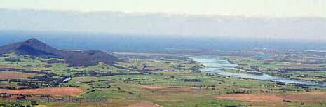
 Bateman's
Bay and surrounds are all located on a coastal plain. Between prolly about 2
and 50km inland is the escarpment of the Great Dividing Range. This pic shows
the sort of landscape we are talking about.
Bateman's
Bay and surrounds are all located on a coastal plain. Between prolly about 2
and 50km inland is the escarpment of the Great Dividing Range. This pic shows
the sort of landscape we are talking about.Bateman's
Bay and surrounds are all located on a coastal plain. Between prolly about 2
and 50km inland is the escarpment of the Great Dividing Range. This pic shows
the sort of landscape we are talking about.
Once a year, in a town called Ulladulla (it's for real! That is a town's name!) they have the blessing of the fleet. Big ceremony, people come from Sydney and miles around to see some Arch Bishop bless the fleet. Easter Sunday was the day that I happened to pass through Ulladulla, and guess what day the blessing of the fleet occurs on???? I have never, ever seen so many people and cars in the one place - there were cars parked everywhere and people risking life and limb running across the road in front of cars full of people trying to find car parks or attempting to flee the place.... It was worse than Chadstone (big shopping mall) on Christmas Eve! What should have been a say 7 minute trip through town took over 25 minutes to navigate. I eventually managed to flee and headed north for Nowra.
I turned my sights away from the ocean and turned inland. My destination was Bundanoon, in the southern highlands of NSW (well, they are southernish, more SW-ish from Sydney to be specific, but we won't mind that), via Kangaroo Valley and some fabulous waterfalls.
Kangaroo Valley lies between a couple of outlying ridges and a mountain or two. It is south of Woollongong and north of Jervis Bay and inland, for those who know the area or want to look it up in an atlas. (As an aside, the residents of Jervis Bay recently complained about the killing of foxes, which are feral in Oz. It seems the foxes had been killing the native bandicoots. With the smaller fox population, the bandicoot population was expanding and the bandicoots were foraging in the human residents' garden, with negative outcomes for the plants in said gardens....).
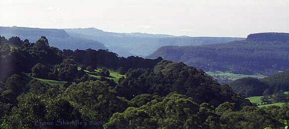
The first obstacle in the way is the pass over Cambewarra Mountain. I got stuck behind someone who was following someone who was following someone who was in a Camry. Never trust a driver who has grey hair and drives a Camry - they will be very slow and cautious and will do about 20kmh around the corners, then speed up on the straight bits so that noone can overtake. The drive up to the Cambewarra Lookout is worthwhile, but it is really barely more than a single lane gouged into the side of the mountain, so it gets very exciting when cars come the other way, which they inevitably do. The pic above was taken from the lookout, which has a very nice teahouse.
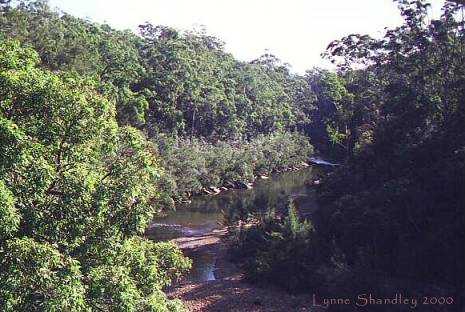
 Kangaroo Valley looked very green. Very very green. Just like in the pic. Australians
aren't used to such green landscape - there must be something wrong with it!
The soil is very fertile, being derived from some of the nearby mountain which
are of volcanic origin. It makes it very green. Along the way I found Hampden
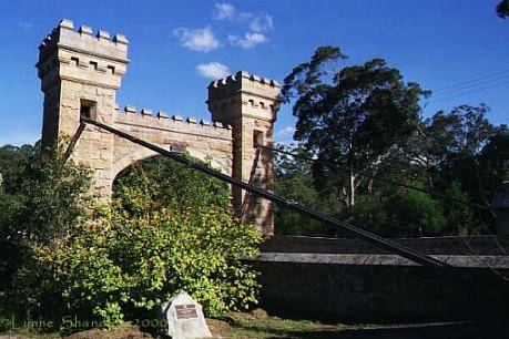
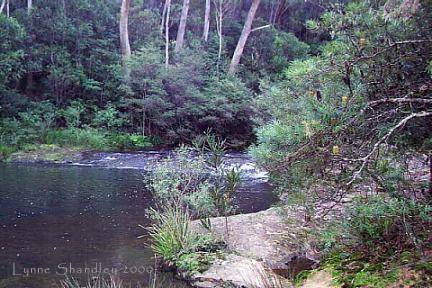
Bridge, the oldest (surviving) suspension bridge in Oz. A pic of it and the
Kangaroo River and the pavement nearby are in the first row of pics below. Whoever
designed the bridge had delusions of grandeur, and certainly never thought that
the bridge would form the main thoroughfare for quite a number of vehicles,
let alone that those vehicles would like to not have to queue to travel across
the one lane bridge....
Kangaroo Valley looked very green. Very very green. Just like in the pic. Australians
aren't used to such green landscape - there must be something wrong with it!
The soil is very fertile, being derived from some of the nearby mountain which
are of volcanic origin. It makes it very green. Along the way I found Hampden
Bridge, the oldest (surviving) suspension bridge in Oz. A pic of it and the
Kangaroo River and the pavement nearby are in the first row of pics below. Whoever
designed the bridge had delusions of grandeur, and certainly never thought that
the bridge would form the main thoroughfare for quite a number of vehicles,
let alone that those vehicles would like to not have to queue to travel across
the one lane bridge....
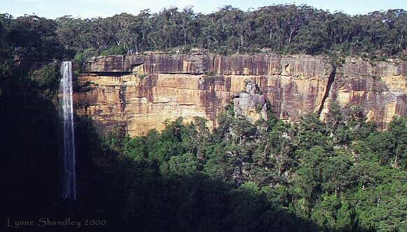
The climb up the escarpment from Kangaroo Valley was much less traumatic than the climb over Cambewarra Mountain. I drove on to the national parks and wildlife service visitor centre at Fitzroy Falls, with the sneaking suspicion that I had missed the turnoff to Belmore Falls. Yep, I had.
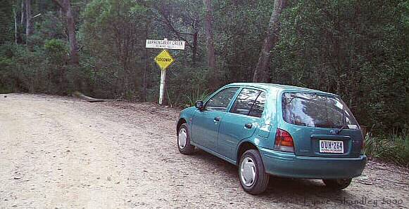
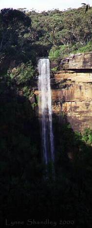
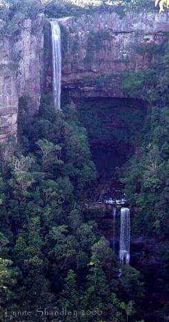
Both Fitzroy Falls and Belmore Falls are very worth a look. They fall from the sandstone escarpment for quite some height. Have a look at the pics below. The drive to Belmore Falls is interesting, half of it being along dirt roads (which were badly in need of grading when I drove on them). The main outlook for the waterfall is on the other side of a ford across the Burpengarry Creek. My little chops is only a baby car, and I was rather glad to see other small cars fording the crossing. As it turned out, the water was only about 15cm (six inches) deep at the deepest point. It was also very cold, as I discovered when I took my shoes off and crossed the ford on foot to have a look at the view from the top of the waterfall (the road did not have parking spaces on the pre-ford side). The ford helps create a small reservoir for the waterfall.
|
Hampden Bridge |
Kangaroo River |
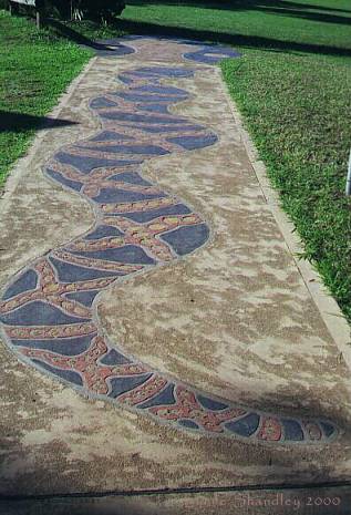
serpent pavement |
|
Fitzroy Falls, wide shot |
the top of Belmore Falls |
taking on Burpengarry Creek |
|
Fitzroy Falls |
Belmore Falls |
Burpengarry Creek |
After getting the obligatory happy snaps, I then moved on to Bundanoon. That page will follow soon!
Kangaroo Valley and waterfalls/ Lynne / Last modified 8th June 2000