East Gippsland is an area of Victoria that lies between the Great
Dividing Range and the coast, east of the Snowy River. I didn't quite
make it that far on this trip. Instead I guess I can say I visited
the eastern part of Gippland. Guess I should get a map online, eh?
It is an area of outstanding natural beauty, with quite a number of national parks (hop along to the Parks Victoria website for more info about these) and state parks. In a recent trip to Lakes Entrance, I went exploring around the area, sure that I could find something that would take me away from the tourist areas and off the beaten track.
I think I found it :-)
My little car (a Toyota Starlet) is not exactly an off-road cruiser. He is not really designed for bouncing along corrugations and dirt tracks. It sometimes gets a little exciting on the bumpy bits (gee, I hope we get some traction back soon cos I really would like to go down this road forwards, not sideways.... ;-). I am pleased to say that me and my little chops (the car) survived the trip. But then that is obvious....
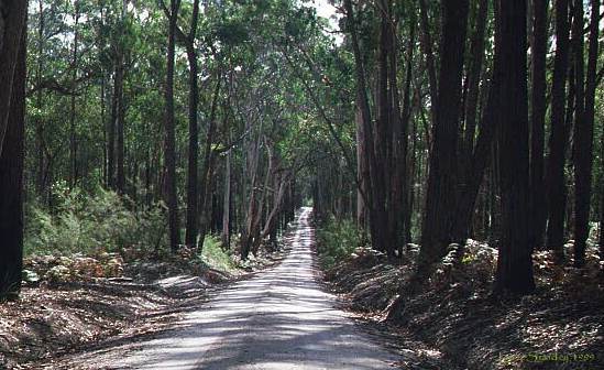
Victoria's state forests boast a number of "forest drives". For some goodly part of the Princes Highway between Lakes Entrance and Nowa Nowa, the road runs through the Colquhuon State Forest. A number of the tracks though the forest are accessible to two wheel drive cars, in good weather. I first chose the Burnt Bridge drive, thinking that a burnt bridge may be interesting. Not far from the highway, I found a display dedicated to the Koori people who had lived in the area and who still do live in the area, though in vastly reduced numbers. Among the many things that white man brought with him was death.
The forest road was a little bit exciting - that is where we found corrugations so bad that we started sliding along the road sideways. What fun!
Enough yapping - here are some pics!
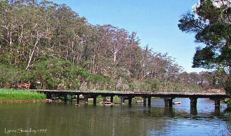
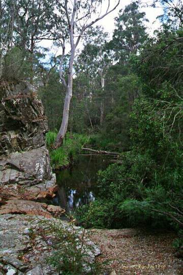
After winding your way through the eucalypt forest, the ground begins to slope quite steeply down into a gully. The vegetation becomes more dense and lush - more like temperate rainforest. Then the scene of the lake opens up in front of you. Quite pretty, isn't it? I presume that this is the site of the said burnt bridge that the drive is named after. All I can say is that I was very glad to notice a pit toilet provided a little further up the hill. All that bouncing had - no, let's not go there. The dunny had a great view - a loo with a view! Who needed to shut the door?
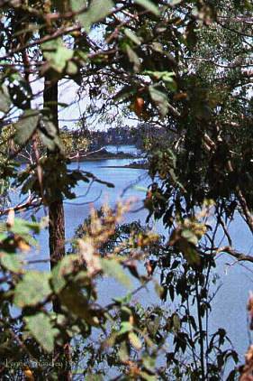
A little further down the track, I had to make a decision. I had no idea that I was skirting the edges of Lake Tyers. Crystal Point or some other point? Crystal Point was a misnomer, I felt, but the other place offered up this beautiful view. My little car and I rumbled along some quite good tracks to reach the points - the roads were of packed sand, the only problem being ground clearance.
A few kilometres later, we were back on the main drag, on the way to
Nowa Nowa, Orbost and places further east. Then I noticed a turn
off to "Trestle Bridge Drive". That sounded pretty interesting -
better than hooning along the Princes Highway.
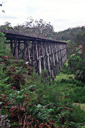
Unlike the Burnt Bridge Drive, this drive actually did deliver the promised trestle bridge. It formed part of an old railway line and is a pretty impressive bit of architecture. You can scamble around a bit of it but no access is allowed to the bridge itself. Too dangerous!
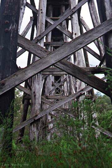
This road was more heavily used than the Burnt Bridge Drive. In the first 6 kilometres of the drive, I was nearly run off the road by three different four wheel drives. Blasted pests. They were obviously suprised to see my little baby bouncing along the road.
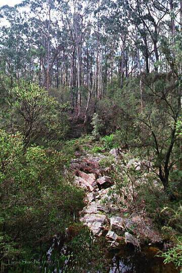
Not far from the trestle bridge was a picnic spot near some falls - hmm, Starcke's Falls? I am not sure. Oh well, I may just have to go for a drive, just a wee tad of a drive to find out ;-). I took these pictures from around that area.
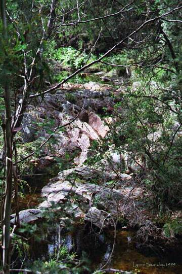
Oh, and for those who don't like 'going' in the bush, there is a pit toilet nearby (but this one doesn't have such a good view).
It was quite an adventure, driving along all these bush tracks with no map, trusting that the sign posts were correct. Only a very few junctions were not signposted. After driving some 20 kilometres, I suddenly popped out onto the Princes Highway west of Lakes Entrance. That certainly surprised me!
Back to Lynne's pics page.
Gippsland pics/ created by Lynne/last modified 4th September 2001. All piccies copyright Lynne Shandley